![](/images/other/stat-length.png)
![Excursión Senderismo Saint-Agnan-en-Vercors - le grand veymont - Photo](https://media.geolcdn.com/t/1900/400/ext.pjpeg?maxdim=2&url=https%3A%2F%2Fstatic1.geolcdn.com%2Fsiteimages%2Fupload%2Ffiles%2F1553511878bg_sport_marche.png)
le grand veymont
hugo26
Usuario
![Longitud](/images/other/stat-length.png)
Longitud
17,4 km
![Altitud máxima](https://static1.geolcdn.com/siteimages/upload/files/1508320355ic_sort_altitude_max_24dp.png)
Altitud máxima
2328 m
![Desnivel positivo](https://static1.geolcdn.com/siteimages/upload/files/1508320355ic_sort_den_pos_24dp.png)
Desnivel positivo
900 m
![Km-Effort](/images/other/stat-length.png)
Km-Effort
30 km
![Altitud mínima](https://static1.geolcdn.com/siteimages/upload/files/1508320355ic_sort_altitude_min_24dp.png)
Altitud mínima
1465 m
![Desnivel negativo](https://static1.geolcdn.com/siteimages/upload/files/1508320355ic_sort_den_neg_24dp.png)
Desnivel negativo
954 m
![Boucle](https://static1.geolcdn.com/siteimages/upload/files/16400158638029165_repeat_loop_refresh_sync_direction_icon.png)
Boucle
No
Fecha de creación :
2022-05-26 14:22:55.301
Última modificación :
2022-05-26 14:26:16.284
![Senderismo](https://static1.geolcdn.com/sitytour/trail-icons/101.png)
6h44
Dificultad : Muy difícil
![Escanee este código QR para abrir la excursión en la aplicación SityTrail](https://capi.geolives.com/qq0zvz2zws4bq2lad0pu/sitytour/trails/3257812/qr.png?size=200)
Aplicación GPS de excursión GRATIS
A propósito
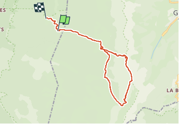
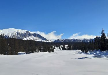
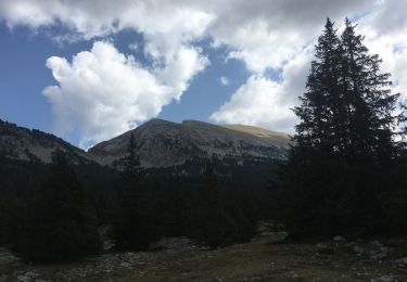
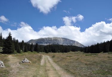
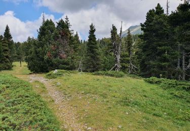
Ruta Senderismo de 17,4 km a descubrir en Auvergne-Rhône-Alpes, Drôme, Saint-Agnan-en-Vercors. Esta ruta ha sido propuesta por hugo26.
Descripción
belle rando au départ du refuge de pré râteau, le pas de la ville, le grand veymont, le pas des chatons, et retour. Parcours plus cour que depuis le parking de la coche.- 6km
Localización
País:
France
Región :
Auvergne-Rhône-Alpes
Departamento/provincia :
Drôme
Municipio :
Saint-Agnan-en-Vercors
Localidad:
Unknown
Salida:(Dec)
Salida:(UTM)
695440 ; 4974158 (31T) N.
Comentarios
Excursiones cerca
![Excursión Senderismo Saint-Agnan-en-Vercors - Vercors - La Coche Grand Veymont Queyrie - Photo](https://media.geolcdn.com/t/375/260/ext.jpg?maxdim=2&url=https%3A%2F%2Fstatic1.geolcdn.com%2Fsiteimages%2Fupload%2Ffiles%2F1553511878bg_sport_marche.png)
![Senderismo Senderismo](https://static1.geolcdn.com/sitytour/trail-icons/101.png)
Vercors - La Coche Grand Veymont Queyrie
Senderismo
Muy fácil
(1)
Saint-Agnan-en-Vercors,
Auvergne-Rhône-Alpes,
Drôme,
France
![](/images/other/stat-length.png)
24 km | 33 km-effort
7h 22min
![](https://static1.geolcdn.com/siteimages/upload/files/16400158638029165_repeat_loop_refresh_sync_direction_icon.png)
Sí
![Excursión Senderismo Saint-Agnan-en-Vercors - 26 tiolache - Photo](https://media.geolcdn.com/t/375/260/901b344f-b319-4266-9f0a-69075395b314.jpg&format=jpg&maxdim=2)
![Senderismo Senderismo](https://static1.geolcdn.com/sitytour/trail-icons/101.png)
26 tiolache
Senderismo
Fácil
Saint-Agnan-en-Vercors,
Auvergne-Rhône-Alpes,
Drôme,
France
![](/images/other/stat-length.png)
14,4 km | 21 km-effort
6h 13min
![](https://static1.geolcdn.com/siteimages/upload/files/16400158638029165_repeat_loop_refresh_sync_direction_icon.png)
Sí
![Excursión Senderismo Saint-Agnan-en-Vercors - 26 st Agnan champ gros de la vache - Photo](https://media.geolcdn.com/t/375/260/3e876886-71b3-45d3-bba1-ada65af3bf18.jpg&format=jpg&maxdim=2)
![Senderismo Senderismo](https://static1.geolcdn.com/sitytour/trail-icons/101.png)
26 st Agnan champ gros de la vache
Senderismo
Medio
Saint-Agnan-en-Vercors,
Auvergne-Rhône-Alpes,
Drôme,
France
![](/images/other/stat-length.png)
16,9 km | 27 km-effort
6h 51min
![](https://static1.geolcdn.com/siteimages/upload/files/16400158638029165_repeat_loop_refresh_sync_direction_icon.png)
Sí
![Excursión Senderismo Saint-Agnan-en-Vercors - Les Hauts Plateaux du Vercors - Photo](https://media.geolcdn.com/t/375/260/ec115f7c-48d5-47de-819e-7d8cda136852.jpg&format=jpg&maxdim=2)
![Senderismo Senderismo](https://static1.geolcdn.com/sitytour/trail-icons/101.png)
Les Hauts Plateaux du Vercors
Senderismo
Difícil
Saint-Agnan-en-Vercors,
Auvergne-Rhône-Alpes,
Drôme,
France
![](/images/other/stat-length.png)
12 km | 19,1 km-effort
3h 51min
![](https://static1.geolcdn.com/siteimages/upload/files/16400158638029165_repeat_loop_refresh_sync_direction_icon.png)
Sí
![Excursión Senderismo Saint-Agnan-en-Vercors - trop Alexis - Photo](https://media.geolcdn.com/t/375/260/c36b90eb-63fa-4a9c-9518-bbd91f5e8a29.jpg&format=jpg&maxdim=2)
![Senderismo Senderismo](https://static1.geolcdn.com/sitytour/trail-icons/101.png)
trop Alexis
Senderismo
Muy difícil
Saint-Agnan-en-Vercors,
Auvergne-Rhône-Alpes,
Drôme,
France
![](/images/other/stat-length.png)
16,3 km | 28 km-effort
7h 59min
![](https://static1.geolcdn.com/siteimages/upload/files/16400158638029165_repeat_loop_refresh_sync_direction_icon.png)
Sí
![Excursión Senderismo Saint-Agnan-en-Vercors - Malaval - Photo](https://media.geolcdn.com/t/375/260/39c0c415-627d-42e7-b9a5-65769dc8255c.jpg&format=jpg&maxdim=2)
![Senderismo Senderismo](https://static1.geolcdn.com/sitytour/trail-icons/101.png)
Malaval
Senderismo
Muy difícil
Saint-Agnan-en-Vercors,
Auvergne-Rhône-Alpes,
Drôme,
France
![](/images/other/stat-length.png)
14,6 km | 24 km-effort
5h 49min
![](https://static1.geolcdn.com/siteimages/upload/files/16400158638029165_repeat_loop_refresh_sync_direction_icon.png)
Sí
![Excursión Senderismo Saint-Agnan-en-Vercors - Grand Veymont par pré râteau - Photo](https://media.geolcdn.com/t/375/260/e54a027e-72ab-4658-aa09-80fa6ce42b41.jpg&format=jpg&maxdim=2)
![Senderismo Senderismo](https://static1.geolcdn.com/sitytour/trail-icons/101.png)
Grand Veymont par pré râteau
Senderismo
Difícil
Saint-Agnan-en-Vercors,
Auvergne-Rhône-Alpes,
Drôme,
France
![](/images/other/stat-length.png)
19 km | 32 km-effort
5h 56min
![](https://static1.geolcdn.com/siteimages/upload/files/16400158638029165_repeat_loop_refresh_sync_direction_icon.png)
Sí
![Senderismo Senderismo](https://static1.geolcdn.com/sitytour/trail-icons/101.png)
Aiguillette ou Petit Veymont par la Coche - Grande Cabane
Senderismo
Difícil
Saint-Agnan-en-Vercors,
Auvergne-Rhône-Alpes,
Drôme,
France
![](/images/other/stat-length.png)
19,3 km | 27 km-effort
5h 30min
![](https://static1.geolcdn.com/siteimages/upload/files/16400158638029165_repeat_loop_refresh_sync_direction_icon.png)
Sí
![Excursión Senderismo Saint-Agnan-en-Vercors - pas de berrieves rocher de segure - Photo](https://media.geolcdn.com/t/375/260/8507e7ef-df48-4f35-b54a-d6d5f91a87e0.jpg&format=jpg&maxdim=2)
![Senderismo Senderismo](https://static1.geolcdn.com/sitytour/trail-icons/101.png)
pas de berrieves rocher de segure
Senderismo
Fácil
Saint-Agnan-en-Vercors,
Auvergne-Rhône-Alpes,
Drôme,
France
![](/images/other/stat-length.png)
15,3 km | 23 km-effort
4h 30min
![](https://static1.geolcdn.com/siteimages/upload/files/16400158638029165_repeat_loop_refresh_sync_direction_icon.png)
Sí