![](/images/other/stat-length.png)
![Excursión Senderismo Montoison - Balade à Montoison Serre de Jupe - Avec description - Photo](https://media.geolcdn.com/t/1900/400/ext.pjpeg?maxdim=2&url=https%3A%2F%2Fstatic1.geolcdn.com%2Fsiteimages%2Fupload%2Ffiles%2F1553511878bg_sport_marche.png)
Balade à Montoison Serre de Jupe - Avec description
bob2023
Usuario
![Longitud](/images/other/stat-length.png)
Longitud
5 km
![Altitud máxima](https://static1.geolcdn.com/siteimages/upload/files/1508320355ic_sort_altitude_max_24dp.png)
Altitud máxima
255 m
![Desnivel positivo](https://static1.geolcdn.com/siteimages/upload/files/1508320355ic_sort_den_pos_24dp.png)
Desnivel positivo
103 m
![Km-Effort](/images/other/stat-length.png)
Km-Effort
6,4 km
![Altitud mínima](https://static1.geolcdn.com/siteimages/upload/files/1508320355ic_sort_altitude_min_24dp.png)
Altitud mínima
166 m
![Desnivel negativo](https://static1.geolcdn.com/siteimages/upload/files/1508320355ic_sort_den_neg_24dp.png)
Desnivel negativo
100 m
![Boucle](https://static1.geolcdn.com/siteimages/upload/files/16400158638029165_repeat_loop_refresh_sync_direction_icon.png)
Boucle
Sí
Fecha de creación :
2018-08-26 08:32:27.876
Última modificación :
2018-08-26 08:32:27.896
![Senderismo](https://static1.geolcdn.com/sitytour/trail-icons/101.png)
1h22
Dificultad : Muy fácil
![Escanee este código QR para abrir la excursión en la aplicación SityTrail](https://capi.geolives.com/qq0zvz2zws4bq2lad0pu/sitytour/trails/325010/qr.png?size=200)
Aplicación GPS de excursión GRATIS
A propósito
Ruta Senderismo de 5 km a descubrir en Auvergne-Rhône-Alpes, Drôme, Montoison. Esta ruta ha sido propuesta por bob2023.
Descripción
Se garer en haut de la route près de la barrière du chemin forestier.
Suivre le balisage triangle Jaune n° 160.
Raccourci possible en prenant le point rouge vers le point bleue et orange.
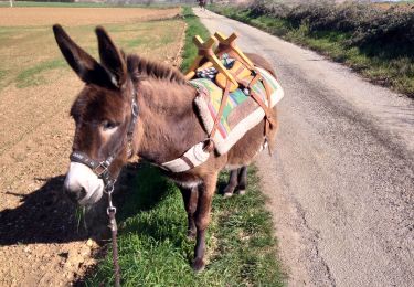
Localización
País:
France
Región :
Auvergne-Rhône-Alpes
Departamento/provincia :
Drôme
Municipio :
Montoison
Localidad:
Unknown
Salida:(Dec)
Salida:(UTM)
653304 ; 4964131 (31T) N.
Comentarios
Excursiones cerca
![Excursión Paseo en burro Livron-sur-Drôme - Abiche toundra - Photo](https://media.geolcdn.com/t/375/260/b830dd80-a5ad-40d3-8f64-a9fd76af46ca.jpg&format=jpg&maxdim=2)
![Paseo en burro Paseo en burro](https://static1.geolcdn.com/sitytour/trail-icons/303.png)
Abiche toundra
Paseo en burro
Fácil
Livron-sur-Drôme,
Auvergne-Rhône-Alpes,
Drôme,
France
![](/images/other/stat-length.png)
5,5 km | 6,4 km-effort
1h 45min
![](https://static1.geolcdn.com/siteimages/upload/files/16400158638029165_repeat_loop_refresh_sync_direction_icon.png)
Sí
![Excursión Senderismo Upie - 26 UPIE zel 10.01.25 - Photo](https://media.geolcdn.com/t/375/260/2b767135-d0f6-4245-a21c-bbb031bd60c2.jpg&format=jpg&maxdim=2)
![Senderismo Senderismo](https://static1.geolcdn.com/sitytour/trail-icons/101.png)
26 UPIE zel 10.01.25
Senderismo
Fácil
Upie,
Auvergne-Rhône-Alpes,
Drôme,
France
![](/images/other/stat-length.png)
13,9 km | 20 km-effort
5h 16min
![](https://static1.geolcdn.com/siteimages/upload/files/16400158638029165_repeat_loop_refresh_sync_direction_icon.png)
Sí
![Excursión Senderismo Upie - UPIE - Photo](https://media.geolcdn.com/t/375/260/ext.jpg?maxdim=2&url=https%3A%2F%2Fstatic1.geolcdn.com%2Fsiteimages%2Fupload%2Ffiles%2F1553511878bg_sport_marche.png)
![Senderismo Senderismo](https://static1.geolcdn.com/sitytour/trail-icons/101.png)
![Excursión Senderismo Upie - mont miery - Photo](https://media.geolcdn.com/t/375/260/ext.jpg?maxdim=2&url=https%3A%2F%2Fstatic1.geolcdn.com%2Fsiteimages%2Fupload%2Ffiles%2F1553511878bg_sport_marche.png)
![Senderismo Senderismo](https://static1.geolcdn.com/sitytour/trail-icons/101.png)
mont miery
Senderismo
Muy fácil
Upie,
Auvergne-Rhône-Alpes,
Drôme,
France
![](/images/other/stat-length.png)
9,3 km | 12,8 km-effort
2h 35min
![](https://static1.geolcdn.com/siteimages/upload/files/16400158638029165_repeat_loop_refresh_sync_direction_icon.png)
Sí
![Excursión Senderismo Beauvallon - 26 - chemin de Diane - Photo](https://media.geolcdn.com/t/375/260/ext.jpg?maxdim=2&url=https%3A%2F%2Fstatic1.geolcdn.com%2Fsiteimages%2Fupload%2Ffiles%2F1553511878bg_sport_marche.png)
![Senderismo Senderismo](https://static1.geolcdn.com/sitytour/trail-icons/101.png)
26 - chemin de Diane
Senderismo
Medio
Beauvallon,
Auvergne-Rhône-Alpes,
Drôme,
France
![](/images/other/stat-length.png)
8,3 km | 9,4 km-effort
2h 8min
![](https://static1.geolcdn.com/siteimages/upload/files/16400158638029165_repeat_loop_refresh_sync_direction_icon.png)
Sí
![Senderismo Senderismo](https://static1.geolcdn.com/sitytour/trail-icons/101.png)
Upie : Balade à la vierge du Mont Miéry
Senderismo
Fácil
Upie,
Auvergne-Rhône-Alpes,
Drôme,
France
![](/images/other/stat-length.png)
9,4 km | 13,2 km-effort
2h 19min
![](https://static1.geolcdn.com/siteimages/upload/files/16400158638029165_repeat_loop_refresh_sync_direction_icon.png)
Sí
![Excursión Senderismo Upie - UPIE Trape aux loups - Photo](https://media.geolcdn.com/t/375/260/ext.jpg?maxdim=2&url=https%3A%2F%2Fstatic1.geolcdn.com%2Fsiteimages%2Fupload%2Ffiles%2F1553511878bg_sport_marche.png)
![Senderismo Senderismo](https://static1.geolcdn.com/sitytour/trail-icons/101.png)
UPIE Trape aux loups
Senderismo
Muy fácil
Upie,
Auvergne-Rhône-Alpes,
Drôme,
France
![](/images/other/stat-length.png)
5,2 km | 6,8 km-effort
2h 11min
![](https://static1.geolcdn.com/siteimages/upload/files/16400158638029165_repeat_loop_refresh_sync_direction_icon.png)
Sí
![Excursión Senderismo Upie - 2022-07-28_22h45m51_MontMiery-Upie - Photo](https://media.geolcdn.com/t/375/260/ext.jpg?maxdim=2&url=https%3A%2F%2Fstatic1.geolcdn.com%2Fsiteimages%2Fupload%2Ffiles%2F1553511878bg_sport_marche.png)
![Senderismo Senderismo](https://static1.geolcdn.com/sitytour/trail-icons/101.png)
2022-07-28_22h45m51_MontMiery-Upie
Senderismo
Medio
Upie,
Auvergne-Rhône-Alpes,
Drôme,
France
![](/images/other/stat-length.png)
8 km | 11,5 km-effort
2h 37min
![](https://static1.geolcdn.com/siteimages/upload/files/16400158638029165_repeat_loop_refresh_sync_direction_icon.png)
Sí
![Excursión Senderismo Upie - Upie - Photo](https://media.geolcdn.com/t/375/260/ext.jpg?maxdim=2&url=https%3A%2F%2Fstatic1.geolcdn.com%2Fsiteimages%2Fupload%2Ffiles%2F1553511878bg_sport_marche.png)
![Senderismo Senderismo](https://static1.geolcdn.com/sitytour/trail-icons/101.png)