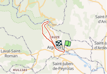
![](/images/other/stat-length.png)
![Excursión Senderismo Saint-Martin-d'Ardèche - aiguèze - Photo](https://media.geolcdn.com/t/1900/400/ext.pjpeg?maxdim=2&url=https%3A%2F%2Fstatic1.geolcdn.com%2Fsiteimages%2Fupload%2Ffiles%2F1553511878bg_sport_marche.png)
aiguèze
jeanjacquescavet
Usuario
![Longitud](/images/other/stat-length.png)
![Altitud máxima](https://static1.geolcdn.com/siteimages/upload/files/1508320355ic_sort_altitude_max_24dp.png)
![Desnivel positivo](https://static1.geolcdn.com/siteimages/upload/files/1508320355ic_sort_den_pos_24dp.png)
![Km-Effort](/images/other/stat-length.png)
![Altitud mínima](https://static1.geolcdn.com/siteimages/upload/files/1508320355ic_sort_altitude_min_24dp.png)
![Desnivel negativo](https://static1.geolcdn.com/siteimages/upload/files/1508320355ic_sort_den_neg_24dp.png)
![Boucle](https://static1.geolcdn.com/siteimages/upload/files/16400158638029165_repeat_loop_refresh_sync_direction_icon.png)
![Senderismo](https://static1.geolcdn.com/sitytour/trail-icons/101.png)
3h12
Dificultad : Difícil
![Escanee este código QR para abrir la excursión en la aplicación SityTrail](https://capi.geolives.com/qq0zvz2zws4bq2lad0pu/sitytour/trails/3228232/qr.png?size=200)
Aplicación GPS de excursión GRATIS
A propósito
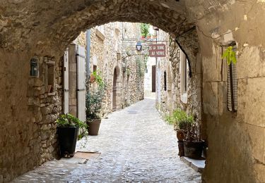
Ruta Senderismo de 9,5 km a descubrir en Auvergne-Rhône-Alpes, Ardecha, Saint-Martin-d'Ardèche. Esta ruta ha sido propuesta por jeanjacquescavet.
Descripción
boucle à partir de Saint Martin d'Ardèche
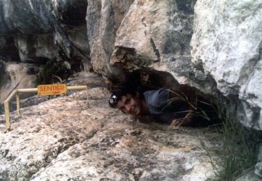
Passer le pont suspendu
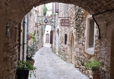
remonter jusqu'à Ai guèze
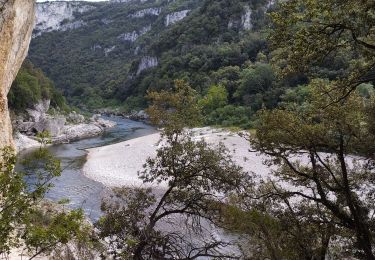
descendre au bord de l'Ardèche
suivre la rive jusque la plage en face Roc Pointu
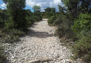
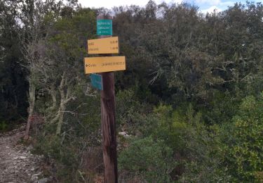
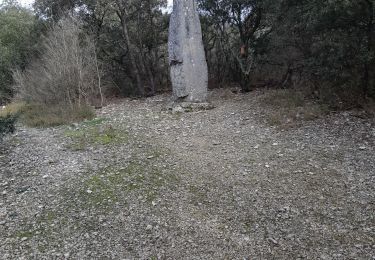
remonter par un petit sentier pour rejoindre le GR4
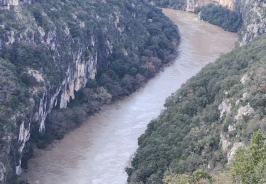
retour vers aiguèze et Saint Martin
Localización
Comentarios
Excursiones cerca
![Excursión Senderismo Saint-Martin-d'Ardèche - GR4 Aigueze - Photo](https://media.geolcdn.com/t/375/260/ext.jpg?maxdim=2&url=https%3A%2F%2Fservices.sitytrail.com%2FGeolivesWS%2FDownloadMedia.ashx%3FTrailID%3D325544%26Media%3Dfix__20140709163308.jpg)
![Senderismo Senderismo](https://static1.geolcdn.com/sitytour/trail-icons/101.png)
Senderismo
![](/images/other/stat-length.png)
![](https://static1.geolcdn.com/siteimages/upload/files/16400158638029165_repeat_loop_refresh_sync_direction_icon.png)
![Excursión Senderismo Aiguèze - 30 aigueze ribeirol - Photo](https://media.geolcdn.com/t/375/260/a5de248d-2217-49e5-9c57-d3e37cd5f6c4.jpg&format=jpg&maxdim=2)
![Senderismo Senderismo](https://static1.geolcdn.com/sitytour/trail-icons/101.png)
Senderismo
![](/images/other/stat-length.png)
![](https://static1.geolcdn.com/siteimages/upload/files/16400158638029165_repeat_loop_refresh_sync_direction_icon.png)
![Excursión Senderismo Saint-Martin-d'Ardèche - Aigueze rocher de Castelviel - Photo](https://media.geolcdn.com/t/375/260/416d7ebd-2359-4463-8249-a90d2272e98d.jpg&format=jpg&maxdim=2)
![Senderismo Senderismo](https://static1.geolcdn.com/sitytour/trail-icons/101.png)
Senderismo
![](/images/other/stat-length.png)
![](https://static1.geolcdn.com/siteimages/upload/files/16400158638029165_repeat_loop_refresh_sync_direction_icon.png)
![Excursión Senderismo Saint-Martin-d'Ardèche - Sauze bivouac de Gournier - Photo](https://media.geolcdn.com/t/375/260/baac8ebe-8937-4db4-b6c4-7e0bd115b9f1.jpg&format=jpg&maxdim=2)
![Senderismo Senderismo](https://static1.geolcdn.com/sitytour/trail-icons/101.png)
Senderismo
![](/images/other/stat-length.png)
![](https://static1.geolcdn.com/siteimages/upload/files/16400158638029165_repeat_loop_refresh_sync_direction_icon.png)
![Excursión Senderismo Saint-Martin-d'Ardèche - 07 st martin d ardeche gorge ardeche - Photo](https://media.geolcdn.com/t/375/260/fdc113c1-1a01-412d-be10-a6b4f2c87d8a.jpg&format=jpg&maxdim=2)
![Senderismo Senderismo](https://static1.geolcdn.com/sitytour/trail-icons/101.png)
Senderismo
![](/images/other/stat-length.png)
![](https://static1.geolcdn.com/siteimages/upload/files/16400158638029165_repeat_loop_refresh_sync_direction_icon.png)
![Excursión Senderismo Aiguèze - Aigueze - Photo](https://media.geolcdn.com/t/375/260/e7b8de9a-d915-48ca-baac-0319f593dc54.jpg&format=jpg&maxdim=2)
![Senderismo Senderismo](https://static1.geolcdn.com/sitytour/trail-icons/101.png)
![Excursión Senderismo Saint-Martin-d'Ardèche - Saint Martin d’Ardéche - Photo](https://media.geolcdn.com/t/375/260/b543bd48-15f1-4b47-a933-7d4f79f7128e.jpg&format=jpg&maxdim=2)
![Senderismo Senderismo](https://static1.geolcdn.com/sitytour/trail-icons/101.png)
Senderismo
![](/images/other/stat-length.png)
![](https://static1.geolcdn.com/siteimages/upload/files/16400158638029165_repeat_loop_refresh_sync_direction_icon.png)
![Excursión Senderismo Saint-Marcel-d'Ardèche - rando octobre rose - Photo](https://media.geolcdn.com/t/375/260/501d2ffe-4bd2-45c8-898e-66f9a74c15e7.jpg&format=jpg&maxdim=2)
![Senderismo Senderismo](https://static1.geolcdn.com/sitytour/trail-icons/101.png)
Senderismo
![](/images/other/stat-length.png)
![](https://static1.geolcdn.com/siteimages/upload/files/16400158638029165_repeat_loop_refresh_sync_direction_icon.png)
![Excursión A pie Aiguèze - FR-PR 24 - Photo](https://media.geolcdn.com/t/375/260/adb231a8-9d03-4c90-9261-a3c9f3c8fd1c.jpeg&format=jpg&maxdim=2)
![A pie A pie](https://static1.geolcdn.com/sitytour/trail-icons/100.png)