


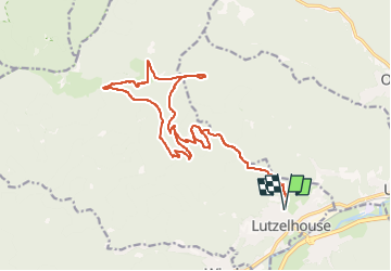

14,9 km | 21 km-effort


Usuario


Aplicación GPS de excursión GRATIS
 SityTrail
IGN / Institutos geográficos
SityTrail World
El mundo es suyo
Ruta Senderismo de 21 km a descubrir en Gran Este, Bajo-Rin, Lutzelhouse. Esta ruta ha sido propuesta por Gaëtan Isb.
Départ Lutzelhouse. Passage par la Grotte du Loup, puis par l'Enceinte du Jardin des Fées à la Grande Côte. Direction le col du Narion pour rejoindre ensuite le Rocher de Mutzig. Retour par le Grand et Petit Katzengerg. Et on retrouve l'itinéraire de départ au niveau de la Grotte du Loup.

Senderismo

Paseo ecuestre

Bici de montaña

Bici de montaña

Senderismo
Senderismo
Paseo ecuestre

Paseo ecuestre
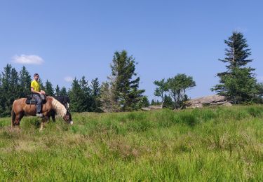
Paseo ecuestre