![](/images/other/stat-length.png)
![Excursión Senderismo Hyères - hyeres les maurettes - Photo](https://media.geolcdn.com/t/1900/400/94a9b8bc-4cbf-43be-a95c-d8b262efea22.jpg&format=pjpeg&maxdim=2)
hyeres les maurettes
marchev
Usuario
![Longitud](/images/other/stat-length.png)
![Altitud máxima](https://static1.geolcdn.com/siteimages/upload/files/1508320355ic_sort_altitude_max_24dp.png)
![Desnivel positivo](https://static1.geolcdn.com/siteimages/upload/files/1508320355ic_sort_den_pos_24dp.png)
![Km-Effort](/images/other/stat-length.png)
![Altitud mínima](https://static1.geolcdn.com/siteimages/upload/files/1508320355ic_sort_altitude_min_24dp.png)
![Desnivel negativo](https://static1.geolcdn.com/siteimages/upload/files/1508320355ic_sort_den_neg_24dp.png)
![Boucle](https://static1.geolcdn.com/siteimages/upload/files/16400158638029165_repeat_loop_refresh_sync_direction_icon.png)
![Senderismo](https://static1.geolcdn.com/sitytour/trail-icons/101.png)
2h36
Dificultad : Fácil
![Escanee este código QR para abrir la excursión en la aplicación SityTrail](https://capi.geolives.com/qq0zvz2zws4bq2lad0pu/sitytour/trails/3208383/qr.png?size=200)
Aplicación GPS de excursión GRATIS
A propósito
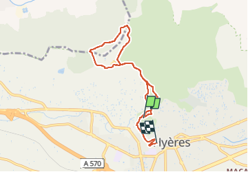
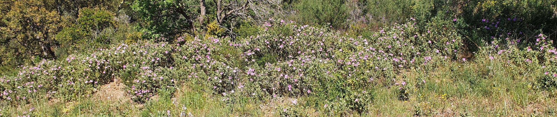
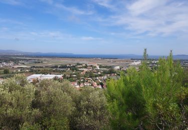
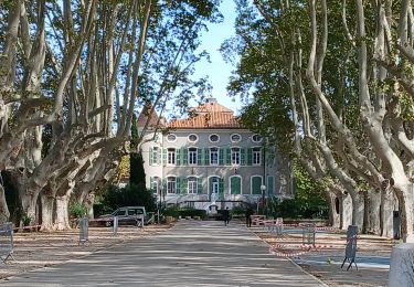
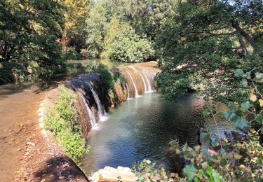
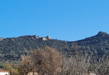
Ruta Senderismo de 7,7 km a descubrir en Provenza-Alpes-Costa Azul, Var, Hyères. Esta ruta ha sido propuesta por marchev.
Descripción
manque le début de la randonnée Départ Avenues des iles d'or.
Prendre le passage Saint Croix à côté de l'immeuble au20 avenue des ïles d'or.Puis montée st croix. Tourner à gauche pour la rue Victor Bach. Puis montée du chemin de la Porte Saint Jean et début randonnée.
Localización
Comentarios
Excursiones cerca
![Excursión Senderismo La Crau - Le Paradis et le mont des oiseaux - Photo](https://media.geolcdn.com/t/375/260/3ea9709f-1bf2-4174-850e-73122825f7f5.jpg&format=jpg&maxdim=2)
![Senderismo Senderismo](https://static1.geolcdn.com/sitytour/trail-icons/101.png)
Senderismo
![](/images/other/stat-length.png)
![](https://static1.geolcdn.com/siteimages/upload/files/16400158638029165_repeat_loop_refresh_sync_direction_icon.png)
![Excursión Senderismo La Crau - fenouillet Daniel Louis - Photo](https://media.geolcdn.com/t/375/260/74a8e577-0c5f-4f83-9925-bb595eab64a1.jpg&format=jpg&maxdim=2)
![Senderismo Senderismo](https://static1.geolcdn.com/sitytour/trail-icons/101.png)
Senderismo
![](/images/other/stat-length.png)
![](https://static1.geolcdn.com/siteimages/upload/files/16400158638029165_repeat_loop_refresh_sync_direction_icon.png)
![Excursión Senderismo La Crau - le fenouillet un après-midi d'automne - Photo](https://media.geolcdn.com/t/375/260/ext.jpg?maxdim=2&url=https%3A%2F%2Fservices.sitytrail.com%2FGeolivesWS%2FDownloadMedia.ashx%3FTrailID%3D650501%26Media%3D20161024161101.jpg)
![Senderismo Senderismo](https://static1.geolcdn.com/sitytour/trail-icons/101.png)
Senderismo
![](/images/other/stat-length.png)
![](https://static1.geolcdn.com/siteimages/upload/files/16400158638029165_repeat_loop_refresh_sync_direction_icon.png)
![Excursión Ruta La Crau - Le Fenouillet et château d' Hyères - Photo](https://media.geolcdn.com/t/375/260/b5c97bc5-16a4-4fca-8ec6-5ff57c47ff40.jpg&format=jpg&maxdim=2)
![Ruta Ruta](https://static1.geolcdn.com/sitytour/trail-icons/104.png)
Ruta
![](/images/other/stat-length.png)
![](https://static1.geolcdn.com/siteimages/upload/files/16400158638029165_repeat_loop_refresh_sync_direction_icon.png)
![Excursión Bici de carretera Hyères - Hyères J1 P13 - Photo](https://media.geolcdn.com/t/375/260/0ca1c939-16f5-433a-9547-e226cdb8bcbb.jpg&format=jpg&maxdim=2)
![Bici de carretera Bici de carretera](https://static1.geolcdn.com/sitytour/trail-icons/201.png)
Bici de carretera
![](/images/other/stat-length.png)
![](https://static1.geolcdn.com/siteimages/upload/files/16400158638029165_repeat_loop_refresh_sync_direction_icon.png)
![Excursión Senderismo La Crau - Fenouillet - Chateau de Hyères - retour par les vignes - Photo](https://media.geolcdn.com/t/375/260/d2132167-a625-4ff2-ae44-a142bdaeb4e4.jpg&format=jpg&maxdim=2)
![Senderismo Senderismo](https://static1.geolcdn.com/sitytour/trail-icons/101.png)
Senderismo
![](/images/other/stat-length.png)
![](https://static1.geolcdn.com/siteimages/upload/files/16400158638029165_repeat_loop_refresh_sync_direction_icon.png)
![Excursión Senderismo Solliès-Ville - Domaine de la Castille-20-09-2024 - Photo](https://media.geolcdn.com/t/375/260/9ee509a8-ebbc-40e1-99f5-ffe140dfc55e.jpg&format=jpg&maxdim=2)
![Senderismo Senderismo](https://static1.geolcdn.com/sitytour/trail-icons/101.png)
Senderismo
![](/images/other/stat-length.png)
![](https://static1.geolcdn.com/siteimages/upload/files/16400158638029165_repeat_loop_refresh_sync_direction_icon.png)
![Excursión Senderismo Solliès-Ville - Domaine de la Castille- Solliès-Pont-08-09-23 - Photo](https://media.geolcdn.com/t/375/260/252af893-9283-4684-96a0-b5a46e961400.jpg&format=jpg&maxdim=2)
![Senderismo Senderismo](https://static1.geolcdn.com/sitytour/trail-icons/101.png)
Senderismo
![](/images/other/stat-length.png)
![](https://static1.geolcdn.com/siteimages/upload/files/16400158638029165_repeat_loop_refresh_sync_direction_icon.png)
![Excursión Senderismo La Crau - fenouillet plan du pont - Photo](https://media.geolcdn.com/t/375/260/b7ab377c-6bf0-4fec-8a5c-2b318085c2ea.jpg&format=jpg&maxdim=2)
![Senderismo Senderismo](https://static1.geolcdn.com/sitytour/trail-icons/101.png)
Senderismo
![](/images/other/stat-length.png)
![](https://static1.geolcdn.com/siteimages/upload/files/16400158638029165_repeat_loop_refresh_sync_direction_icon.png)