


 - Photo 21")
 - Photo 22")
 - Photo 23")
 - Photo 24")
 - Photo 25")
 - Photo 26")

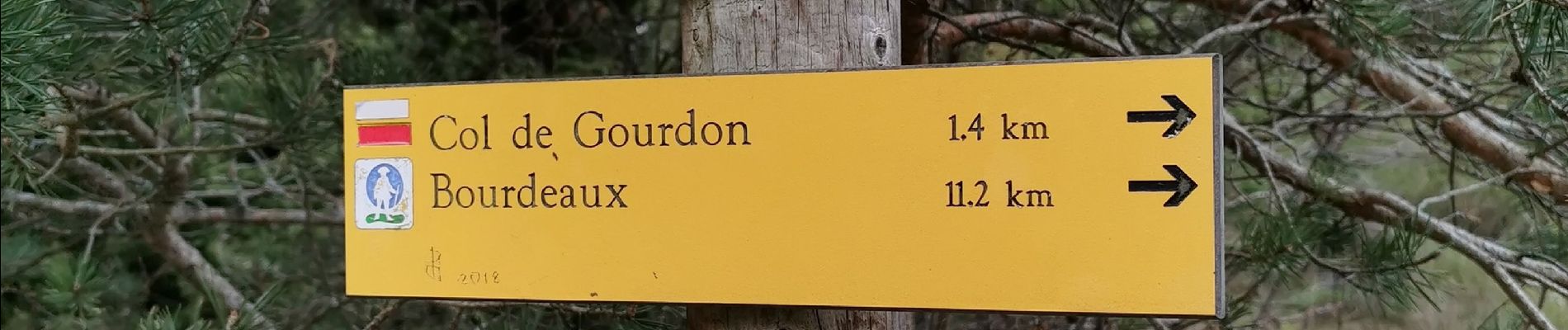
7,9 km | 11,2 km-effort

Usuario


Aplicación GPS de excursión GRATIS
 SityTrail
IGN / Institutos geográficos
SityTrail World
El mundo es suyo
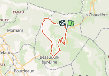
Ruta Senderismo de 13,7 km a descubrir en Auvergne-Rhône-Alpes, Drôme, Bézaudun-sur-Bîne. Esta ruta ha sido propuesta por Philindy26.
Départ au col du Gourdon (953m)...
Géolocalisation (Google Maps) : https://goo.gl/maps/qysoCERchML35Nq36
Prendre la direction de Floréal (750m) et Fonderesse (849m) par le GR965.
Puis continuer sur le GR9-965 et la Crête de la Tour jusqu'à la Tour de Bézaudun (765m).
Retour par le sentier de la Vialle et récupération de la route goudronnée à la Baume. Continuer la montée par la RD156 jusqu'à Font Hiver (835m) où il faut prendre tout droit dans le virage un sentier qui vous ramènera au Col du Gourdon (953m).
 - Photo 1")
 - Photo 2")
 - Photo 3")
 - Photo 4")
 - Photo 5")
 - Photo 6")
 - Photo 7")
 - Photo 8")
 - Photo 9")
 - Photo 10")
 - Photo 11")
 - Photo 12")
 - Photo 13")
 - Photo 14")
 - Photo 15")
 - Photo 16")
 - Photo 17")
 - Photo 18")
 - Photo 19")
 - Photo 20")
26 fotos en total. Haga clic en una foto para mostrarlas todas en la galería.

Senderismo

Senderismo

Senderismo

Senderismo

Senderismo

Senderismo

Senderismo

Bici de carretera

Senderismo