![](/images/other/stat-length.png)
![Excursión Caballo Mauron - Forêt et Pivolet - Mauron - Photo](https://media.geolcdn.com/t/1900/400/ext.pjpeg?maxdim=2&url=https%3A%2F%2Fservices.sitytrail.com%2FGeolivesWS%2FDownloadMedia.ashx%3FTrailID%3D317519%26Media%3D16760_5.jpg)
Forêt et Pivolet - Mauron
tracegps
Usuario
![Longitud](/images/other/stat-length.png)
Longitud
12,8 km
![Altitud máxima](https://static1.geolcdn.com/siteimages/upload/files/1508320355ic_sort_altitude_max_24dp.png)
Altitud máxima
159 m
![Desnivel positivo](https://static1.geolcdn.com/siteimages/upload/files/1508320355ic_sort_den_pos_24dp.png)
Desnivel positivo
201 m
![Km-Effort](/images/other/stat-length.png)
Km-Effort
15,3 km
![Altitud mínima](https://static1.geolcdn.com/siteimages/upload/files/1508320355ic_sort_altitude_min_24dp.png)
Altitud mínima
77 m
![Desnivel negativo](https://static1.geolcdn.com/siteimages/upload/files/1508320355ic_sort_den_neg_24dp.png)
Desnivel negativo
155 m
![Boucle](https://static1.geolcdn.com/siteimages/upload/files/16400158638029165_repeat_loop_refresh_sync_direction_icon.png)
Boucle
No
Fecha de creación :
2014-12-10 00:00:00.0
Última modificación :
2014-12-10 00:00:00.0
![Caballo](https://static1.geolcdn.com/sitytour/trail-icons/300.png)
1h30
Dificultad : Medio
![Escanee este código QR para abrir la excursión en la aplicación SityTrail](https://capi.geolives.com/qq0zvz2zws4bq2lad0pu/sitytour/trails/317519/qr.png?size=200)
Aplicación GPS de excursión GRATIS
A propósito
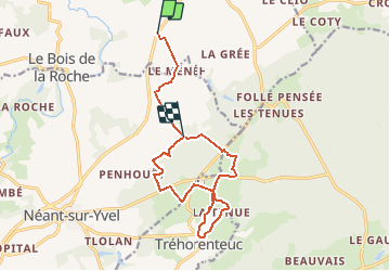
Ruta Caballo de 12,8 km a descubrir en Bretaña, Morbihan, Mauron. Esta ruta ha sido propuesta por tracegps.
Descripción
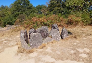
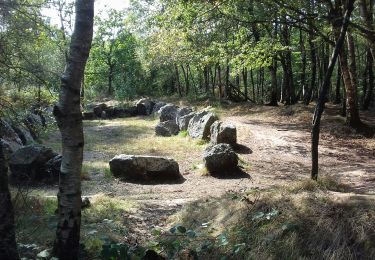
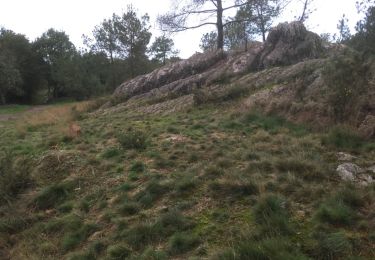
Le circuit permet de faire une boucle dans la forêt en passant par Tréhorenteucpuis en longeant le ruisseau de Pivolet.
Localización
País:
France
Región :
Bretaña
Departamento/provincia :
Morbihan
Municipio :
Mauron
Localidad:
Unknown
Salida:(Dec)
Salida:(UTM)
552131 ; 5322256 (30U) N.
Comentarios
Excursiones cerca
![Excursión Paseo ecuestre Néant-sur-Yvel - Broceliande - Photo](https://media.geolcdn.com/t/375/260/203abf06-19c3-4c8f-9ce2-990712cb0787.jpg&format=jpg&maxdim=2)
![Paseo ecuestre Paseo ecuestre](https://static1.geolcdn.com/sitytour/trail-icons/301.png)
Broceliande
Paseo ecuestre
Medio
(1)
Néant-sur-Yvel,
Bretaña,
Morbihan,
France
![](/images/other/stat-length.png)
22 km | 26 km-effort
4h 46min
![](https://static1.geolcdn.com/siteimages/upload/files/16400158638029165_repeat_loop_refresh_sync_direction_icon.png)
Sí
![Excursión Senderismo Tréhorenteuc - les landes de Gurwant et le Val sans retour - Photo](https://media.geolcdn.com/t/375/260/8ebdb65c-0df1-4e76-a908-0321b1ff5945.jpg&format=jpg&maxdim=2)
![Senderismo Senderismo](https://static1.geolcdn.com/sitytour/trail-icons/101.png)
les landes de Gurwant et le Val sans retour
Senderismo
Fácil
Tréhorenteuc,
Bretaña,
Morbihan,
France
![](/images/other/stat-length.png)
14,9 km | 18,2 km-effort
4h 46min
![](https://static1.geolcdn.com/siteimages/upload/files/16400158638029165_repeat_loop_refresh_sync_direction_icon.png)
Sí
![Excursión Senderismo Tréhorenteuc - Tréhorenteuc - Photo](https://media.geolcdn.com/t/375/260/d78e64c2-e4c4-446d-80e9-2d94e7737353.jpg&format=jpg&maxdim=2)
![Senderismo Senderismo](https://static1.geolcdn.com/sitytour/trail-icons/101.png)
![Excursión Senderismo Mauron - GR_37_CF_40_Mauron_Taupont_20220925 - Photo](https://media.geolcdn.com/t/375/260/5934c0c6-bee8-44fc-9fe2-148a0c004337.jpg&format=jpg&maxdim=2)
![Senderismo Senderismo](https://static1.geolcdn.com/sitytour/trail-icons/101.png)
GR_37_CF_40_Mauron_Taupont_20220925
Senderismo
Muy fácil
Mauron,
Bretaña,
Morbihan,
France
![](/images/other/stat-length.png)
22 km | 25 km-effort
4h 47min
![](https://static1.geolcdn.com/siteimages/upload/files/16400158638029165_repeat_loop_refresh_sync_direction_icon.png)
No
![Excursión Senderismo Tréhorenteuc - Broceliande - Photo](https://media.geolcdn.com/t/375/260/81018fdd-76b5-4b1a-8652-c9a532731623.jpg&format=jpg&maxdim=2)
![Senderismo Senderismo](https://static1.geolcdn.com/sitytour/trail-icons/101.png)
Broceliande
Senderismo
Medio
Tréhorenteuc,
Bretaña,
Morbihan,
France
![](/images/other/stat-length.png)
72 km | 85 km-effort
4h 45min
![](https://static1.geolcdn.com/siteimages/upload/files/16400158638029165_repeat_loop_refresh_sync_direction_icon.png)
No
![Excursión Senderismo Néant-sur-Yvel - TUMULUS DU JARDIN AUX MOINES (9/20) - Photo](https://media.geolcdn.com/t/375/260/7bb9903b-d90a-4ad2-bb6c-2c00df8bd974.jpg&format=jpg&maxdim=2)
![Senderismo Senderismo](https://static1.geolcdn.com/sitytour/trail-icons/101.png)
TUMULUS DU JARDIN AUX MOINES (9/20)
Senderismo
Medio
Néant-sur-Yvel,
Bretaña,
Morbihan,
France
![](/images/other/stat-length.png)
11,7 km | 14,2 km-effort
3h 30min
![](https://static1.geolcdn.com/siteimages/upload/files/16400158638029165_repeat_loop_refresh_sync_direction_icon.png)
Sí
![Excursión Senderismo Tréhorenteuc - Le val sans retour - Tréhorenteuc - Photo](https://media.geolcdn.com/t/375/260/ext.jpg?maxdim=2&url=https%3A%2F%2Fservices.sitytrail.com%2FGeolivesWS%2FDownloadMedia.ashx%3FTrailID%3D112815%26Media%3D12508_6.jpg)
![Senderismo Senderismo](https://static1.geolcdn.com/sitytour/trail-icons/101.png)
Le val sans retour - Tréhorenteuc
Senderismo
Medio
Tréhorenteuc,
Bretaña,
Morbihan,
France
![](/images/other/stat-length.png)
8,3 km | 10,1 km-effort
2h 4min
![](https://static1.geolcdn.com/siteimages/upload/files/16400158638029165_repeat_loop_refresh_sync_direction_icon.png)
Sí
![Excursión Senderismo Paimpont - PAIMPONT - Photo](https://media.geolcdn.com/t/375/260/caf6292e-29eb-440a-8b85-0ee040f025a9.jpg&format=jpg&maxdim=2)
![Senderismo Senderismo](https://static1.geolcdn.com/sitytour/trail-icons/101.png)
PAIMPONT
Senderismo
Fácil
Paimpont,
Bretaña,
Ille-et-Vilaine,
France
![](/images/other/stat-length.png)
12,9 km | 15,7 km-effort
3h 20min
![](https://static1.geolcdn.com/siteimages/upload/files/16400158638029165_repeat_loop_refresh_sync_direction_icon.png)
Sí
![Excursión Senderismo Paimpont - 2017-10-29 FONTAINE DE BARENTON BROCELIANDE - Photo](https://media.geolcdn.com/t/375/260/ext.jpg?maxdim=2&url=https%3A%2F%2Fservices.sitytrail.com%2FGeolivesWS%2FDownloadMedia.ashx%3FTrailID%3D854002%26Media%3D20171029174000.jpg)
![Senderismo Senderismo](https://static1.geolcdn.com/sitytour/trail-icons/101.png)
2017-10-29 FONTAINE DE BARENTON BROCELIANDE
Senderismo
Muy fácil
Paimpont,
Bretaña,
Ille-et-Vilaine,
France
![](/images/other/stat-length.png)
3,1 km | 3,9 km-effort
50min
![](https://static1.geolcdn.com/siteimages/upload/files/16400158638029165_repeat_loop_refresh_sync_direction_icon.png)
Sí