![](/images/other/stat-length.png)
![Excursión Senderismo Noisy-le-Grand - La Boucle de Noisy-Le-Grand - Photo](https://media.geolcdn.com/t/1900/400/ext.pjpeg?maxdim=2&url=https%3A%2F%2Fservices.sitytrail.com%2FGeolivesWS%2FDownloadMedia.ashx%3FTrailID%3D317265%26Media%3D16450_6.jpg)
La Boucle de Noisy-Le-Grand
tracegps
Usuario
![Longitud](/images/other/stat-length.png)
![Altitud máxima](https://static1.geolcdn.com/siteimages/upload/files/1508320355ic_sort_altitude_max_24dp.png)
![Desnivel positivo](https://static1.geolcdn.com/siteimages/upload/files/1508320355ic_sort_den_pos_24dp.png)
![Km-Effort](/images/other/stat-length.png)
![Altitud mínima](https://static1.geolcdn.com/siteimages/upload/files/1508320355ic_sort_altitude_min_24dp.png)
![Desnivel negativo](https://static1.geolcdn.com/siteimages/upload/files/1508320355ic_sort_den_neg_24dp.png)
![Boucle](https://static1.geolcdn.com/siteimages/upload/files/16400158638029165_repeat_loop_refresh_sync_direction_icon.png)
![Senderismo](https://static1.geolcdn.com/sitytour/trail-icons/101.png)
4h00
Dificultad : Medio
![Escanee este código QR para abrir la excursión en la aplicación SityTrail](https://capi.geolives.com/qq0zvz2zws4bq2lad0pu/sitytour/trails/317265/qr.png?size=200)
Aplicación GPS de excursión GRATIS
A propósito
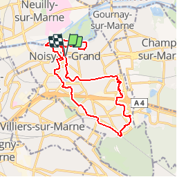
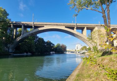
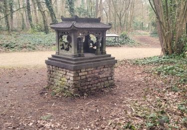
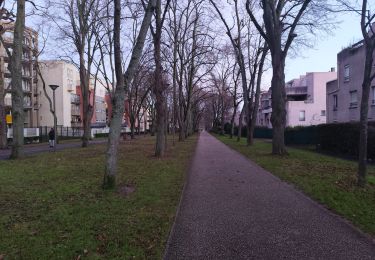
Ruta Senderismo de 15,7 km a descubrir en Isla de Francia, Sena-Saint Denis, Noisy-le-Grand. Esta ruta ha sido propuesta por tracegps.
Descripción
Conçu et balisé par le Club Noiséen de Randonnée Pédestre, le chemin de Petite Randonnée -PR N°27- est un circuit qui vous fera découvrir une ville aux facettes insolites, au gré d’une flânerie entre édifices anciens et architecture moderne.
Localización
Comentarios
Excursiones cerca
![Excursión Senderismo Neuilly-Plaisance - Neuilly Plaisance gare Rer sortie Bords de Marne/ Base Nautique Vaires sur Marne - Photo](https://media.geolcdn.com/t/375/260/3fb9e5a2-0030-4f1a-a960-e880d0c7625d.jpg&format=jpg&maxdim=2)
![Senderismo Senderismo](https://static1.geolcdn.com/sitytour/trail-icons/101.png)
Senderismo
![](/images/other/stat-length.png)
![](https://static1.geolcdn.com/siteimages/upload/files/16400158638029165_repeat_loop_refresh_sync_direction_icon.png)
![Excursión Senderismo Émerainville - GRP CV-IDF 05 - Photo](https://media.geolcdn.com/t/375/260/726621e0-1908-4a49-bd96-d431c02673d0.jpg&format=jpg&maxdim=2)
![Senderismo Senderismo](https://static1.geolcdn.com/sitytour/trail-icons/101.png)
Senderismo
![](/images/other/stat-length.png)
![](https://static1.geolcdn.com/siteimages/upload/files/16400158638029165_repeat_loop_refresh_sync_direction_icon.png)
![Excursión Senderismo Chelles - GRP CV-IDF 06 - Photo](https://media.geolcdn.com/t/375/260/3e851a57-05bf-470c-9490-37cd07bf40e9.jpg&format=jpg&maxdim=2)
![Senderismo Senderismo](https://static1.geolcdn.com/sitytour/trail-icons/101.png)
Senderismo
![](/images/other/stat-length.png)
![](https://static1.geolcdn.com/siteimages/upload/files/16400158638029165_repeat_loop_refresh_sync_direction_icon.png)
![Excursión Senderismo Champs-sur-Marne - Boucle 20 km autour de Champs sur Marne - Photo](https://media.geolcdn.com/t/375/260/e5bc49c5-8534-4b14-8b85-21b9437dca8c.jpg&format=jpg&maxdim=2)
![Senderismo Senderismo](https://static1.geolcdn.com/sitytour/trail-icons/101.png)
Senderismo
![](/images/other/stat-length.png)
![](https://static1.geolcdn.com/siteimages/upload/files/16400158638029165_repeat_loop_refresh_sync_direction_icon.png)
![Excursión A pie Champigny-sur-Marne - Sur les bords de Marne - Photo](https://media.geolcdn.com/t/375/260/0848a8c4-6d65-4224-9dca-3686da6f2272.jpg&format=jpg&maxdim=2)
![A pie A pie](https://static1.geolcdn.com/sitytour/trail-icons/100.png)
A pie
![](/images/other/stat-length.png)
![](https://static1.geolcdn.com/siteimages/upload/files/16400158638029165_repeat_loop_refresh_sync_direction_icon.png)
![Excursión Senderismo Saint-Maur-des-Fossés - Boucle St Maur - Vincennes - Photo](https://media.geolcdn.com/t/375/260/07d4e882-57e1-4d05-a0e2-c5807ef2ec4c.jpg&format=jpg&maxdim=2)
![Senderismo Senderismo](https://static1.geolcdn.com/sitytour/trail-icons/101.png)
Senderismo
![](/images/other/stat-length.png)
![](https://static1.geolcdn.com/siteimages/upload/files/16400158638029165_repeat_loop_refresh_sync_direction_icon.png)
![Excursión Senderismo Gournay-sur-Marne - Boucle Gournay/ Marne - Noisy le Grand - Champs sur Marne - Photo](https://media.geolcdn.com/t/375/260/89921577-96fb-496f-92ce-fb28ab23f5a4.jpg&format=jpg&maxdim=2)
![Senderismo Senderismo](https://static1.geolcdn.com/sitytour/trail-icons/101.png)
Senderismo
![](/images/other/stat-length.png)
![](https://static1.geolcdn.com/siteimages/upload/files/16400158638029165_repeat_loop_refresh_sync_direction_icon.png)
![Excursión Bici de montaña Fontenay-sous-Bois - vtt bois de vincennes - Photo](https://media.geolcdn.com/t/375/260/ext.jpg?maxdim=2&url=https%3A%2F%2Fstatic1.geolcdn.com%2Fsiteimages%2Fupload%2Ffiles%2F1524743154velo.jpg)
![Bici de montaña Bici de montaña](https://static1.geolcdn.com/sitytour/trail-icons/202.png)
Bici de montaña
![](/images/other/stat-length.png)
![](https://static1.geolcdn.com/siteimages/upload/files/16400158638029165_repeat_loop_refresh_sync_direction_icon.png)
![Excursión Senderismo Noisiel - Noisiel et la chocolaterie - Photo](https://media.geolcdn.com/t/375/260/fe97f7ad-9814-4701-bd30-917c29bd7d99.jpg&format=jpg&maxdim=2)
![Senderismo Senderismo](https://static1.geolcdn.com/sitytour/trail-icons/101.png)
Senderismo
![](/images/other/stat-length.png)
![](https://static1.geolcdn.com/siteimages/upload/files/16400158638029165_repeat_loop_refresh_sync_direction_icon.png)