![](/images/other/stat-length.png)
![Excursión Bici de montaña Saizerais - Le Bois St Ignon - Saizerais - Photo](https://media.geolcdn.com/t/1900/400/ext.pjpeg?maxdim=2&url=https%3A%2F%2Fservices.sitytrail.com%2FGeolivesWS%2FDownloadMedia.ashx%3FTrailID%3D317067%26Media%3D16213_6.jpg)
Le Bois St Ignon - Saizerais
tracegps
Usuario
![Longitud](/images/other/stat-length.png)
![Altitud máxima](https://static1.geolcdn.com/siteimages/upload/files/1508320355ic_sort_altitude_max_24dp.png)
![Desnivel positivo](https://static1.geolcdn.com/siteimages/upload/files/1508320355ic_sort_den_pos_24dp.png)
![Km-Effort](/images/other/stat-length.png)
![Altitud mínima](https://static1.geolcdn.com/siteimages/upload/files/1508320355ic_sort_altitude_min_24dp.png)
![Desnivel negativo](https://static1.geolcdn.com/siteimages/upload/files/1508320355ic_sort_den_neg_24dp.png)
![Boucle](https://static1.geolcdn.com/siteimages/upload/files/16400158638029165_repeat_loop_refresh_sync_direction_icon.png)
![Bici de montaña](https://static1.geolcdn.com/sitytour/trail-icons/202.png)
45m
Dificultad : Fácil
![Escanee este código QR para abrir la excursión en la aplicación SityTrail](https://capi.geolives.com/qq0zvz2zws4bq2lad0pu/sitytour/trails/317067/qr.png?size=200)
Aplicación GPS de excursión GRATIS
A propósito
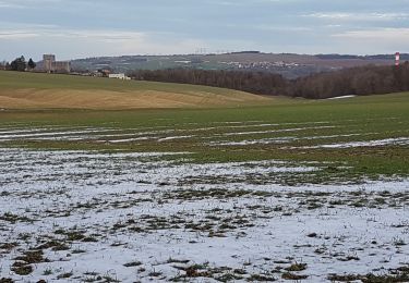
Ruta Bici de montaña de 6,9 km a descubrir en Gran Este, Meurthe y Mosela, Saizerais. Esta ruta ha sido propuesta por tracegps.
Descripción
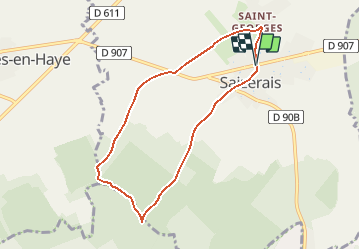
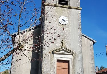
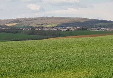
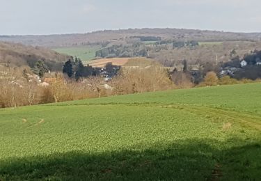
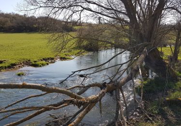
Circuit proposé par OXYGENE et la commune de Saizerais. Situé en bordure du plateau lorrain, non loin du confluent de la Moselle et de la Meurthe, à l'entrée sud du Parc Régional de Lorraine, le village de Saizerais se trouve à proximité de forêts très belles comme la forêt domaniale de Natrou ou la forêt domaniale de l'Avant Garde. Bois et terrain découvert au programme de cette boucle, au départ de la mairie, qui permet de goûter à la tranquillité du Bois St Ignon Retrouvez le plan et descriptif du circuit sur le site de l'association OXYGENE.
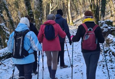
Localización
Comentarios
Excursiones cerca
![Excursión Senderismo Liverdun - Liverdun - La grande boucle de Natrou - Photo](https://media.geolcdn.com/t/375/260/5dac390e-3606-42c9-8130-3aab112c0eaf.jpg&format=jpg&maxdim=2)
![Senderismo Senderismo](https://static1.geolcdn.com/sitytour/trail-icons/101.png)
Senderismo
![](/images/other/stat-length.png)
![](https://static1.geolcdn.com/siteimages/upload/files/16400158638029165_repeat_loop_refresh_sync_direction_icon.png)
![Excursión A pie Marbache - Circuit de la Vierge de Belleville - Photo](https://media.geolcdn.com/t/375/260/ed731c2b-3434-456a-907f-b6c3a07468bd.jpeg&format=jpg&maxdim=2)
![A pie A pie](https://static1.geolcdn.com/sitytour/trail-icons/100.png)
A pie
![](/images/other/stat-length.png)
![](https://static1.geolcdn.com/siteimages/upload/files/16400158638029165_repeat_loop_refresh_sync_direction_icon.png)
![Excursión Senderismo Saizerais - SAIZERAIS - LES CORNOUILLERS ET LES HOSPICES - Photo](https://media.geolcdn.com/t/375/260/54e8a510-a902-4c19-acc7-c2168d7e5db6.jpg&format=jpg&maxdim=2)
![Senderismo Senderismo](https://static1.geolcdn.com/sitytour/trail-icons/101.png)
Senderismo
![](/images/other/stat-length.png)
![](https://static1.geolcdn.com/siteimages/upload/files/16400158638029165_repeat_loop_refresh_sync_direction_icon.png)
![Excursión Senderismo Rogéville - ROGEVILLE - LA PETITE SUISSE PAR MAMEY ET GEZONCOURT - Photo](https://media.geolcdn.com/t/375/260/9da3ecdf-5552-45ce-a8e5-2bd94b8442b6.jpg&format=jpg&maxdim=2)
![Senderismo Senderismo](https://static1.geolcdn.com/sitytour/trail-icons/101.png)
Senderismo
![](/images/other/stat-length.png)
![](https://static1.geolcdn.com/siteimages/upload/files/16400158638029165_repeat_loop_refresh_sync_direction_icon.png)
![Excursión Senderismo Dieulouard - DIEULOUARD - VERS BELLEVILLE ET SAIZERAIS - Photo](https://media.geolcdn.com/t/375/260/c2018011-1bfa-47ce-b819-34efd5861339.jpg&format=jpg&maxdim=2)
![Senderismo Senderismo](https://static1.geolcdn.com/sitytour/trail-icons/101.png)
Senderismo
![](/images/other/stat-length.png)
![](https://static1.geolcdn.com/siteimages/upload/files/16400158638029165_repeat_loop_refresh_sync_direction_icon.png)
![Excursión Senderismo Marbache - MARBACHE - LA TARTE - Photo](https://media.geolcdn.com/t/375/260/c7ab0792-3c24-41a0-b793-e6399a96c4a4.jpg&format=jpg&maxdim=2)
![Senderismo Senderismo](https://static1.geolcdn.com/sitytour/trail-icons/101.png)
Senderismo
![](/images/other/stat-length.png)
![](https://static1.geolcdn.com/siteimages/upload/files/16400158638029165_repeat_loop_refresh_sync_direction_icon.png)
![Excursión Senderismo Gézoncourt - GEZONCOURT - PETITE SUISSE LORRAINE - Photo](https://media.geolcdn.com/t/375/260/0c868cf4-7521-4b69-b2f6-03625391f5f0.jpg&format=jpg&maxdim=2)
![Senderismo Senderismo](https://static1.geolcdn.com/sitytour/trail-icons/101.png)
Senderismo
![](/images/other/stat-length.png)
![](https://static1.geolcdn.com/siteimages/upload/files/16400158638029165_repeat_loop_refresh_sync_direction_icon.png)
![Excursión Senderismo Dieulouard - LA VIERGE DE BELLEVILLE - Photo](https://media.geolcdn.com/t/375/260/92071029-0e02-4fd1-a34a-416f4acba2b2.jpg&format=jpg&maxdim=2)
![Senderismo Senderismo](https://static1.geolcdn.com/sitytour/trail-icons/101.png)
Senderismo
![](/images/other/stat-length.png)
![](https://static1.geolcdn.com/siteimages/upload/files/16400158638029165_repeat_loop_refresh_sync_direction_icon.png)
![Excursión Senderismo Liverdun - foret de Natrou & vallée de la Moselle avec barrage de la Marne au Rhin avec l écluse - Photo](https://media.geolcdn.com/t/375/260/ext.jpg?maxdim=2&url=https%3A%2F%2Fservices.sitytrail.com%2FGeolivesWS%2FDownloadMedia.ashx%3FTrailID%3D688485%26Media%3D20170123164830.jpg)
![Senderismo Senderismo](https://static1.geolcdn.com/sitytour/trail-icons/101.png)
Senderismo
![](/images/other/stat-length.png)
![](https://static1.geolcdn.com/siteimages/upload/files/16400158638029165_repeat_loop_refresh_sync_direction_icon.png)