![](/images/other/stat-length.png)
![Excursión Senderismo Saint-André-de-Cruzières - Montagne de la Serre - Saint André de Cruzières - Photo](https://media.geolcdn.com/t/1900/400/ext.pjpeg?maxdim=2&url=https%3A%2F%2Fservices.sitytrail.com%2FGeolivesWS%2FDownloadMedia.ashx%3FTrailID%3D317001%26Media%3D16134_6.jpg)
Montagne de la Serre - Saint André de Cruzières
tracegps
Usuario
![Longitud](/images/other/stat-length.png)
![Altitud máxima](https://static1.geolcdn.com/siteimages/upload/files/1508320355ic_sort_altitude_max_24dp.png)
![Desnivel positivo](https://static1.geolcdn.com/siteimages/upload/files/1508320355ic_sort_den_pos_24dp.png)
![Km-Effort](/images/other/stat-length.png)
![Altitud mínima](https://static1.geolcdn.com/siteimages/upload/files/1508320355ic_sort_altitude_min_24dp.png)
![Desnivel negativo](https://static1.geolcdn.com/siteimages/upload/files/1508320355ic_sort_den_neg_24dp.png)
![Boucle](https://static1.geolcdn.com/siteimages/upload/files/16400158638029165_repeat_loop_refresh_sync_direction_icon.png)
![Senderismo](https://static1.geolcdn.com/sitytour/trail-icons/101.png)
5h00
Dificultad : Difícil
![Escanee este código QR para abrir la excursión en la aplicación SityTrail](https://capi.geolives.com/qq0zvz2zws4bq2lad0pu/sitytour/trails/317001/qr.png?size=200)
Aplicación GPS de excursión GRATIS
A propósito
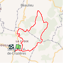
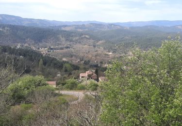
Ruta Senderismo de 17,9 km a descubrir en Auvergne-Rhône-Alpes, Ardecha, Saint-André-de-Cruzières. Esta ruta ha sido propuesta por tracegps.
Descripción
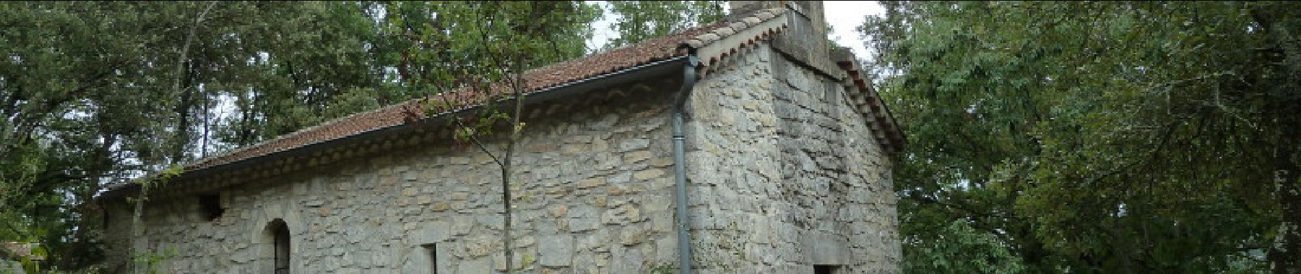
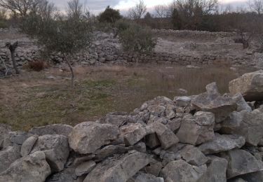
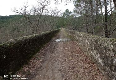
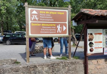
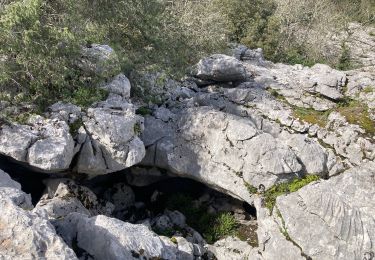
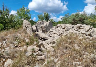
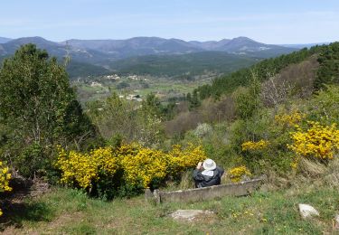
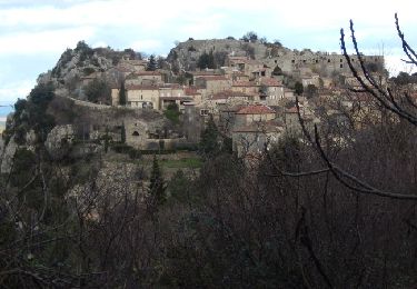
Remonter la rue principale de St André, passer à l'église puis sous le cimetière. Au Mas Rose se fier au GPS car le balisage est faible, puis monter sur une crête (limite de commune) et aller au Serre de Cruzières où le chemin épouse une longue crête. A un col (panneaux), quitter la crête vers Beaulieu et bifurquer vers Les Divols, cheminer dans les lapiaz puis rejoindre la D225,la suivre à gauche et la quitter en face. Trouver La Chapelette, bien suivre le balisage, retrouver la route un court instant et aller en direction de Lacroix et retrouver le chemin de l'aller au Mas Rose pour regagner le départ.
Localización
Comentarios
Excursiones cerca
![Excursión Senderismo Saint-Paul-le-Jeune - Du Viaduc de Doulovy au Fort de Banne - Saint Paul le Jeune - Photo](https://media.geolcdn.com/t/375/260/ext.jpg?maxdim=2&url=https%3A%2F%2Fservices.sitytrail.com%2FGeolivesWS%2FDownloadMedia.ashx%3FTrailID%3D317552%26Media%3D16802_6.jpg)
![Senderismo Senderismo](https://static1.geolcdn.com/sitytour/trail-icons/101.png)
Senderismo
![](/images/other/stat-length.png)
![](https://static1.geolcdn.com/siteimages/upload/files/16400158638029165_repeat_loop_refresh_sync_direction_icon.png)
![Excursión Senderismo Saint-André-de-Cruzières - 07 chandouillet grotte cotepatiere sauvas peyrejol - Photo](https://media.geolcdn.com/t/375/260/f87b5d53-f27e-44e1-a082-e539e9102b98.jpg&format=jpg&maxdim=2)
![Senderismo Senderismo](https://static1.geolcdn.com/sitytour/trail-icons/101.png)
Senderismo
![](/images/other/stat-length.png)
![](https://static1.geolcdn.com/siteimages/upload/files/16400158638029165_repeat_loop_refresh_sync_direction_icon.png)
![Excursión Senderismo Saint-Paul-le-Jeune - 07 les passages de voûtes au pont Doulovy 2 /02/25 - Photo](https://media.geolcdn.com/t/375/260/82fa3a1c-3766-4d3c-9be6-6015db6e1d7e.jpg&format=jpg&maxdim=2)
![Senderismo Senderismo](https://static1.geolcdn.com/sitytour/trail-icons/101.png)
Senderismo
![](/images/other/stat-length.png)
![](https://static1.geolcdn.com/siteimages/upload/files/16400158638029165_repeat_loop_refresh_sync_direction_icon.png)
![Excursión Senderismo Courry - ARDECHE/GARD COURY Grotte de la cocaliere sentier de decouvertegrotte de la cocaliere - Photo](https://media.geolcdn.com/t/375/260/e5a0d0f9-58ff-4a07-a2b3-c16e7f6eaab2.jpg&format=jpg&maxdim=2)
![Senderismo Senderismo](https://static1.geolcdn.com/sitytour/trail-icons/101.png)
Senderismo
![](/images/other/stat-length.png)
![](https://static1.geolcdn.com/siteimages/upload/files/16400158638029165_repeat_loop_refresh_sync_direction_icon.png)
![Excursión Senderismo Saint-André-de-Cruzières - CHADOUILLET - Photo](https://media.geolcdn.com/t/375/260/772623f8-cb56-4d04-9b3d-145b33c03c4b.jpeg&format=jpg&maxdim=2)
![Senderismo Senderismo](https://static1.geolcdn.com/sitytour/trail-icons/101.png)
Senderismo
![](/images/other/stat-length.png)
![](https://static1.geolcdn.com/siteimages/upload/files/16400158638029165_repeat_loop_refresh_sync_direction_icon.png)
![Excursión Senderismo Saint-Paul-le-Jeune - Sentier des dolmens - Photo](https://media.geolcdn.com/t/375/260/12f79681-eaef-4f4e-bdc8-c82f9112e8f0.jpg&format=jpg&maxdim=2)
![Senderismo Senderismo](https://static1.geolcdn.com/sitytour/trail-icons/101.png)
Senderismo
![](/images/other/stat-length.png)
![](https://static1.geolcdn.com/siteimages/upload/files/16400158638029165_repeat_loop_refresh_sync_direction_icon.png)
![Excursión Senderismo Saint-Paul-le-Jeune - St Paul Le Jeune-Chapelle St Sébastien 18km - Photo](https://media.geolcdn.com/t/375/260/cd1a704f-04ae-4412-9b27-5f3683850b1d.jpg&format=jpg&maxdim=2)
![Senderismo Senderismo](https://static1.geolcdn.com/sitytour/trail-icons/101.png)
Senderismo
![](/images/other/stat-length.png)
![](https://static1.geolcdn.com/siteimages/upload/files/16400158638029165_repeat_loop_refresh_sync_direction_icon.png)
![Excursión Senderismo Saint-Paul-le-Jeune - St-Paul le jeune-Chapelle St Sébastien 18,5 km. - Photo](https://media.geolcdn.com/t/375/260/50065471-46bf-4681-b82d-c9dab470e89b.jpg&format=jpg&maxdim=2)
![Senderismo Senderismo](https://static1.geolcdn.com/sitytour/trail-icons/101.png)
Senderismo
![](/images/other/stat-length.png)
![](https://static1.geolcdn.com/siteimages/upload/files/16400158638029165_repeat_loop_refresh_sync_direction_icon.png)
![Excursión Bici de montaña Saint-Paul-le-Jeune - Du Viaduc de Doulovy au Fort de Banne - Saint Paul le Jeune - Photo](https://media.geolcdn.com/t/375/260/ext.jpg?maxdim=2&url=https%3A%2F%2Fservices.sitytrail.com%2FGeolivesWS%2FDownloadMedia.ashx%3FTrailID%3D317553%26Media%3D16802_6.jpg)
![Bici de montaña Bici de montaña](https://static1.geolcdn.com/sitytour/trail-icons/202.png)
Bici de montaña
![](/images/other/stat-length.png)
![](https://static1.geolcdn.com/siteimages/upload/files/16400158638029165_repeat_loop_refresh_sync_direction_icon.png)