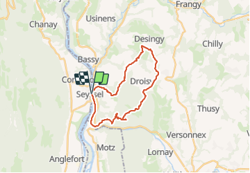
![](/images/other/stat-length.png)
![Excursión Senderismo Seyssel - 14-03-2022 Seyssel - La Montagne des Princes - Photo](https://media.geolcdn.com/t/1900/400/2bb59beb-9357-4487-bc40-f89c52f27ae9.jpg&format=pjpeg&maxdim=2)
14-03-2022 Seyssel - La Montagne des Princes
Kargil
Usuario GUIDE
![Longitud](/images/other/stat-length.png)
![Altitud máxima](https://static1.geolcdn.com/siteimages/upload/files/1508320355ic_sort_altitude_max_24dp.png)
![Desnivel positivo](https://static1.geolcdn.com/siteimages/upload/files/1508320355ic_sort_den_pos_24dp.png)
![Km-Effort](/images/other/stat-length.png)
![Altitud mínima](https://static1.geolcdn.com/siteimages/upload/files/1508320355ic_sort_altitude_min_24dp.png)
![Desnivel negativo](https://static1.geolcdn.com/siteimages/upload/files/1508320355ic_sort_den_neg_24dp.png)
![Boucle](https://static1.geolcdn.com/siteimages/upload/files/16400158638029165_repeat_loop_refresh_sync_direction_icon.png)
![Senderismo](https://static1.geolcdn.com/sitytour/trail-icons/101.png)
5h57
Dificultad : Medio
![Escanee este código QR para abrir la excursión en la aplicación SityTrail](https://capi.geolives.com/qq0zvz2zws4bq2lad0pu/sitytour/trails/3166796/qr.png?size=200)
Aplicación GPS de excursión GRATIS
A propósito
Ruta Senderismo de 24 km a descubrir en Auvergne-Rhône-Alpes, Alta Saboya, Seyssel. Esta ruta ha sido propuesta por Kargil.
Descripción
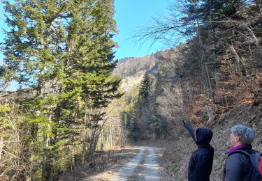
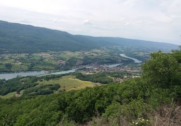
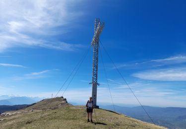
Une montée soutenue en sous-bois avec des panoramas méritants de petits détours.
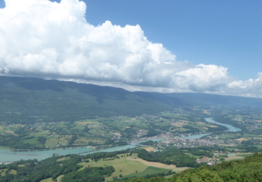
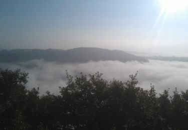
Une descente toute en douceur avec des vues magnifiques sur les Alpes, puis Le Bugey et enfin la vallée du Rhône.
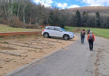
Randonnée sans difficulté technique pouvant être rallongée ou raccourcie au gré des nombreux sentiers du secteur.
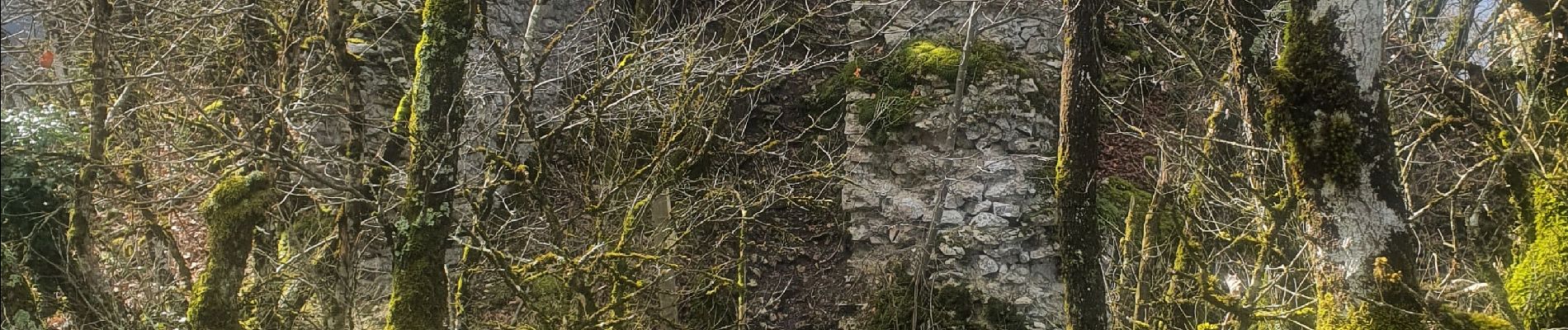
Rester attentif quand le sentier est humide.
Localización
Comentarios
Excursiones cerca
![Excursión Senderismo Vallières-sur-Fier - VAL_DE_FIER_BALCONS - Photo](https://media.geolcdn.com/t/375/260/ext.jpg?maxdim=2&url=https%3A%2F%2Fservices.sitytrail.com%2FGeolivesWS%2FDownloadMedia.ashx%3FTrailID%3D603115%26Media%3Daae1b741-5652-4a0f-9677-926404386cfd.png)
![Senderismo Senderismo](https://static1.geolcdn.com/sitytour/trail-icons/101.png)
Senderismo
![](/images/other/stat-length.png)
![](https://static1.geolcdn.com/siteimages/upload/files/16400158638029165_repeat_loop_refresh_sync_direction_icon.png)
![Excursión Senderismo Corbonod - GRAND COLOMBIER: SUR LYAND - CHARBEMENES - CHALET D'ARVIERES - Photo](https://media.geolcdn.com/t/375/260/23de9000-aeb2-412c-a056-3c3ba2ac6100.jpg&format=jpg&maxdim=2)
![Senderismo Senderismo](https://static1.geolcdn.com/sitytour/trail-icons/101.png)
Senderismo
![](/images/other/stat-length.png)
![](https://static1.geolcdn.com/siteimages/upload/files/16400158638029165_repeat_loop_refresh_sync_direction_icon.png)
![Excursión Senderismo Droisy - MONTAGNE DES PRINCES: Départ de Droisy / Passage sud sous les falaises - Photo](https://media.geolcdn.com/t/375/260/47664c6d-16b5-4521-a2e3-e1fddaf307e0.jpg&format=jpg&maxdim=2)
![Senderismo Senderismo](https://static1.geolcdn.com/sitytour/trail-icons/101.png)
Senderismo
![](/images/other/stat-length.png)
![](https://static1.geolcdn.com/siteimages/upload/files/16400158638029165_repeat_loop_refresh_sync_direction_icon.png)
![Excursión Senderismo Droisy - MONTAGNE DES PRINCES: DROISY - PASSAGE SUD SOUS LES FALAISES - Photo](https://media.geolcdn.com/t/375/260/488262c3-91d3-4551-a4ed-725cf5c6cdfd.jpg&format=jpg&maxdim=2)
![Senderismo Senderismo](https://static1.geolcdn.com/sitytour/trail-icons/101.png)
Senderismo
![](/images/other/stat-length.png)
![](https://static1.geolcdn.com/siteimages/upload/files/16400158638029165_repeat_loop_refresh_sync_direction_icon.png)
![Excursión Senderismo Motz - MOTZ SERRIERES: BORDS DU RHONE - Photo](https://media.geolcdn.com/t/375/260/d5979f91-e62c-40fa-96a4-fc46ef5f42b9.jpg&format=jpg&maxdim=2)
![Senderismo Senderismo](https://static1.geolcdn.com/sitytour/trail-icons/101.png)
Senderismo
![](/images/other/stat-length.png)
![](https://static1.geolcdn.com/siteimages/upload/files/16400158638029165_repeat_loop_refresh_sync_direction_icon.png)
![Excursión Senderismo Corbonod - GRAND COLOMBIER: SUR LYAND - CHARBEMENES par les crêtes - COLOMBIER - RETOUR PAR VALLON D'ARVIERES - Photo](https://media.geolcdn.com/t/375/260/b12dfb88-143c-4b4b-96de-73aa15f6023a.jpg&format=jpg&maxdim=2)
![Senderismo Senderismo](https://static1.geolcdn.com/sitytour/trail-icons/101.png)
Senderismo
![](/images/other/stat-length.png)
![](https://static1.geolcdn.com/siteimages/upload/files/16400158638029165_repeat_loop_refresh_sync_direction_icon.png)
![Excursión Senderismo Corbonod - combe merlin - Photo](https://media.geolcdn.com/t/375/260/ext.jpg?maxdim=2&url=https%3A%2F%2Fservices.sitytrail.com%2FGeolivesWS%2FDownloadMedia.ashx%3FTrailID%3D1046732%26Media%3Dfix__20180926124253.jpg)
![Senderismo Senderismo](https://static1.geolcdn.com/sitytour/trail-icons/101.png)
Senderismo
![](/images/other/stat-length.png)
![](https://static1.geolcdn.com/siteimages/upload/files/16400158638029165_repeat_loop_refresh_sync_direction_icon.png)
![Excursión Senderismo Seyssel - balade - Photo](https://media.geolcdn.com/t/375/260/ext.jpg?maxdim=2&url=https%3A%2F%2Fservices.sitytrail.com%2FGeolivesWS%2FDownloadMedia.ashx%3FTrailID%3D659253%26Media%3Dfix__20161112144854.jpg)
![Senderismo Senderismo](https://static1.geolcdn.com/sitytour/trail-icons/101.png)
Senderismo
![](/images/other/stat-length.png)
![](https://static1.geolcdn.com/siteimages/upload/files/16400158638029165_repeat_loop_refresh_sync_direction_icon.png)
![Excursión Marcha nórdica Vallières-sur-Fier - Val de Fier - Croix saint-André - Photo](https://media.geolcdn.com/t/375/260/ext.jpg?maxdim=2&url=https%3A%2F%2Fservices.sitytrail.com%2FGeolivesWS%2FDownloadMedia.ashx%3FTrailID%3D345602%26Media%3Dfix__20140916090536.jpg)
![Marcha nórdica Marcha nórdica](https://static1.geolcdn.com/sitytour/trail-icons/102.png)
Marcha nórdica
![](/images/other/stat-length.png)
![](https://static1.geolcdn.com/siteimages/upload/files/16400158638029165_repeat_loop_refresh_sync_direction_icon.png)