![](/images/other/stat-length.png)
![Excursión Senderismo Puurs-Sint-Amands - Lippelobos - Photo](https://media.geolcdn.com/t/1900/400/ext.pjpeg?maxdim=2&url=https%3A%2F%2Fstatic1.geolcdn.com%2Fsiteimages%2Fupload%2Ffiles%2F1553511878bg_sport_marche.png)
Lippelobos
Geert H.
Usuario
![Longitud](/images/other/stat-length.png)
Longitud
7,6 km
![Altitud máxima](https://static1.geolcdn.com/siteimages/upload/files/1508320355ic_sort_altitude_max_24dp.png)
Altitud máxima
23 m
![Desnivel positivo](https://static1.geolcdn.com/siteimages/upload/files/1508320355ic_sort_den_pos_24dp.png)
Desnivel positivo
69 m
![Km-Effort](/images/other/stat-length.png)
Km-Effort
8,5 km
![Altitud mínima](https://static1.geolcdn.com/siteimages/upload/files/1508320355ic_sort_altitude_min_24dp.png)
Altitud mínima
3 m
![Desnivel negativo](https://static1.geolcdn.com/siteimages/upload/files/1508320355ic_sort_den_neg_24dp.png)
Desnivel negativo
69 m
![Boucle](https://static1.geolcdn.com/siteimages/upload/files/16400158638029165_repeat_loop_refresh_sync_direction_icon.png)
Boucle
Sí
Fecha de creación :
2022-03-06 17:29:43.316
Última modificación :
2022-03-07 09:13:49.281
![Senderismo](https://static1.geolcdn.com/sitytour/trail-icons/101.png)
1h55
Dificultad : Medio
![Escanee este código QR para abrir la excursión en la aplicación SityTrail](https://capi.geolives.com/qq0zvz2zws4bq2lad0pu/sitytour/trails/3157530/qr.png?size=200)
Aplicación GPS de excursión GRATIS
A propósito
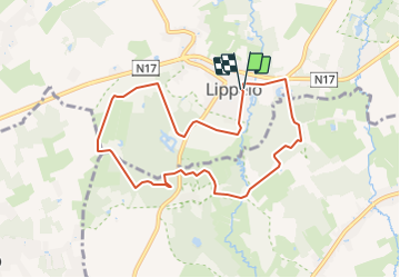
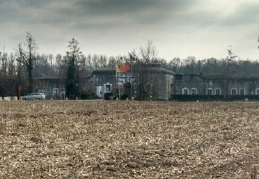
Ruta Senderismo de 7,6 km a descubrir en Flandes, Amberes, Puurs-Sint-Amands. Esta ruta ha sido propuesta por Geert H..
Descripción
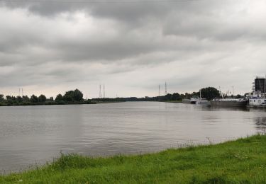
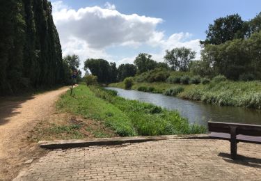
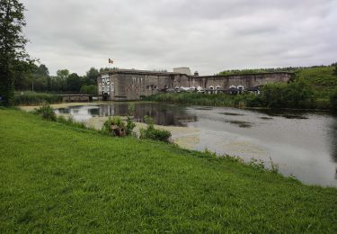
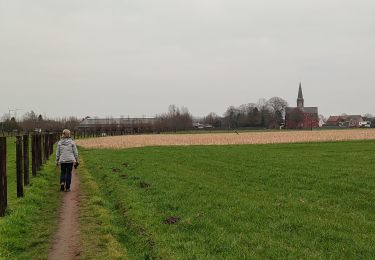
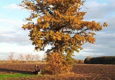
Walk in the Lippelo forest and along the Grote Molenbeek. You will pass the geographic center of Flanders during the route.
Localización
País:
Belgium
Región :
Flandes
Departamento/provincia :
Amberes
Municipio :
Puurs-Sint-Amands
Localidad:
Lippelo
Salida:(Dec)
Salida:(UTM)
588551 ; 5655370 (31U) N.
Comentarios
Excursiones cerca
![Excursión A pie Buggenhout - Wandeling Konijnenberg en Arboretum - Photo](https://media.geolcdn.com/t/375/260/3f10f8e8-9a4d-413d-9c1f-4e306b040279.jpeg&format=jpg&maxdim=2)
![A pie A pie](https://static1.geolcdn.com/sitytour/trail-icons/100.png)
Wandeling Konijnenberg en Arboretum
A pie
Fácil
Buggenhout,
Flandes,
Provincia de Flandes Oriental,
Belgium
![](/images/other/stat-length.png)
3,6 km | 4,2 km-effort
57min
![](https://static1.geolcdn.com/siteimages/upload/files/16400158638029165_repeat_loop_refresh_sync_direction_icon.png)
Sí
![Excursión Senderismo Londerzeel - Londerzeel Lippelo 19 km - Photo](https://media.geolcdn.com/t/375/260/f350d401-70e5-49a4-84f9-0eb3bee85cb4.jpg&format=jpg&maxdim=2)
![Senderismo Senderismo](https://static1.geolcdn.com/sitytour/trail-icons/101.png)
Londerzeel Lippelo 19 km
Senderismo
Fácil
Londerzeel,
Flandes,
Brabante Flamenco,
Belgium
![](/images/other/stat-length.png)
19,2 km | 21 km-effort
3h 56min
![](https://static1.geolcdn.com/siteimages/upload/files/16400158638029165_repeat_loop_refresh_sync_direction_icon.png)
Sí
![Excursión Senderismo Puurs-Sint-Amands - Dodentoch 2023 - Fin des 100 km - Photo](https://media.geolcdn.com/t/375/260/36da7172-a16f-4e5a-83e7-0166424bfce6.jpg&format=jpg&maxdim=2)
![Senderismo Senderismo](https://static1.geolcdn.com/sitytour/trail-icons/101.png)
Dodentoch 2023 - Fin des 100 km
Senderismo
Fácil
Puurs-Sint-Amands,
Flandes,
Amberes,
Belgium
![](/images/other/stat-length.png)
31 km | 33 km-effort
6h 8min
![](https://static1.geolcdn.com/siteimages/upload/files/16400158638029165_repeat_loop_refresh_sync_direction_icon.png)
No
![Excursión Senderismo Puurs-Sint-Amands - Randonnée à Sauvegarde - Photo](https://media.geolcdn.com/t/375/260/9a483e96-6e2b-480f-b6f9-d5e845c14cfd.jpg&format=jpg&maxdim=2)
![Senderismo Senderismo](https://static1.geolcdn.com/sitytour/trail-icons/101.png)
Randonnée à Sauvegarde
Senderismo
Muy fácil
(1)
Puurs-Sint-Amands,
Flandes,
Amberes,
Belgium
![](/images/other/stat-length.png)
19,7 km | 21 km-effort
4h 54min
![](https://static1.geolcdn.com/siteimages/upload/files/16400158638029165_repeat_loop_refresh_sync_direction_icon.png)
Sí
![Excursión Senderismo Puurs-Sint-Amands - Sauvegarde 20 km - Photo](https://media.geolcdn.com/t/375/260/ext.jpg?maxdim=2&url=https%3A%2F%2Fservices.sitytrail.com%2FGeolivesWS%2FDownloadMedia.ashx%3FTrailID%3D1012041%26Media%3D20180728151705.jpg)
![Senderismo Senderismo](https://static1.geolcdn.com/sitytour/trail-icons/101.png)
Sauvegarde 20 km
Senderismo
Fácil
(1)
Puurs-Sint-Amands,
Flandes,
Amberes,
Belgium
![](/images/other/stat-length.png)
20 km | 21 km-effort
4h 50min
![](https://static1.geolcdn.com/siteimages/upload/files/16400158638029165_repeat_loop_refresh_sync_direction_icon.png)
Sí
![Excursión Senderismo Puurs-Sint-Amands - Fort Liezele - Oppuurs and back - Photo](https://media.geolcdn.com/t/375/260/a5b0573d-615e-41e8-bbc2-0605ff4cfdc8.jpg&format=jpg&maxdim=2)
![Senderismo Senderismo](https://static1.geolcdn.com/sitytour/trail-icons/101.png)
Fort Liezele - Oppuurs and back
Senderismo
Medio
Puurs-Sint-Amands,
Flandes,
Amberes,
Belgium
![](/images/other/stat-length.png)
10,5 km | 11,1 km-effort
2h 31min
![](https://static1.geolcdn.com/siteimages/upload/files/16400158638029165_repeat_loop_refresh_sync_direction_icon.png)
Sí
![Excursión Senderismo Londerzeel - Sint-Jozef - Lippelo - Photo](https://media.geolcdn.com/t/375/260/cb2fb7e7-fb57-4b3a-90b5-e0b3bc9ec3ee.jpg&format=jpg&maxdim=2)
![Senderismo Senderismo](https://static1.geolcdn.com/sitytour/trail-icons/101.png)
Sint-Jozef - Lippelo
Senderismo
Fácil
Londerzeel,
Flandes,
Brabante Flamenco,
Belgium
![](/images/other/stat-length.png)
12,2 km | 13,4 km-effort
2h 28min
![](https://static1.geolcdn.com/siteimages/upload/files/16400158638029165_repeat_loop_refresh_sync_direction_icon.png)
Sí
![Excursión Senderismo Buggenhout - Buggenhout - Photo](https://media.geolcdn.com/t/375/260/ext.jpg?maxdim=2&url=https%3A%2F%2Fservices.sitytrail.com%2FGeolivesWS%2FDownloadMedia.ashx%3FTrailID%3D864232%26Media%3Dfix__20171119085009.jpg)
![Senderismo Senderismo](https://static1.geolcdn.com/sitytour/trail-icons/101.png)
Buggenhout
Senderismo
Fácil
Buggenhout,
Flandes,
Provincia de Flandes Oriental,
Belgium
![](/images/other/stat-length.png)
6,7 km | 6,9 km-effort
1h 40min
![](https://static1.geolcdn.com/siteimages/upload/files/16400158638029165_repeat_loop_refresh_sync_direction_icon.png)
Sí
![Excursión Senderismo Puurs-Sint-Amands - Trage Wegen Klein Brabant - Photo](https://media.geolcdn.com/t/375/260/ext.jpg?maxdim=2&url=https%3A%2F%2Fservices.sitytrail.com%2FGeolivesWS%2FDownloadMedia.ashx%3FTrailID%3D538341%26Media%3Dfix__20160315152615.jpg)
![Senderismo Senderismo](https://static1.geolcdn.com/sitytour/trail-icons/101.png)
Trage Wegen Klein Brabant
Senderismo
Medio
Puurs-Sint-Amands,
Flandes,
Amberes,
Belgium
![](/images/other/stat-length.png)
20 km | 21 km-effort
4h 18min
![](https://static1.geolcdn.com/siteimages/upload/files/16400158638029165_repeat_loop_refresh_sync_direction_icon.png)
Sí