


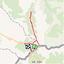

13,1 km | 23 km-effort


Usuario


Aplicación GPS de excursión GRATIS
 SityTrail
IGN / Institutos geográficos
SityTrail World
El mundo es suyo
Ruta Senderismo de 11,5 km a descubrir en Provenza-Alpes-Costa Azul, Altos Alpes, Molines-en-Queyras. Esta ruta ha sido propuesta por GerardBouche.
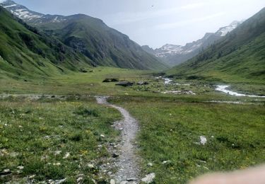
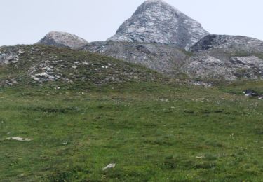
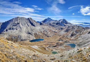
Col Agnel->Refuge Agnel->Col Vieux->Lac Foréant->Lac Egorgéou->Pain de Sucre (Belgique)

Senderismo
Senderismo

Senderismo

Senderismo

Senderismo

Senderismo
Senderismo
Senderismo

Senderismo