![](/images/other/stat-length.png)
entre Pont sur SEINE et MARNAY
jeannine grandjean
Usuario
![Longitud](/images/other/stat-length.png)
![Altitud máxima](https://static1.geolcdn.com/siteimages/upload/files/1508320355ic_sort_altitude_max_24dp.png)
![Desnivel positivo](https://static1.geolcdn.com/siteimages/upload/files/1508320355ic_sort_den_pos_24dp.png)
![Km-Effort](/images/other/stat-length.png)
![Altitud mínima](https://static1.geolcdn.com/siteimages/upload/files/1508320355ic_sort_altitude_min_24dp.png)
![Desnivel negativo](https://static1.geolcdn.com/siteimages/upload/files/1508320355ic_sort_den_neg_24dp.png)
![Boucle](https://static1.geolcdn.com/siteimages/upload/files/16400158638029165_repeat_loop_refresh_sync_direction_icon.png)
![Senderismo](https://static1.geolcdn.com/sitytour/trail-icons/101.png)
2h43
Dificultad : Difícil
![Escanee este código QR para abrir la excursión en la aplicación SityTrail](https://capi.geolives.com/qq0zvz2zws4bq2lad0pu/sitytour/trails/3133781/qr.png?size=200)
Aplicación GPS de excursión GRATIS
A propósito
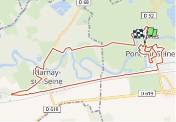
Ruta Senderismo de 13,1 km a descubrir en Gran Este, Aube, Pont-sur-Seine. Esta ruta ha sido propuesta por jeannine grandjean.
Descripción
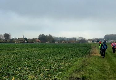
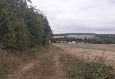
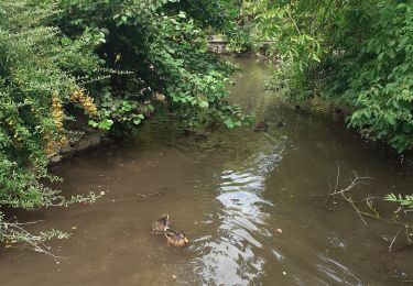
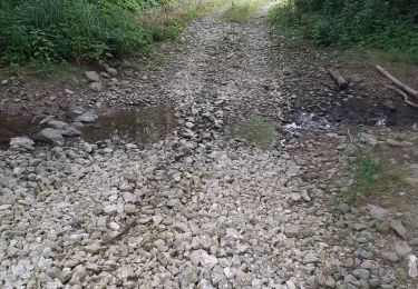
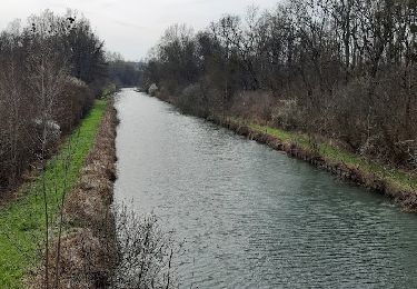
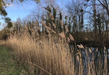
au départ du camping, flânerie dans Pont en suivant l'emplacement des anciens remparts puis les rives de la Seine. Rejoindre le camping, traverser la rivière et par le premier chemin à gauche, rejoindre Marnay à travers les chemins de pâturage. Traverser de nouveau la Seine pour gagner l'autre rive et descendre en contrebas de l'église pour longer quelque temps la rivière ; passer devant le Jardin Botanique, regagner Pont en longeant le canal de Bernières Conflans ; ne pas manquer le pont-levis, le lavoir, la Porte saint-Martin et l'église du même nom, avant de rejoindre le camping
Localización
Comentarios
Excursiones cerca
![Excursión Senderismo Saint-Aubin - Saint Aubin et la vallée de l'Ardusson - Photo](https://media.geolcdn.com/t/375/260/f350ed10-944d-4a3f-a8a0-a8fbb2c48c0b.jpg&format=jpg&maxdim=2)
![Senderismo Senderismo](https://static1.geolcdn.com/sitytour/trail-icons/101.png)
Senderismo
![](/images/other/stat-length.png)
![](https://static1.geolcdn.com/siteimages/upload/files/16400158638029165_repeat_loop_refresh_sync_direction_icon.png)
![Excursión Senderismo Saint-Aubin - St Aubin - Fontaine Mâcon - St Aubin - Photo](https://media.geolcdn.com/t/375/260/e257991e-7cb7-4143-9b1a-d9a805529f6d.jpg&format=jpg&maxdim=2)
![Senderismo Senderismo](https://static1.geolcdn.com/sitytour/trail-icons/101.png)
Senderismo
![](/images/other/stat-length.png)
![](https://static1.geolcdn.com/siteimages/upload/files/16400158638029165_repeat_loop_refresh_sync_direction_icon.png)
![Excursión Senderismo Saint-Aubin - St Aubin - Fontaine Mâcon - Abbaye du Paraclet - St Aubin - Photo](https://media.geolcdn.com/t/375/260/91520258-9572-40f5-aac3-ae8eb59945ec.jpg&format=jpg&maxdim=2)
![Senderismo Senderismo](https://static1.geolcdn.com/sitytour/trail-icons/101.png)
Senderismo
![](/images/other/stat-length.png)
![](https://static1.geolcdn.com/siteimages/upload/files/16400158638029165_repeat_loop_refresh_sync_direction_icon.png)
![Excursión Bicicleta híbrida Marnay-sur-Seine - Marnay bis - Photo](https://media.geolcdn.com/t/375/260/d3dd4a92-ca0b-442d-80fb-f340a7687fae.jpg&format=jpg&maxdim=2)
![Bicicleta híbrida Bicicleta híbrida](https://static1.geolcdn.com/sitytour/trail-icons/203.png)
Bicicleta híbrida
![](/images/other/stat-length.png)
![](https://static1.geolcdn.com/siteimages/upload/files/16400158638029165_repeat_loop_refresh_sync_direction_icon.png)
![Excursión Senderismo Crancey - Entre CRANCEY et PONT SUR SEINE - Photo](https://media.geolcdn.com/t/375/260/57d0ce4e-2aa7-4ecd-8bc9-3fd6665e20d8.jpg&format=jpg&maxdim=2)
![Senderismo Senderismo](https://static1.geolcdn.com/sitytour/trail-icons/101.png)
Senderismo
![](/images/other/stat-length.png)
![](https://static1.geolcdn.com/siteimages/upload/files/16400158638029165_repeat_loop_refresh_sync_direction_icon.png)
![Excursión Senderismo Pont-sur-Seine - De Pont sur Seine à Marnay - Photo](https://media.geolcdn.com/t/375/260/381e93b8-caf4-43dd-ac99-d1509d92dd1f.jpg&format=jpg&maxdim=2)
![Senderismo Senderismo](https://static1.geolcdn.com/sitytour/trail-icons/101.png)
Senderismo
![](/images/other/stat-length.png)
![](https://static1.geolcdn.com/siteimages/upload/files/16400158638029165_repeat_loop_refresh_sync_direction_icon.png)
![Excursión Senderismo Esclavolles-Lurey - Esclavolles Esclavolles via éoliennes et Potangis - Photo](https://media.geolcdn.com/t/375/260/ext.jpg?maxdim=2&url=https%3A%2F%2Fstatic1.geolcdn.com%2Fsiteimages%2Fupload%2Ffiles%2F1553511878bg_sport_marche.png)
![Senderismo Senderismo](https://static1.geolcdn.com/sitytour/trail-icons/101.png)
Senderismo
![](/images/other/stat-length.png)
![](https://static1.geolcdn.com/siteimages/upload/files/16400158638029165_repeat_loop_refresh_sync_direction_icon.png)
![Excursión A pie Saint-Aubin - Saint-Aubin, Quincey - Photo](https://media.geolcdn.com/t/375/260/ext.jpg?maxdim=2&url=https%3A%2F%2Fstatic1.geolcdn.com%2Fsiteimages%2Fupload%2Ffiles%2F1545311037marcheuse_200dpi.jpg)
![A pie A pie](https://static1.geolcdn.com/sitytour/trail-icons/100.png)
A pie
![](/images/other/stat-length.png)
![](https://static1.geolcdn.com/siteimages/upload/files/16400158638029165_repeat_loop_refresh_sync_direction_icon.png)
![Excursión A pie La Villeneuve-au-Châtelot - La Villeneuve au Châtelot, Courtavant - Photo](https://media.geolcdn.com/t/375/260/ext.jpg?maxdim=2&url=https%3A%2F%2Fstatic1.geolcdn.com%2Fsiteimages%2Fupload%2Ffiles%2F1545311037marcheuse_200dpi.jpg)
![A pie A pie](https://static1.geolcdn.com/sitytour/trail-icons/100.png)
A pie
![](/images/other/stat-length.png)
![](https://static1.geolcdn.com/siteimages/upload/files/16400158638029165_repeat_loop_refresh_sync_direction_icon.png)