![](/images/other/stat-length.png)
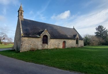
![Excursión A pie Nostang - Le Long du Roch - Photo](https://media.geolcdn.com/t/1900/400/ec20f331-9ff2-497c-afa4-4796269c3d10.jpeg&format=pjpeg&maxdim=2)
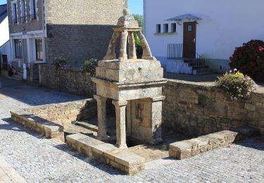
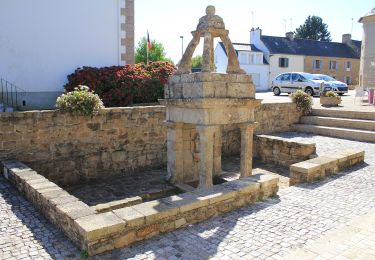
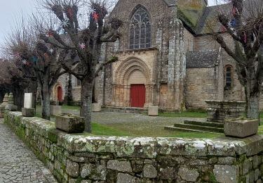
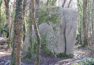
Le Long du Roch
SityTrail - itinéraires balisés pédestres
Tous les sentiers balisés d’Europe GUIDE+
![Longitud](/images/other/stat-length.png)
Longitud
7,5 km
![Altitud máxima](https://static1.geolcdn.com/siteimages/upload/files/1508320355ic_sort_altitude_max_24dp.png)
Altitud máxima
44 m
![Desnivel positivo](https://static1.geolcdn.com/siteimages/upload/files/1508320355ic_sort_den_pos_24dp.png)
Desnivel positivo
102 m
![Km-Effort](/images/other/stat-length.png)
Km-Effort
8,9 km
![Altitud mínima](https://static1.geolcdn.com/siteimages/upload/files/1508320355ic_sort_altitude_min_24dp.png)
Altitud mínima
1 m
![Desnivel negativo](https://static1.geolcdn.com/siteimages/upload/files/1508320355ic_sort_den_neg_24dp.png)
Desnivel negativo
103 m
![Boucle](https://static1.geolcdn.com/siteimages/upload/files/16400158638029165_repeat_loop_refresh_sync_direction_icon.png)
Boucle
Sí
Baliza
Fecha de creación :
2022-02-17 10:56:48.117
Última modificación :
2022-03-03 22:25:26.557
![A pie](https://static1.geolcdn.com/sitytour/trail-icons/100.png)
2h01
Dificultad : Fácil
![Escanee este código QR para abrir la excursión en la aplicación SityTrail](https://capi.geolives.com/qq0zvz2zws4bq2lad0pu/sitytour/trails/3130736/qr.png?size=200)
Aplicación GPS de excursión GRATIS
A propósito
Ruta A pie de 7,5 km a descubrir en Bretaña, Morbihan, Nostang. Esta ruta ha sido propuesta por SityTrail - itinéraires balisés pédestres.
Descripción
Trail created by Communauté de Communes Blavet Bellevue Océan.
Localización
País:
France
Región :
Bretaña
Departamento/provincia :
Morbihan
Municipio :
Nostang
Localidad:
Unknown
Salida:(Dec)
Salida:(UTM)
485737 ; 5288291 (30T) N.
Comentarios
Excursiones cerca
![Excursión Bicicleta Nostang - Nostang La Gouarde 14/06 - Photo](https://media.geolcdn.com/t/375/260/ext.jpg?maxdim=2&url=https%3A%2F%2Fservices.sitytrail.com%2FGeolivesWS%2FDownloadMedia.ashx%3FTrailID%3D312463%26Media%3D)
![Bicicleta Bicicleta](https://static1.geolcdn.com/sitytour/trail-icons/200.png)
Nostang La Gouarde 14/06
Bicicleta
Medio
(1)
Nostang,
Bretaña,
Morbihan,
France
![](/images/other/stat-length.png)
6,8 km | 7,7 km-effort
1h 17min
![](https://static1.geolcdn.com/siteimages/upload/files/16400158638029165_repeat_loop_refresh_sync_direction_icon.png)
Sí
![Excursión A pie Sainte-Hélène - Entre bois et landes - Photo](https://media.geolcdn.com/t/375/260/5d12285a-22b7-4730-9da0-e1571eab1985.jpeg&format=jpg&maxdim=2)
![A pie A pie](https://static1.geolcdn.com/sitytour/trail-icons/100.png)
Entre bois et landes
A pie
Fácil
Sainte-Hélène,
Bretaña,
Morbihan,
France
![](/images/other/stat-length.png)
6,9 km | 7,7 km-effort
1h 44min
![](https://static1.geolcdn.com/siteimages/upload/files/16400158638029165_repeat_loop_refresh_sync_direction_icon.png)
Sí
![Excursión A pie Sainte-Hélène - Circuit de Pont Madame - Photo](https://media.geolcdn.com/t/375/260/378c5d51-7139-4b46-8065-f391676a94b0.jpeg&format=jpg&maxdim=2)
![A pie A pie](https://static1.geolcdn.com/sitytour/trail-icons/100.png)
Circuit de Pont Madame
A pie
Fácil
Sainte-Hélène,
Bretaña,
Morbihan,
France
![](/images/other/stat-length.png)
5,1 km | 5,8 km-effort
1h 18min
![](https://static1.geolcdn.com/siteimages/upload/files/16400158638029165_repeat_loop_refresh_sync_direction_icon.png)
No
![Excursión Senderismo Nostang - De Nostang à la pointe du Gouarde - Photo](https://media.geolcdn.com/t/375/260/ext.jpg?maxdim=2&url=https%3A%2F%2Fstatic1.geolcdn.com%2Fsiteimages%2Fupload%2Ffiles%2F1553511878bg_sport_marche.png)
![Senderismo Senderismo](https://static1.geolcdn.com/sitytour/trail-icons/101.png)
De Nostang à la pointe du Gouarde
Senderismo
Fácil
(4)
Nostang,
Bretaña,
Morbihan,
France
![](/images/other/stat-length.png)
9,8 km | 11 km-effort
2h 36min
![](https://static1.geolcdn.com/siteimages/upload/files/16400158638029165_repeat_loop_refresh_sync_direction_icon.png)
Sí
![Excursión Senderismo Merlevenez - PR_56_Merlevenez_BA_02_Circuit1b_Trevelzun_20240128 - Photo](https://media.geolcdn.com/t/375/260/1dce9dff-7a48-40fd-9f7a-7c1e7cb05c96.jpg&format=jpg&maxdim=2)
![Senderismo Senderismo](https://static1.geolcdn.com/sitytour/trail-icons/101.png)
PR_56_Merlevenez_BA_02_Circuit1b_Trevelzun_20240128
Senderismo
Medio
Merlevenez,
Bretaña,
Morbihan,
France
![](/images/other/stat-length.png)
9,8 km | 10,9 km-effort
2h 28min
![](https://static1.geolcdn.com/siteimages/upload/files/16400158638029165_repeat_loop_refresh_sync_direction_icon.png)
Sí
![Excursión Senderismo Plouhinec - PR_56_Plouhinec_EA_05_Circuit1b_Des-Sous-Bois-De-St-Fiacre_20240106 - Photo](https://media.geolcdn.com/t/375/260/2f316c98-30bf-4bcf-9062-3c6a9bdd7eab.jpg&format=jpg&maxdim=2)
![Senderismo Senderismo](https://static1.geolcdn.com/sitytour/trail-icons/101.png)
PR_56_Plouhinec_EA_05_Circuit1b_Des-Sous-Bois-De-St-Fiacre_20240106
Senderismo
Muy fácil
Plouhinec,
Bretaña,
Morbihan,
France
![](/images/other/stat-length.png)
6,8 km | 7,5 km-effort
1h 37min
![](https://static1.geolcdn.com/siteimages/upload/files/16400158638029165_repeat_loop_refresh_sync_direction_icon.png)
Sí
![Excursión Senderismo Plouhinec - PR_56_Plouhinec_DA_04_Circuit4b_De-St-Fiacre-Et-Du-Vamen_20231228 - Photo](https://media.geolcdn.com/t/375/260/a857060c-e71c-426f-afaf-a1550e132fb9.jpg&format=jpg&maxdim=2)
![Senderismo Senderismo](https://static1.geolcdn.com/sitytour/trail-icons/101.png)
PR_56_Plouhinec_DA_04_Circuit4b_De-St-Fiacre-Et-Du-Vamen_20231228
Senderismo
Muy fácil
Plouhinec,
Bretaña,
Morbihan,
France
![](/images/other/stat-length.png)
9,2 km | 10,2 km-effort
2h 18min
![](https://static1.geolcdn.com/siteimages/upload/files/16400158638029165_repeat_loop_refresh_sync_direction_icon.png)
Sí
![Excursión Senderismo Sainte-Hélène - PR_56_Ste-Helene_CA_03_Circuit1b_Pont-Madame_20231202 - Photo](https://media.geolcdn.com/t/375/260/b86c1f59-60bf-424c-a24c-077c9852b088.jpg&format=jpg&maxdim=2)
![Senderismo Senderismo](https://static1.geolcdn.com/sitytour/trail-icons/101.png)
PR_56_Ste-Helene_CA_03_Circuit1b_Pont-Madame_20231202
Senderismo
Medio
Sainte-Hélène,
Bretaña,
Morbihan,
France
![](/images/other/stat-length.png)
8,4 km | 9,3 km-effort
1h 37min
![](https://static1.geolcdn.com/siteimages/upload/files/16400158638029165_repeat_loop_refresh_sync_direction_icon.png)
Sí
![Excursión Senderismo Sainte-Hélène - PR_56_Ste-Helene_BA_02_Circuit1b_Entre-Bois-Et-Landes_20231107 - Photo](https://media.geolcdn.com/t/375/260/6091acee-86da-41b2-a360-3af3d50e3f3f.jpg&format=jpg&maxdim=2)
![Senderismo Senderismo](https://static1.geolcdn.com/sitytour/trail-icons/101.png)
PR_56_Ste-Helene_BA_02_Circuit1b_Entre-Bois-Et-Landes_20231107
Senderismo
Muy fácil
Sainte-Hélène,
Bretaña,
Morbihan,
France
![](/images/other/stat-length.png)
8,2 km | 9,1 km-effort
1h 40min
![](https://static1.geolcdn.com/siteimages/upload/files/16400158638029165_repeat_loop_refresh_sync_direction_icon.png)
Sí