![](/images/other/stat-length.png)
![Excursión A pie Kiefersfelden - Kaiser Max Weg - Photo](https://media.geolcdn.com/t/1900/400/d9479138-c4d4-4de4-9913-7bba84071432.jpeg&format=pjpeg&maxdim=2)
Kaiser Max Weg
SityTrail - itinéraires balisés pédestres
Tous les sentiers balisés d’Europe GUIDE+
![Longitud](/images/other/stat-length.png)
Longitud
9,8 km
![Altitud máxima](https://static1.geolcdn.com/siteimages/upload/files/1508320355ic_sort_altitude_max_24dp.png)
Altitud máxima
589 m
![Desnivel positivo](https://static1.geolcdn.com/siteimages/upload/files/1508320355ic_sort_den_pos_24dp.png)
Desnivel positivo
216 m
![Km-Effort](/images/other/stat-length.png)
Km-Effort
12,7 km
![Altitud mínima](https://static1.geolcdn.com/siteimages/upload/files/1508320355ic_sort_altitude_min_24dp.png)
Altitud mínima
472 m
![Desnivel negativo](https://static1.geolcdn.com/siteimages/upload/files/1508320355ic_sort_den_neg_24dp.png)
Desnivel negativo
225 m
![Boucle](https://static1.geolcdn.com/siteimages/upload/files/16400158638029165_repeat_loop_refresh_sync_direction_icon.png)
Boucle
No
Baliza
Fecha de creación :
2022-02-16 17:34:17.504
Última modificación :
2022-02-16 17:34:17.504
![A pie](https://static1.geolcdn.com/sitytour/trail-icons/100.png)
2h53
Dificultad : Fácil
![Escanee este código QR para abrir la excursión en la aplicación SityTrail](https://capi.geolives.com/qq0zvz2zws4bq2lad0pu/sitytour/trails/3129952/qr.png?size=200)
Aplicación GPS de excursión GRATIS
A propósito
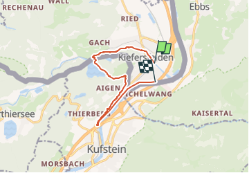
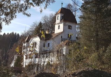
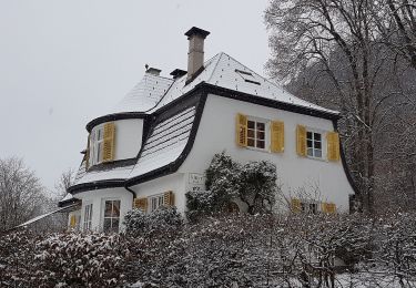
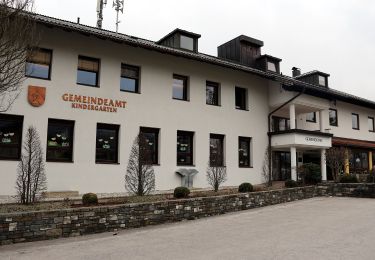
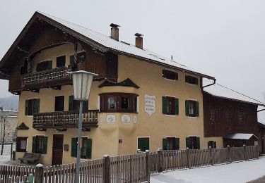
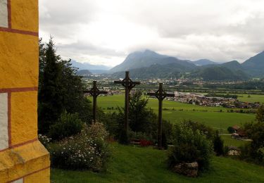
Ruta A pie de 9,8 km a descubrir en Baviera, Landkreis Rosenheim, Kiefersfelden. Esta ruta ha sido propuesta por SityTrail - itinéraires balisés pédestres.
Descripción
Trail created by IVV.
Im Bereich Kieferfelden sehr schlecht ausgeschildert (2020)
Symbol: Grüne Rechtecke mit Reichsapfelsilhouette und der Aufschrift "Kaiser Max Weg"
Localización
País:
Germany
Región :
Baviera
Departamento/provincia :
Landkreis Rosenheim
Municipio :
Kiefersfelden
Localidad:
Unknown
Salida:(Dec)
Salida:(UTM)
289075 ; 5276973 (33T) N.
Comentarios
Excursiones cerca
![Excursión A pie Stadt Kufstein - Prinz Luitpold Weg - Photo](https://media.geolcdn.com/t/375/260/7aaf1793-4671-43af-9ad0-5e7767904bdf.jpeg&format=jpg&maxdim=2)
![A pie A pie](https://static1.geolcdn.com/sitytour/trail-icons/100.png)
Prinz Luitpold Weg
A pie
Fácil
Stadt Kufstein,
Tirol,
Bezirk Kufstein,
Austria
![](/images/other/stat-length.png)
3,5 km | 4,1 km-effort
55min
![](https://static1.geolcdn.com/siteimages/upload/files/16400158638029165_repeat_loop_refresh_sync_direction_icon.png)
No
![Excursión A pie Stadt Kufstein - Kapellenweg - Photo](https://media.geolcdn.com/t/375/260/e7b6607e-c32c-4d8c-b4a0-d43dc902835a.jpeg&format=jpg&maxdim=2)
![A pie A pie](https://static1.geolcdn.com/sitytour/trail-icons/100.png)
Kapellenweg
A pie
Fácil
Stadt Kufstein,
Tirol,
Bezirk Kufstein,
Austria
![](/images/other/stat-length.png)
13,1 km | 16,6 km-effort
3h 46min
![](https://static1.geolcdn.com/siteimages/upload/files/16400158638029165_repeat_loop_refresh_sync_direction_icon.png)
Sí
![Excursión A pie Stadt Kufstein - Denkmalwanderung - Photo](https://media.geolcdn.com/t/375/260/050b7c40-79f2-444c-adf3-bc878881d4c9.jpeg&format=jpg&maxdim=2)
![A pie A pie](https://static1.geolcdn.com/sitytour/trail-icons/100.png)
Denkmalwanderung
A pie
Fácil
Stadt Kufstein,
Tirol,
Bezirk Kufstein,
Austria
![](/images/other/stat-length.png)
5,7 km | 7 km-effort
1h 36min
![](https://static1.geolcdn.com/siteimages/upload/files/16400158638029165_repeat_loop_refresh_sync_direction_icon.png)
Sí
![Excursión A pie Stadt Kufstein - Energieweg Kufstein - Photo](https://media.geolcdn.com/t/375/260/768c9069-4cc0-4c9d-965e-70eff8e8e6d4.jpeg&format=jpg&maxdim=2)
![A pie A pie](https://static1.geolcdn.com/sitytour/trail-icons/100.png)
Energieweg Kufstein
A pie
Fácil
Stadt Kufstein,
Tirol,
Bezirk Kufstein,
Austria
![](/images/other/stat-length.png)
3,2 km | 6,4 km-effort
1h 27min
![](https://static1.geolcdn.com/siteimages/upload/files/16400158638029165_repeat_loop_refresh_sync_direction_icon.png)
No
![Excursión A pie Stadt Kufstein - Rund um Kufstein - Photo](https://media.geolcdn.com/t/375/260/e1bd58f2-db1d-4ff1-908f-b08c89061459.jpeg&format=jpg&maxdim=2)
![A pie A pie](https://static1.geolcdn.com/sitytour/trail-icons/100.png)
Rund um Kufstein
A pie
Fácil
Stadt Kufstein,
Tirol,
Bezirk Kufstein,
Austria
![](/images/other/stat-length.png)
10,2 km | 12,3 km-effort
2h 47min
![](https://static1.geolcdn.com/siteimages/upload/files/16400158638029165_repeat_loop_refresh_sync_direction_icon.png)
Sí
![Excursión A pie Stadt Kufstein - Elfenhain-Trail - Photo](https://media.geolcdn.com/t/375/260/bf877ae3-7b85-40db-872a-fc43df081ae7.jpeg&format=jpg&maxdim=2)
![A pie A pie](https://static1.geolcdn.com/sitytour/trail-icons/100.png)
Elfenhain-Trail
A pie
Fácil
Stadt Kufstein,
Tirol,
Bezirk Kufstein,
Austria
![](/images/other/stat-length.png)
4,8 km | 8,9 km-effort
2h 1min
![](https://static1.geolcdn.com/siteimages/upload/files/16400158638029165_repeat_loop_refresh_sync_direction_icon.png)
Sí
![Excursión A pie Gemeinde Ebbs - Inn Rundweg - Photo](https://media.geolcdn.com/t/375/260/daaecc59-bccf-4b5e-b34b-e9247f0a0214.jpeg&format=jpg&maxdim=2)
![A pie A pie](https://static1.geolcdn.com/sitytour/trail-icons/100.png)
Inn Rundweg
A pie
Fácil
Gemeinde Ebbs,
Tirol,
Bezirk Kufstein,
Austria
![](/images/other/stat-length.png)
4,1 km | 4,4 km-effort
1h 0min
![](https://static1.geolcdn.com/siteimages/upload/files/16400158638029165_repeat_loop_refresh_sync_direction_icon.png)
Sí
![Excursión A pie Stadt Kufstein - Brentenjoch-Trail - Photo](https://media.geolcdn.com/t/375/260/1c6a7877-1f15-44ce-859e-d53183c65a67.jpeg&format=jpg&maxdim=2)
![A pie A pie](https://static1.geolcdn.com/sitytour/trail-icons/100.png)
Brentenjoch-Trail
A pie
Fácil
Stadt Kufstein,
Tirol,
Bezirk Kufstein,
Austria
![](/images/other/stat-length.png)
9,7 km | 16,8 km-effort
3h 49min
![](https://static1.geolcdn.com/siteimages/upload/files/16400158638029165_repeat_loop_refresh_sync_direction_icon.png)
No
![Excursión A pie Gemeinde Ebbs - St. Nikolaus Rundweg - Photo](https://media.geolcdn.com/t/375/260/3503f523-6992-40ce-bbac-ceb7704c0996.jpeg&format=jpg&maxdim=2)
![A pie A pie](https://static1.geolcdn.com/sitytour/trail-icons/100.png)
St. Nikolaus Rundweg
A pie
Fácil
Gemeinde Ebbs,
Tirol,
Bezirk Kufstein,
Austria
![](/images/other/stat-length.png)
8,5 km | 11,6 km-effort
2h 38min
![](https://static1.geolcdn.com/siteimages/upload/files/16400158638029165_repeat_loop_refresh_sync_direction_icon.png)
Sí