![](/images/other/stat-length.png)
![Excursión A pie La Chapelle-des-Fougeretz - Les 5 Rottes - Photo](https://media.geolcdn.com/t/1900/400/58bed8b2-b520-4e15-968b-0f9cacb497d3.jpeg&format=pjpeg&maxdim=2)
Les 5 Rottes
SityTrail - itinéraires balisés pédestres
Tous les sentiers balisés d’Europe GUIDE+
![Longitud](/images/other/stat-length.png)
Longitud
9,3 km
![Altitud máxima](https://static1.geolcdn.com/siteimages/upload/files/1508320355ic_sort_altitude_max_24dp.png)
Altitud máxima
82 m
![Desnivel positivo](https://static1.geolcdn.com/siteimages/upload/files/1508320355ic_sort_den_pos_24dp.png)
Desnivel positivo
84 m
![Km-Effort](/images/other/stat-length.png)
Km-Effort
10,4 km
![Altitud mínima](https://static1.geolcdn.com/siteimages/upload/files/1508320355ic_sort_altitude_min_24dp.png)
Altitud mínima
46 m
![Desnivel negativo](https://static1.geolcdn.com/siteimages/upload/files/1508320355ic_sort_den_neg_24dp.png)
Desnivel negativo
85 m
![Boucle](https://static1.geolcdn.com/siteimages/upload/files/16400158638029165_repeat_loop_refresh_sync_direction_icon.png)
Boucle
Sí
Baliza
Fecha de creación :
2022-02-15 18:12:34.708
Última modificación :
2022-03-02 20:38:13.771
![A pie](https://static1.geolcdn.com/sitytour/trail-icons/100.png)
2h22
Dificultad : Fácil
![Escanee este código QR para abrir la excursión en la aplicación SityTrail](https://capi.geolives.com/qq0zvz2zws4bq2lad0pu/sitytour/trails/3123410/qr.png?size=200)
Aplicación GPS de excursión GRATIS
A propósito
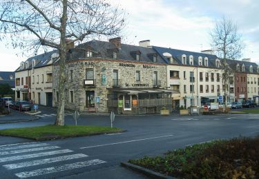
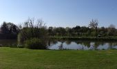
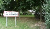
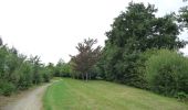
Ruta A pie de 9,3 km a descubrir en Bretaña, Ille-et-Vilaine, La Chapelle-des-Fougeretz. Esta ruta ha sido propuesta por SityTrail - itinéraires balisés pédestres.
Descripción
Trail created by Commune de La Chapelle-des-Fougeretz.
Localización
País:
France
Región :
Bretaña
Departamento/provincia :
Ille-et-Vilaine
Municipio :
La Chapelle-des-Fougeretz
Localidad:
Unknown
Salida:(Dec)
Salida:(UTM)
594057 ; 5337021 (30U) N.
Comentarios
Excursiones cerca
![Excursión A pie Melesse - Sentier des Melessiens - Photo](https://media.geolcdn.com/t/375/260/0f30e474-f118-48a0-a59b-66ca1ed3bb91.jpeg&format=jpg&maxdim=2)
![A pie A pie](https://static1.geolcdn.com/sitytour/trail-icons/100.png)
Sentier des Melessiens
A pie
Fácil
Melesse,
Bretaña,
Ille-et-Vilaine,
France
![](/images/other/stat-length.png)
8,5 km | 9,6 km-effort
2h 10min
![](https://static1.geolcdn.com/siteimages/upload/files/16400158638029165_repeat_loop_refresh_sync_direction_icon.png)
Sí
![Excursión A pie Pacé - Circuit de La Foucherais - Photo](https://media.geolcdn.com/t/375/260/699f6728-1ad0-4ad3-b744-a968a0e522f6.jpeg&format=jpg&maxdim=2)
![A pie A pie](https://static1.geolcdn.com/sitytour/trail-icons/100.png)
Circuit de La Foucherais
A pie
Fácil
Pacé,
Bretaña,
Ille-et-Vilaine,
France
![](/images/other/stat-length.png)
13,4 km | 14,8 km-effort
3h 22min
![](https://static1.geolcdn.com/siteimages/upload/files/16400158638029165_repeat_loop_refresh_sync_direction_icon.png)
Sí
![Excursión A pie La Mézière - Circuit de La Rivière - Photo](https://media.geolcdn.com/t/375/260/effb608e-9523-4c80-8eff-d9597a799e45.jpeg&format=jpg&maxdim=2)
![A pie A pie](https://static1.geolcdn.com/sitytour/trail-icons/100.png)
Circuit de La Rivière
A pie
Fácil
La Mézière,
Bretaña,
Ille-et-Vilaine,
France
![](/images/other/stat-length.png)
9,1 km | 10,6 km-effort
2h 24min
![](https://static1.geolcdn.com/siteimages/upload/files/16400158638029165_repeat_loop_refresh_sync_direction_icon.png)
Sí
![Excursión A pie Gévezé - Sentier de la Chaussée - Photo](https://media.geolcdn.com/t/375/260/b68bfa03-18ec-4b2e-a7fc-64dc0a472980.jpeg&format=jpg&maxdim=2)
![A pie A pie](https://static1.geolcdn.com/sitytour/trail-icons/100.png)
Sentier de la Chaussée
A pie
Fácil
Gévezé,
Bretaña,
Ille-et-Vilaine,
France
![](/images/other/stat-length.png)
14,6 km | 16,1 km-effort
3h 39min
![](https://static1.geolcdn.com/siteimages/upload/files/16400158638029165_repeat_loop_refresh_sync_direction_icon.png)
Sí
![Excursión A pie La Mézière - Sentier de Montgerval - Photo](https://media.geolcdn.com/t/375/260/f85f597a-f5d9-4626-9ff3-a4f1fc6b4cfc.jpeg&format=jpg&maxdim=2)
![A pie A pie](https://static1.geolcdn.com/sitytour/trail-icons/100.png)
Sentier de Montgerval
A pie
Fácil
La Mézière,
Bretaña,
Ille-et-Vilaine,
France
![](/images/other/stat-length.png)
11 km | 12,3 km-effort
2h 47min
![](https://static1.geolcdn.com/siteimages/upload/files/16400158638029165_repeat_loop_refresh_sync_direction_icon.png)
Sí
![Excursión A pie Saint-Grégoire - Circuit de la Boutière - Photo](https://media.geolcdn.com/t/375/260/be6e7bb0-1772-48a6-9f30-2bc59080eacb.jpeg&format=jpg&maxdim=2)
![A pie A pie](https://static1.geolcdn.com/sitytour/trail-icons/100.png)
Circuit de la Boutière
A pie
Fácil
Saint-Grégoire,
Bretaña,
Ille-et-Vilaine,
France
![](/images/other/stat-length.png)
9 km | 9,9 km-effort
2h 14min
![](https://static1.geolcdn.com/siteimages/upload/files/16400158638029165_repeat_loop_refresh_sync_direction_icon.png)
Sí
![Excursión A pie Gévezé - Circuit du Moulin de la Moltais - Photo](https://media.geolcdn.com/t/375/260/0b61b143-c705-414e-8194-5fcc4095b5f1.jpeg&format=jpg&maxdim=2)
![A pie A pie](https://static1.geolcdn.com/sitytour/trail-icons/100.png)
Circuit du Moulin de la Moltais
A pie
Fácil
Gévezé,
Bretaña,
Ille-et-Vilaine,
France
![](/images/other/stat-length.png)
7,8 km | 9,1 km-effort
2h 3min
![](https://static1.geolcdn.com/siteimages/upload/files/16400158638029165_repeat_loop_refresh_sync_direction_icon.png)
Sí
![Excursión A pie Gévezé - Circuit de la Motte Marcillé - Photo](https://media.geolcdn.com/t/375/260/92a5fd14-c2a6-4b26-bc47-2f8fa78eecb4.jpeg&format=jpg&maxdim=2)
![A pie A pie](https://static1.geolcdn.com/sitytour/trail-icons/100.png)
Circuit de la Motte Marcillé
A pie
Fácil
Gévezé,
Bretaña,
Ille-et-Vilaine,
France
![](/images/other/stat-length.png)
6 km | 7,1 km-effort
1h 36min
![](https://static1.geolcdn.com/siteimages/upload/files/16400158638029165_repeat_loop_refresh_sync_direction_icon.png)
No
![Excursión Senderismo La Chapelle-des-Fougeretz - LA CHAPELLE DES FOUGERETZ / BEAUREGARD 10/01/2019 - Photo](https://media.geolcdn.com/t/375/260/ext.jpg?maxdim=2&url=https%3A%2F%2Fservices.sitytrail.com%2FGeolivesWS%2FDownloadMedia.ashx%3FTrailID%3D1095734%26Media%3Dfix__20190110143947.jpg)
![Senderismo Senderismo](https://static1.geolcdn.com/sitytour/trail-icons/101.png)
LA CHAPELLE DES FOUGERETZ / BEAUREGARD 10/01/2019
Senderismo
Muy fácil
La Chapelle-des-Fougeretz,
Bretaña,
Ille-et-Vilaine,
France
![](/images/other/stat-length.png)
12,3 km | 13,5 km-effort
3h 4min
![](https://static1.geolcdn.com/siteimages/upload/files/16400158638029165_repeat_loop_refresh_sync_direction_icon.png)
No