![](/images/other/stat-length.png)
![Excursión A pie Nimega - Wandelroute Ooijpolder - Photo](https://media.geolcdn.com/t/1900/400/b675ec49-5d64-4d5a-9a09-8126ea7255f0.jpeg&format=pjpeg&maxdim=2)
Wandelroute Ooijpolder
SityTrail - itinéraires balisés pédestres
Tous les sentiers balisés d’Europe GUIDE+
![Longitud](/images/other/stat-length.png)
Longitud
12,9 km
![Altitud máxima](https://static1.geolcdn.com/siteimages/upload/files/1508320355ic_sort_altitude_max_24dp.png)
Altitud máxima
23 m
![Desnivel positivo](https://static1.geolcdn.com/siteimages/upload/files/1508320355ic_sort_den_pos_24dp.png)
Desnivel positivo
72 m
![Km-Effort](/images/other/stat-length.png)
Km-Effort
13,9 km
![Altitud mínima](https://static1.geolcdn.com/siteimages/upload/files/1508320355ic_sort_altitude_min_24dp.png)
Altitud mínima
6 m
![Desnivel negativo](https://static1.geolcdn.com/siteimages/upload/files/1508320355ic_sort_den_neg_24dp.png)
Desnivel negativo
72 m
![Boucle](https://static1.geolcdn.com/siteimages/upload/files/16400158638029165_repeat_loop_refresh_sync_direction_icon.png)
Boucle
Sí
Baliza
Fecha de creación :
2022-02-14 15:04:06.824
Última modificación :
2022-02-14 15:04:06.824
![A pie](https://static1.geolcdn.com/sitytour/trail-icons/100.png)
3h09
Dificultad : Fácil
![Escanee este código QR para abrir la excursión en la aplicación SityTrail](https://capi.geolives.com/qq0zvz2zws4bq2lad0pu/sitytour/trails/3109543/qr.png?size=200)
Aplicación GPS de excursión GRATIS
A propósito
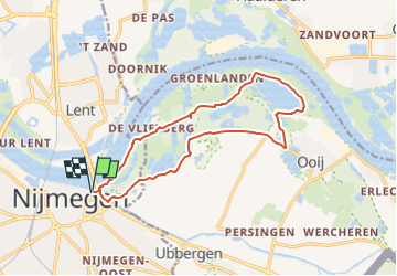
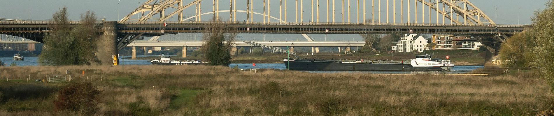
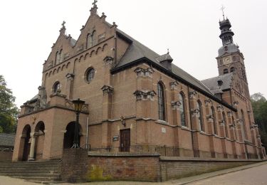
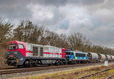
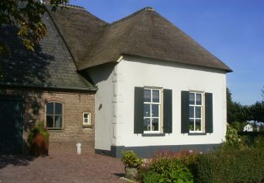
Ruta A pie de 12,9 km a descubrir en Güeldres, Desconocido, Nimega. Esta ruta ha sido propuesta por SityTrail - itinéraires balisés pédestres.
Descripción
Trail created by Staatsbosbeheer.
Sitio web: https://www.staatsbosbeheer.nl/-/media/gelderse-poort/wandelroute-ooijpolder-gelderse-poort.pdf
Localización
País:
Netherlands
Región :
Güeldres
Departamento/provincia :
Desconocido
Municipio :
Nimega
Localidad:
Unknown
Salida:(Dec)
Salida:(UTM)
697744 ; 5748097 (31U) N.
Comentarios
Excursiones cerca
![Excursión A pie Berg en Dal - Welkom op Heerlijkheid Beek! Gele route - Photo](https://media.geolcdn.com/t/375/260/0fe1614f-d01c-4c62-b10b-2f92bc916492.jpeg&format=jpg&maxdim=2)
![A pie A pie](https://static1.geolcdn.com/sitytour/trail-icons/100.png)
Welkom op Heerlijkheid Beek! Gele route
A pie
Fácil
Berg en Dal,
Güeldres,
Desconocido,
Netherlands
![](/images/other/stat-length.png)
3,1 km | 4,3 km-effort
58min
![](https://static1.geolcdn.com/siteimages/upload/files/16400158638029165_repeat_loop_refresh_sync_direction_icon.png)
Sí
![Excursión A pie Berg en Dal - Welkom op Heerlijkheid Beek! Rode route - Photo](https://media.geolcdn.com/t/375/260/9eda9f26-2f1a-4b32-aad9-d7bcc9427f9a.jpeg&format=jpg&maxdim=2)
![A pie A pie](https://static1.geolcdn.com/sitytour/trail-icons/100.png)
Welkom op Heerlijkheid Beek! Rode route
A pie
Fácil
Berg en Dal,
Güeldres,
Desconocido,
Netherlands
![](/images/other/stat-length.png)
4,8 km | 6,3 km-effort
1h 26min
![](https://static1.geolcdn.com/siteimages/upload/files/16400158638029165_repeat_loop_refresh_sync_direction_icon.png)
Sí
![Excursión A pie Berg en Dal - N-70 Natuurwandelroute - Photo](https://media.geolcdn.com/t/375/260/15a329a4-42a2-4c1e-8655-9146a0297156.jpeg&format=jpg&maxdim=2)
![A pie A pie](https://static1.geolcdn.com/sitytour/trail-icons/100.png)
N-70 Natuurwandelroute
A pie
Fácil
Berg en Dal,
Güeldres,
Desconocido,
Netherlands
![](/images/other/stat-length.png)
14 km | 18,7 km-effort
4h 15min
![](https://static1.geolcdn.com/siteimages/upload/files/16400158638029165_repeat_loop_refresh_sync_direction_icon.png)
Sí
![Excursión A pie Heumen - Natuurwandeling Heumensoord - Photo](https://media.geolcdn.com/t/375/260/dev_fca02aa4-fdd9-4fdf-a441-dd1e210ebce6.jpeg&format=jpg&maxdim=2)
![A pie A pie](https://static1.geolcdn.com/sitytour/trail-icons/100.png)
Natuurwandeling Heumensoord
A pie
Fácil
Heumen,
Güeldres,
Desconocido,
Netherlands
![](/images/other/stat-length.png)
6,1 km | 6,6 km-effort
1h 29min
![](https://static1.geolcdn.com/siteimages/upload/files/16400158638029165_repeat_loop_refresh_sync_direction_icon.png)
Sí
![Excursión A pie Overbetuwe - Rondje Balveren - Photo](https://media.geolcdn.com/t/375/260/35397aa3-1c9e-4bd2-b6d8-d78d17801e23.jpeg&format=jpg&maxdim=2)
![A pie A pie](https://static1.geolcdn.com/sitytour/trail-icons/100.png)
Rondje Balveren
A pie
Fácil
Overbetuwe,
Güeldres,
Desconocido,
Netherlands
![](/images/other/stat-length.png)
5,8 km | 6 km-effort
1h 21min
![](https://static1.geolcdn.com/siteimages/upload/files/16400158638029165_repeat_loop_refresh_sync_direction_icon.png)
Sí
![Excursión A pie Nimega - Copperpad - Photo](https://media.geolcdn.com/t/375/260/ext.jpg?maxdim=2&url=https%3A%2F%2Fstatic1.geolcdn.com%2Fsiteimages%2Fupload%2Ffiles%2F1545311037marcheuse_200dpi.jpg)
![A pie A pie](https://static1.geolcdn.com/sitytour/trail-icons/100.png)
![Excursión Senderismo Nimega - This-Duivelsberg - Photo](https://media.geolcdn.com/t/375/260/ext.jpg?maxdim=2&url=https%3A%2F%2Fstatic1.geolcdn.com%2Fsiteimages%2Fupload%2Ffiles%2F1553511878bg_sport_marche.png)
![Senderismo Senderismo](https://static1.geolcdn.com/sitytour/trail-icons/101.png)
This-Duivelsberg
Senderismo
Medio
Nimega,
Güeldres,
Desconocido,
Netherlands
![](/images/other/stat-length.png)
6,6 km | 7,6 km-effort
1h 45min
![](https://static1.geolcdn.com/siteimages/upload/files/16400158638029165_repeat_loop_refresh_sync_direction_icon.png)
No
![Excursión Senderismo Berg en Dal - Nijmegen N70 16km. - Photo](https://media.geolcdn.com/t/375/260/ext.jpg?maxdim=2&url=https%3A%2F%2Fstatic1.geolcdn.com%2Fsiteimages%2Fupload%2Ffiles%2F1553511878bg_sport_marche.png)
![Senderismo Senderismo](https://static1.geolcdn.com/sitytour/trail-icons/101.png)
Nijmegen N70 16km.
Senderismo
Medio
Berg en Dal,
Güeldres,
Desconocido,
Netherlands
![](/images/other/stat-length.png)
16,2 km | 22 km-effort
4h 30min
![](https://static1.geolcdn.com/siteimages/upload/files/16400158638029165_repeat_loop_refresh_sync_direction_icon.png)
Sí
![Excursión Senderismo Berg en Dal - beek ubbergen - Photo](https://media.geolcdn.com/t/375/260/ext.jpg?maxdim=2&url=https%3A%2F%2Fstatic1.geolcdn.com%2Fsiteimages%2Fupload%2Ffiles%2F1553511878bg_sport_marche.png)
![Senderismo Senderismo](https://static1.geolcdn.com/sitytour/trail-icons/101.png)
beek ubbergen
Senderismo
Fácil
Berg en Dal,
Güeldres,
Desconocido,
Netherlands
![](/images/other/stat-length.png)
15,8 km | 19,9 km-effort
4h 14min
![](https://static1.geolcdn.com/siteimages/upload/files/16400158638029165_repeat_loop_refresh_sync_direction_icon.png)
Sí