![](/images/other/stat-length.png)
![Excursión A pie Brütten - Rundweg Winterthur - Photo](https://media.geolcdn.com/t/1900/400/4eefcd50-ed30-49ed-a4bf-326dd07ad8c5.jpeg&format=pjpeg&maxdim=2)
Rundweg Winterthur
SityTrail - itinéraires balisés pédestres
Tous les sentiers balisés d’Europe GUIDE+
![Longitud](/images/other/stat-length.png)
Longitud
21 km
![Altitud máxima](https://static1.geolcdn.com/siteimages/upload/files/1508320355ic_sort_altitude_max_24dp.png)
Altitud máxima
633 m
![Desnivel positivo](https://static1.geolcdn.com/siteimages/upload/files/1508320355ic_sort_den_pos_24dp.png)
Desnivel positivo
413 m
![Km-Effort](/images/other/stat-length.png)
Km-Effort
27 km
![Altitud mínima](https://static1.geolcdn.com/siteimages/upload/files/1508320355ic_sort_altitude_min_24dp.png)
Altitud mínima
391 m
![Desnivel negativo](https://static1.geolcdn.com/siteimages/upload/files/1508320355ic_sort_den_neg_24dp.png)
Desnivel negativo
582 m
![Boucle](https://static1.geolcdn.com/siteimages/upload/files/16400158638029165_repeat_loop_refresh_sync_direction_icon.png)
Boucle
No
Baliza
Fecha de creación :
2022-02-14 08:58:30.075
Última modificación :
2022-02-14 08:58:30.075
![A pie](https://static1.geolcdn.com/sitytour/trail-icons/100.png)
6h10
Dificultad : Medio
![Escanee este código QR para abrir la excursión en la aplicación SityTrail](https://capi.geolives.com/qq0zvz2zws4bq2lad0pu/sitytour/trails/3106964/qr.png?size=200)
Aplicación GPS de excursión GRATIS
A propósito
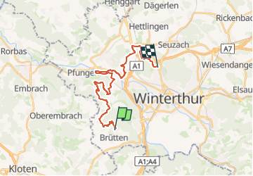
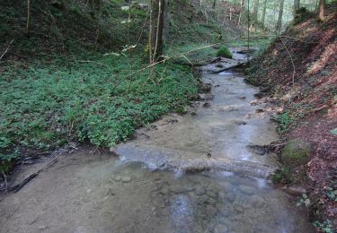
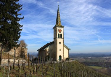
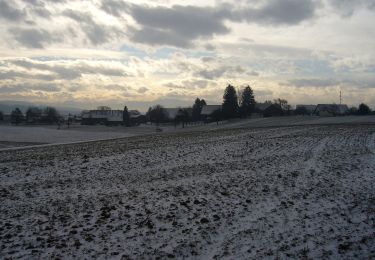
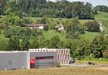
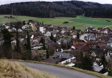
Ruta A pie de 21 km a descubrir en Zúrich, Bezirk Winterthur, Brütten. Esta ruta ha sido propuesta por SityTrail - itinéraires balisés pédestres.
Descripción
Willkommen auf dem Rundweg
Sitio web: https://www.rundweg.winterthur.ch/
Localización
País:
Switzerland
Región :
Zúrich
Departamento/provincia :
Bezirk Winterthur
Municipio :
Brütten
Localidad:
Unknown
Salida:(Dec)
Salida:(UTM)
475624 ; 5258356 (32T) N.
Comentarios
Excursiones cerca
![Excursión A pie Lindau - Kempthal - Winterthur - Photo](https://media.geolcdn.com/t/375/260/b46f637d-974f-48a1-98b4-7a6fcf478692.jpeg&format=jpg&maxdim=2)
![A pie A pie](https://static1.geolcdn.com/sitytour/trail-icons/100.png)
Kempthal - Winterthur
A pie
Fácil
Lindau,
Zúrich,
Bezirk Pfäffikon,
Switzerland
![](/images/other/stat-length.png)
4,9 km | 7,6 km-effort
1h 43min
![](https://static1.geolcdn.com/siteimages/upload/files/16400158638029165_repeat_loop_refresh_sync_direction_icon.png)
No
![Excursión A pie Lindau - Kempthal - Sennhof - Photo](https://media.geolcdn.com/t/375/260/b46f637d-974f-48a1-98b4-7a6fcf478692.jpeg&format=jpg&maxdim=2)
![A pie A pie](https://static1.geolcdn.com/sitytour/trail-icons/100.png)
Kempthal - Sennhof
A pie
Fácil
Lindau,
Zúrich,
Bezirk Pfäffikon,
Switzerland
![](/images/other/stat-length.png)
8,1 km | 10,4 km-effort
2h 21min
![](https://static1.geolcdn.com/siteimages/upload/files/16400158638029165_repeat_loop_refresh_sync_direction_icon.png)
No
![Excursión A pie Winterthur - Brunibrugg - Kyburgerbrugg - Photo](https://media.geolcdn.com/t/375/260/9b0fa434-55c2-423a-913e-72b1327bfe19.jpeg&format=jpg&maxdim=2)
![A pie A pie](https://static1.geolcdn.com/sitytour/trail-icons/100.png)
Brunibrugg - Kyburgerbrugg
A pie
Fácil
Winterthur,
Zúrich,
Bezirk Winterthur,
Switzerland
![](/images/other/stat-length.png)
3,4 km | 4 km-effort
54min
![](https://static1.geolcdn.com/siteimages/upload/files/16400158638029165_repeat_loop_refresh_sync_direction_icon.png)
No
![Excursión A pie Winterthur - Ritplatz - Chämleten - Photo](https://media.geolcdn.com/t/375/260/76f7eae9-adf9-478d-a972-b8ace6f07a39.jpeg&format=jpg&maxdim=2)
![A pie A pie](https://static1.geolcdn.com/sitytour/trail-icons/100.png)
Ritplatz - Chämleten
A pie
Fácil
Winterthur,
Zúrich,
Bezirk Winterthur,
Switzerland
![](/images/other/stat-length.png)
3,6 km | 5,5 km-effort
1h 14min
![](https://static1.geolcdn.com/siteimages/upload/files/16400158638029165_repeat_loop_refresh_sync_direction_icon.png)
No
![Excursión A pie Neftenbach - Tössegg-Klettgau-Weg - Photo](https://media.geolcdn.com/t/375/260/4d46e80c-f6de-449c-aa91-73ffe3091aa2.jpeg&format=jpg&maxdim=2)
![A pie A pie](https://static1.geolcdn.com/sitytour/trail-icons/100.png)
Tössegg-Klettgau-Weg
A pie
Medio
Neftenbach,
Zúrich,
Bezirk Winterthur,
Switzerland
![](/images/other/stat-length.png)
18,9 km | 23 km-effort
5h 12min
![](https://static1.geolcdn.com/siteimages/upload/files/16400158638029165_repeat_loop_refresh_sync_direction_icon.png)
No
![Excursión A pie Lindau - Kempthal - Rorbas - Photo](https://media.geolcdn.com/t/375/260/0952e2e4-f3ce-4b1a-8752-5684d81500cc.jpeg&format=jpg&maxdim=2)
![A pie A pie](https://static1.geolcdn.com/sitytour/trail-icons/100.png)
Kempthal - Rorbas
A pie
Fácil
Lindau,
Zúrich,
Bezirk Pfäffikon,
Switzerland
![](/images/other/stat-length.png)
13,8 km | 17,1 km-effort
3h 53min
![](https://static1.geolcdn.com/siteimages/upload/files/16400158638029165_repeat_loop_refresh_sync_direction_icon.png)
No
![Excursión A pie Pfungen - Pfungen - Stiegen - Photo](https://media.geolcdn.com/t/375/260/5e13f51a-5798-4564-9709-f178bcab977e.jpeg&format=jpg&maxdim=2)
![A pie A pie](https://static1.geolcdn.com/sitytour/trail-icons/100.png)
Pfungen - Stiegen
A pie
Fácil
Pfungen,
Zúrich,
Bezirk Winterthur,
Switzerland
![](/images/other/stat-length.png)
3,7 km | 6,3 km-effort
1h 25min
![](https://static1.geolcdn.com/siteimages/upload/files/16400158638029165_repeat_loop_refresh_sync_direction_icon.png)
No
![Excursión A pie Oberembrach - Oberembrach - Breite - Photo](https://media.geolcdn.com/t/375/260/a7062106-b5f2-4b38-be3a-60e2fa11e1c8.jpeg&format=jpg&maxdim=2)
![A pie A pie](https://static1.geolcdn.com/sitytour/trail-icons/100.png)
Oberembrach - Breite
A pie
Fácil
Oberembrach,
Zúrich,
Bezirk Bülach,
Switzerland
![](/images/other/stat-length.png)
6,8 km | 9,3 km-effort
2h 7min
![](https://static1.geolcdn.com/siteimages/upload/files/16400158638029165_repeat_loop_refresh_sync_direction_icon.png)
No
![Excursión A pie Brütten - Effretikon - Wülflingen - Photo](https://media.geolcdn.com/t/375/260/ffc97948-63ac-4c76-b9d4-b267680ed02f.jpeg&format=jpg&maxdim=2)
![A pie A pie](https://static1.geolcdn.com/sitytour/trail-icons/100.png)
Effretikon - Wülflingen
A pie
Fácil
Brütten,
Zúrich,
Bezirk Winterthur,
Switzerland
![](/images/other/stat-length.png)
6,2 km | 7,6 km-effort
1h 43min
![](https://static1.geolcdn.com/siteimages/upload/files/16400158638029165_repeat_loop_refresh_sync_direction_icon.png)
No