![](/images/other/stat-length.png)
![Excursión A pie Kaiserstuhl - Kaiserstuhl Brücke - Rümikon Rheinufer - Photo](https://media.geolcdn.com/t/1900/400/9b87d37c-eafc-450b-9117-8067314cc6f2.jpeg&format=pjpeg&maxdim=2)
Kaiserstuhl Brücke - Rümikon Rheinufer
SityTrail - itinéraires balisés pédestres
Tous les sentiers balisés d’Europe GUIDE+
![Longitud](/images/other/stat-length.png)
Longitud
4,2 km
![Altitud máxima](https://static1.geolcdn.com/siteimages/upload/files/1508320355ic_sort_altitude_max_24dp.png)
Altitud máxima
360 m
![Desnivel positivo](https://static1.geolcdn.com/siteimages/upload/files/1508320355ic_sort_den_pos_24dp.png)
Desnivel positivo
40 m
![Km-Effort](/images/other/stat-length.png)
Km-Effort
4,8 km
![Altitud mínima](https://static1.geolcdn.com/siteimages/upload/files/1508320355ic_sort_altitude_min_24dp.png)
Altitud mínima
332 m
![Desnivel negativo](https://static1.geolcdn.com/siteimages/upload/files/1508320355ic_sort_den_neg_24dp.png)
Desnivel negativo
45 m
![Boucle](https://static1.geolcdn.com/siteimages/upload/files/16400158638029165_repeat_loop_refresh_sync_direction_icon.png)
Boucle
No
Baliza
Fecha de creación :
2022-02-14 08:47:26.718
Última modificación :
2022-02-14 08:47:26.718
![A pie](https://static1.geolcdn.com/sitytour/trail-icons/100.png)
1h05
Dificultad : Fácil
![Escanee este código QR para abrir la excursión en la aplicación SityTrail](https://capi.geolives.com/qq0zvz2zws4bq2lad0pu/sitytour/trails/3106075/qr.png?size=200)
Aplicación GPS de excursión GRATIS
A propósito
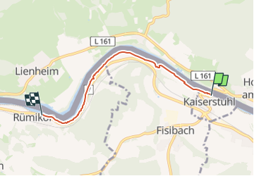
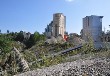
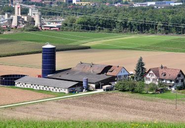
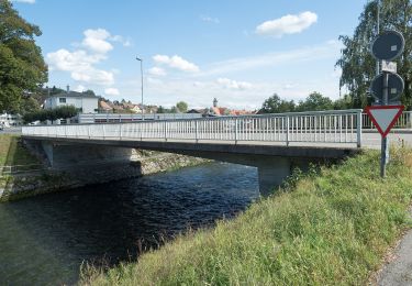
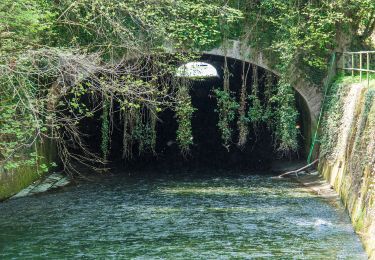
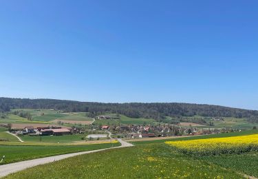
Ruta A pie de 4,2 km a descubrir en Argovia, Bezirk Zurzach, Kaiserstuhl. Esta ruta ha sido propuesta por SityTrail - itinéraires balisés pédestres.
Descripción
Kaiserstuhl Brücke - Rümikon Rheinufer
Symbol: gelber Diamant (waagrecht)
Localización
País:
Switzerland
Región :
Argovia
Departamento/provincia :
Bezirk Zurzach
Municipio :
Kaiserstuhl
Localidad:
Unknown
Salida:(Dec)
Salida:(UTM)
456285 ; 5268614 (32T) N.
Comentarios
Excursiones cerca
![Excursión A pie Weiach - Weiach - Bachs - Photo](https://media.geolcdn.com/t/375/260/a534099c-c62d-4063-8981-0710a66cc224.jpeg&format=jpg&maxdim=2)
![A pie A pie](https://static1.geolcdn.com/sitytour/trail-icons/100.png)
Weiach - Bachs
A pie
Fácil
Weiach,
Zúrich,
Bezirk Dielsdorf,
Switzerland
![](/images/other/stat-length.png)
5 km | 7,7 km-effort
1h 45min
![](https://static1.geolcdn.com/siteimages/upload/files/16400158638029165_repeat_loop_refresh_sync_direction_icon.png)
No
![Excursión A pie Stadel - Zweidlen Station - Neerach - Photo](https://media.geolcdn.com/t/375/260/1c18e405-0cb4-4a47-aced-f764d9fc6e74.jpeg&format=jpg&maxdim=2)
![A pie A pie](https://static1.geolcdn.com/sitytour/trail-icons/100.png)
Zweidlen Station - Neerach
A pie
Fácil
Stadel,
Zúrich,
Bezirk Dielsdorf,
Switzerland
![](/images/other/stat-length.png)
4,9 km | 6,2 km-effort
1h 24min
![](https://static1.geolcdn.com/siteimages/upload/files/16400158638029165_repeat_loop_refresh_sync_direction_icon.png)
No
![Excursión A pie Glattfelden - Zweidlen Station - Weiach - Photo](https://media.geolcdn.com/t/375/260/8ae4039a-2dde-4469-898f-c221717596aa.jpeg&format=jpg&maxdim=2)
![A pie A pie](https://static1.geolcdn.com/sitytour/trail-icons/100.png)
Zweidlen Station - Weiach
A pie
Fácil
Glattfelden,
Zúrich,
Bezirk Bülach,
Switzerland
![](/images/other/stat-length.png)
5,1 km | 7,5 km-effort
1h 41min
![](https://static1.geolcdn.com/siteimages/upload/files/16400158638029165_repeat_loop_refresh_sync_direction_icon.png)
No
![Excursión A pie Stadel - Windlach - Zweidlen - Photo](https://media.geolcdn.com/t/375/260/4ddf0d52-5fad-42aa-aa3c-5d576e6d7924.jpeg&format=jpg&maxdim=2)
![A pie A pie](https://static1.geolcdn.com/sitytour/trail-icons/100.png)
Windlach - Zweidlen
A pie
Fácil
Stadel,
Zúrich,
Bezirk Dielsdorf,
Switzerland
![](/images/other/stat-length.png)
4,1 km | 5,7 km-effort
1h 17min
![](https://static1.geolcdn.com/siteimages/upload/files/16400158638029165_repeat_loop_refresh_sync_direction_icon.png)
No
![Excursión A pie Glattfelden - Zweidlen Station - Bülach - Photo](https://media.geolcdn.com/t/375/260/67170b21-8d7c-4a7e-8c61-2695dbca6845.jpeg&format=jpg&maxdim=2)
![A pie A pie](https://static1.geolcdn.com/sitytour/trail-icons/100.png)
Zweidlen Station - Bülach
A pie
Fácil
Glattfelden,
Zúrich,
Bezirk Bülach,
Switzerland
![](/images/other/stat-length.png)
11,3 km | 14,5 km-effort
3h 17min
![](https://static1.geolcdn.com/siteimages/upload/files/16400158638029165_repeat_loop_refresh_sync_direction_icon.png)
No
![Excursión A pie Glattfelden - Zweidlen Station - Niederhöri - Photo](https://media.geolcdn.com/t/375/260/67170b21-8d7c-4a7e-8c61-2695dbca6845.jpeg&format=jpg&maxdim=2)
![A pie A pie](https://static1.geolcdn.com/sitytour/trail-icons/100.png)
Zweidlen Station - Niederhöri
A pie
Fácil
Glattfelden,
Zúrich,
Bezirk Bülach,
Switzerland
![](/images/other/stat-length.png)
13 km | 15,4 km-effort
3h 30min
![](https://static1.geolcdn.com/siteimages/upload/files/16400158638029165_repeat_loop_refresh_sync_direction_icon.png)
No
![Excursión A pie Glattfelden - Rheinsfelden - Station Glattfelden - Photo](https://media.geolcdn.com/t/375/260/67170b21-8d7c-4a7e-8c61-2695dbca6845.jpeg&format=jpg&maxdim=2)
![A pie A pie](https://static1.geolcdn.com/sitytour/trail-icons/100.png)
Rheinsfelden - Station Glattfelden
A pie
Fácil
Glattfelden,
Zúrich,
Bezirk Bülach,
Switzerland
![](/images/other/stat-length.png)
5,7 km | 6,9 km-effort
1h 33min
![](https://static1.geolcdn.com/siteimages/upload/files/16400158638029165_repeat_loop_refresh_sync_direction_icon.png)
No
![Excursión A pie Glattfelden - Rheinsfelden - Glattfelden - Photo](https://media.geolcdn.com/t/375/260/baa17ef4-1730-42d8-ae88-700f9027f126.jpeg&format=jpg&maxdim=2)
![A pie A pie](https://static1.geolcdn.com/sitytour/trail-icons/100.png)
Rheinsfelden - Glattfelden
A pie
Fácil
Glattfelden,
Zúrich,
Bezirk Bülach,
Switzerland
![](/images/other/stat-length.png)
3,1 km | 4,1 km-effort
56min
![](https://static1.geolcdn.com/siteimages/upload/files/16400158638029165_repeat_loop_refresh_sync_direction_icon.png)
No
![Excursión A pie Fisibach - Fisibach- Bachs - Photo](https://media.geolcdn.com/t/375/260/ede589b8-109a-48d9-9149-5f1bf4e72135.jpeg&format=jpg&maxdim=2)
![A pie A pie](https://static1.geolcdn.com/sitytour/trail-icons/100.png)
Fisibach- Bachs
A pie
Fácil
Fisibach,
Argovia,
Bezirk Zurzach,
Switzerland
![](/images/other/stat-length.png)
6,7 km | 8,9 km-effort
2h 1min
![](https://static1.geolcdn.com/siteimages/upload/files/16400158638029165_repeat_loop_refresh_sync_direction_icon.png)
No