![](/images/other/stat-length.png)
![Excursión A pie Witten - [Δ] Witten - Grundschöttel - Photo](https://media.geolcdn.com/t/1900/400/ext.pjpeg?maxdim=2&url=https%3A%2F%2Fmedia.geolcdn.com%2Ff%2F2e64de42-6724-4fef-8c50-11bf465b833c.jpeg)
[Δ] Witten - Grundschöttel
SityTrail - itinéraires balisés pédestres
Tous les sentiers balisés d’Europe PRO
![Longitud](/images/other/stat-length.png)
Longitud
18 km
![Altitud máxima](https://static1.geolcdn.com/siteimages/upload/files/1508320355ic_sort_altitude_max_24dp.png)
Altitud máxima
247 m
![Desnivel positivo](https://static1.geolcdn.com/siteimages/upload/files/1508320355ic_sort_den_pos_24dp.png)
Desnivel positivo
415 m
![Km-Effort](/images/other/stat-length.png)
Km-Effort
23 km
![Altitud mínima](https://static1.geolcdn.com/siteimages/upload/files/1508320355ic_sort_altitude_min_24dp.png)
Altitud mínima
79 m
![Desnivel negativo](https://static1.geolcdn.com/siteimages/upload/files/1508320355ic_sort_den_neg_24dp.png)
Desnivel negativo
296 m
![Boucle](https://static1.geolcdn.com/siteimages/upload/files/16400158638029165_repeat_loop_refresh_sync_direction_icon.png)
Boucle
No
Baliza
Fecha de creación :
2022-02-11 20:52:44.078
Última modificación :
2022-02-11 20:52:44.078
![A pie](https://static1.geolcdn.com/sitytour/trail-icons/100.png)
5h15
Dificultad : Medio
![Escanee este código QR para abrir la excursión en la aplicación SityTrail](https://capi.geolives.com/qq0zvz2zws4bq2lad0pu/sitytour/trails/3102288/qr.png?size=200)
Aplicación GPS de excursión GRATIS
A propósito
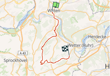
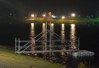
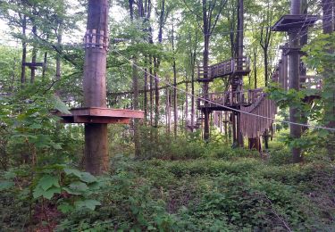
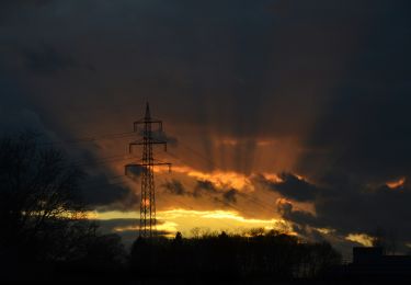
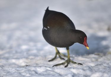
Ruta A pie de 18 km a descubrir en Renania del Norte-Westfalia, Ennepe-Ruhr-Kreis, Witten. Esta ruta ha sido propuesta por SityTrail - itinéraires balisés pédestres.
Descripción
Trail created by Sauerländischer Gebirgsverein.
Symbol: weißer Symbol "stehendes Deieck" auf schwarzem Grund
Localización
País:
Germany
Región :
Renania del Norte-Westfalia
Departamento/provincia :
Ennepe-Ruhr-Kreis
Municipio :
Witten
Localidad:
Unknown
Salida:(Dec)
Salida:(UTM)
383935 ; 5699599 (32U) N.
Comentarios
Excursiones cerca
![Excursión A pie Herdecke - (H) Rund um Herdecke - Photo](https://media.geolcdn.com/t/375/260/ext.jpg?maxdim=2&url=https%3A%2F%2Fmedia.geolcdn.com%2Ff%2F3a47b9d1-1b31-4b2d-8f31-3d9786e651b8.jpeg)
![A pie A pie](https://static1.geolcdn.com/sitytour/trail-icons/100.png)
(H) Rund um Herdecke
A pie
Difícil
Herdecke,
Renania del Norte-Westfalia,
Ennepe-Ruhr-Kreis,
Germany
![](/images/other/stat-length.png)
27 km | 35 km-effort
7h 57min
![](https://static1.geolcdn.com/siteimages/upload/files/16400158638029165_repeat_loop_refresh_sync_direction_icon.png)
Sí
![Excursión A pie Witten - (B) Rund um Bochum - Photo](https://media.geolcdn.com/t/375/260/ext.jpg?maxdim=2&url=https%3A%2F%2Fmedia.geolcdn.com%2Ff%2Fc482ee4b-93d0-4c2e-a058-fb684175fdc6.jpeg)
![A pie A pie](https://static1.geolcdn.com/sitytour/trail-icons/100.png)
(B) Rund um Bochum
A pie
Fácil
Witten,
Renania del Norte-Westfalia,
Ennepe-Ruhr-Kreis,
Germany
![](/images/other/stat-length.png)
11,6 km | 13,6 km-effort
3h 5min
![](https://static1.geolcdn.com/siteimages/upload/files/16400158638029165_repeat_loop_refresh_sync_direction_icon.png)
No
![Excursión A pie Desconocido - O Rund um Querenburg - Photo](https://media.geolcdn.com/t/375/260/ext.jpg?maxdim=2&url=https%3A%2F%2Fmedia.geolcdn.com%2Ff%2F2ccb532b-b9a8-4c2e-8fe3-4a66f0075b09.jpeg)
![A pie A pie](https://static1.geolcdn.com/sitytour/trail-icons/100.png)
O Rund um Querenburg
A pie
Fácil
Desconocido,
Renania del Norte-Westfalia,
Bochum,
Germany
![](/images/other/stat-length.png)
8,5 km | 10,6 km-effort
2h 24min
![](https://static1.geolcdn.com/siteimages/upload/files/16400158638029165_repeat_loop_refresh_sync_direction_icon.png)
Sí
![Excursión A pie Desconocido - Bergbauwanderweg Ruhr-Uni - Photo](https://media.geolcdn.com/t/375/260/ext.jpg?maxdim=2&url=https%3A%2F%2Fmedia.geolcdn.com%2Ff%2Fb8270dab-e7c4-48bb-b979-b7b45290cf51.jpeg)
![A pie A pie](https://static1.geolcdn.com/sitytour/trail-icons/100.png)
Bergbauwanderweg Ruhr-Uni
A pie
Fácil
Desconocido,
Renania del Norte-Westfalia,
Bochum,
Germany
![](/images/other/stat-length.png)
8,1 km | 10,8 km-effort
2h 27min
![](https://static1.geolcdn.com/siteimages/upload/files/16400158638029165_repeat_loop_refresh_sync_direction_icon.png)
No
![Excursión A pie Wetter (Ruhr) - Harkortberg Rundweg A1 - Photo](https://media.geolcdn.com/t/375/260/ext.jpg?maxdim=2&url=https%3A%2F%2Fmedia.geolcdn.com%2Ff%2F726cb39b-5cbe-4b68-b43e-a3bcd858a524.jpeg)
![A pie A pie](https://static1.geolcdn.com/sitytour/trail-icons/100.png)
Harkortberg Rundweg A1
A pie
Fácil
Wetter (Ruhr),
Renania del Norte-Westfalia,
Ennepe-Ruhr-Kreis,
Germany
![](/images/other/stat-length.png)
3,2 km | 4,2 km-effort
57min
![](https://static1.geolcdn.com/siteimages/upload/files/16400158638029165_repeat_loop_refresh_sync_direction_icon.png)
No
![Excursión A pie Herdecke - Hickenstein Rundweg A5 - Photo](https://media.geolcdn.com/t/375/260/ext.jpg?maxdim=2&url=https%3A%2F%2Fmedia.geolcdn.com%2Ff%2Fe1ae7954-601a-4378-ba58-47b05130fee3.jpeg)
![A pie A pie](https://static1.geolcdn.com/sitytour/trail-icons/100.png)
Hickenstein Rundweg A5
A pie
Fácil
Herdecke,
Renania del Norte-Westfalia,
Ennepe-Ruhr-Kreis,
Germany
![](/images/other/stat-length.png)
4 km | 5,6 km-effort
1h 16min
![](https://static1.geolcdn.com/siteimages/upload/files/16400158638029165_repeat_loop_refresh_sync_direction_icon.png)
Sí
![Excursión A pie Desconocido - Eichlinghofen Rundweg A2 - Photo](https://media.geolcdn.com/t/375/260/ext.jpg?maxdim=2&url=https%3A%2F%2Fmedia.geolcdn.com%2Ff%2F1835a1cf-2980-450c-aadc-b2522cbd8fee.jpeg)
![A pie A pie](https://static1.geolcdn.com/sitytour/trail-icons/100.png)
Eichlinghofen Rundweg A2
A pie
Fácil
Desconocido,
Renania del Norte-Westfalia,
Dortmund,
Germany
![](/images/other/stat-length.png)
6,1 km | 7,1 km-effort
1h 36min
![](https://static1.geolcdn.com/siteimages/upload/files/16400158638029165_repeat_loop_refresh_sync_direction_icon.png)
Sí
![Excursión A pie Witten - Herrenholz Rundweg A2 - Photo](https://media.geolcdn.com/t/375/260/ext.jpg?maxdim=2&url=https%3A%2F%2Fmedia.geolcdn.com%2Ff%2F8e7682b8-eb5c-4af9-b8d0-14ab1e7e1477.jpeg)
![A pie A pie](https://static1.geolcdn.com/sitytour/trail-icons/100.png)
Herrenholz Rundweg A2
A pie
Fácil
Witten,
Renania del Norte-Westfalia,
Ennepe-Ruhr-Kreis,
Germany
![](/images/other/stat-length.png)
5,4 km | 7,1 km-effort
1h 36min
![](https://static1.geolcdn.com/siteimages/upload/files/16400158638029165_repeat_loop_refresh_sync_direction_icon.png)
Sí
![Excursión A pie Desconocido - Z Laer - Langendreer - Photo](https://media.geolcdn.com/t/375/260/ext.jpg?maxdim=2&url=https%3A%2F%2Fmedia.geolcdn.com%2Ff%2Fa13f430f-1fbe-4982-9dd2-88e87324873d.jpeg)
![A pie A pie](https://static1.geolcdn.com/sitytour/trail-icons/100.png)
Z Laer - Langendreer
A pie
Fácil
Desconocido,
Renania del Norte-Westfalia,
Bochum,
Germany
![](/images/other/stat-length.png)
3,5 km | 3,8 km-effort
52min
![](https://static1.geolcdn.com/siteimages/upload/files/16400158638029165_repeat_loop_refresh_sync_direction_icon.png)
No