![](/images/other/stat-length.png)
![Excursión A pie Celle - Rundwanderweg Altencelle C1 - Photo](https://media.geolcdn.com/t/1900/400/ext.pjpeg?maxdim=2&url=https%3A%2F%2Fmedia.geolcdn.com%2Ff%2F974a058b-3c88-4bd1-b865-e80792b2024b.jpeg)
Rundwanderweg Altencelle C1
SityTrail - itinéraires balisés pédestres
Tous les sentiers balisés d’Europe PRO
![Longitud](/images/other/stat-length.png)
Longitud
14,7 km
![Altitud máxima](https://static1.geolcdn.com/siteimages/upload/files/1508320355ic_sort_altitude_max_24dp.png)
Altitud máxima
55 m
![Desnivel positivo](https://static1.geolcdn.com/siteimages/upload/files/1508320355ic_sort_den_pos_24dp.png)
Desnivel positivo
106 m
![Km-Effort](/images/other/stat-length.png)
Km-Effort
16,1 km
![Altitud mínima](https://static1.geolcdn.com/siteimages/upload/files/1508320355ic_sort_altitude_min_24dp.png)
Altitud mínima
36 m
![Desnivel negativo](https://static1.geolcdn.com/siteimages/upload/files/1508320355ic_sort_den_neg_24dp.png)
Desnivel negativo
106 m
![Boucle](https://static1.geolcdn.com/siteimages/upload/files/16400158638029165_repeat_loop_refresh_sync_direction_icon.png)
Boucle
Sí
Baliza
Fecha de creación :
2022-02-11 20:35:13.665
Última modificación :
2022-02-11 20:35:13.665
![A pie](https://static1.geolcdn.com/sitytour/trail-icons/100.png)
3h39
Dificultad : Fácil
![Escanee este código QR para abrir la excursión en la aplicación SityTrail](https://capi.geolives.com/qq0zvz2zws4bq2lad0pu/sitytour/trails/3101993/qr.png?size=200)
Aplicación GPS de excursión GRATIS
A propósito
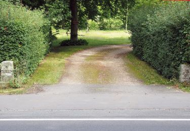
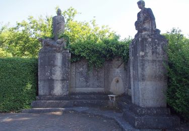
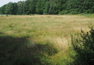
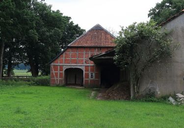
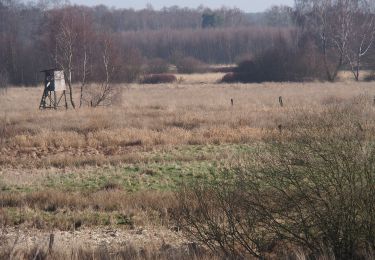
Ruta A pie de 14,7 km a descubrir en Baja Sajonia, Landkreis Celle, Celle. Esta ruta ha sido propuesta por SityTrail - itinéraires balisés pédestres.
Descripción
Trail created by Fördergemeinschaft Historisches Altencelle e.V., Stadt Celle, Fachdienst Stadtplanung.
Localización
País:
Germany
Región :
Baja Sajonia
Departamento/provincia :
Landkreis Celle
Municipio :
Celle
Localidad:
Unknown
Salida:(Dec)
Salida:(UTM)
577119 ; 5827890 (32U) N.
Comentarios
Excursiones cerca
![Excursión A pie Eschede - Südheide 'Beim Hecht im Karpfenteich' W14l (lange Tour) - Photo](https://media.geolcdn.com/t/375/260/ext.jpg?maxdim=2&url=https%3A%2F%2Fmedia.geolcdn.com%2Ff%2Fcd2db2d9-fbcf-4fe7-90c0-c5d9a667393a.jpeg)
![A pie A pie](https://static1.geolcdn.com/sitytour/trail-icons/100.png)
Südheide 'Beim Hecht im Karpfenteich' W14l (lange Tour)
A pie
Fácil
Eschede,
Baja Sajonia,
Landkreis Celle,
Germany
![](/images/other/stat-length.png)
9,3 km | 10,3 km-effort
2h 21min
![](https://static1.geolcdn.com/siteimages/upload/files/16400158638029165_repeat_loop_refresh_sync_direction_icon.png)
Sí
![Excursión A pie Eschede - Südheide 'Beim Hecht im Karpfenteich' W14k (kurze Tour) - Photo](https://media.geolcdn.com/t/375/260/ext.jpg?maxdim=2&url=https%3A%2F%2Fmedia.geolcdn.com%2Ff%2Fcd2db2d9-fbcf-4fe7-90c0-c5d9a667393a.jpeg)
![A pie A pie](https://static1.geolcdn.com/sitytour/trail-icons/100.png)
Südheide 'Beim Hecht im Karpfenteich' W14k (kurze Tour)
A pie
Fácil
Eschede,
Baja Sajonia,
Landkreis Celle,
Germany
![](/images/other/stat-length.png)
3,3 km | 3,7 km-effort
50min
![](https://static1.geolcdn.com/siteimages/upload/files/16400158638029165_repeat_loop_refresh_sync_direction_icon.png)
Sí
![Excursión A pie Eschede - Südheide 'Im Land der Esche' W19k (kurze Tour) - Photo](https://media.geolcdn.com/t/375/260/ext.jpg?maxdim=2&url=https%3A%2F%2Fmedia.geolcdn.com%2Ff%2F97d45ee2-293d-43ca-8309-4bfb97482e63.jpeg)
![A pie A pie](https://static1.geolcdn.com/sitytour/trail-icons/100.png)
Südheide 'Im Land der Esche' W19k (kurze Tour)
A pie
Fácil
Eschede,
Baja Sajonia,
Landkreis Celle,
Germany
![](/images/other/stat-length.png)
3,8 km | 4,2 km-effort
56min
![](https://static1.geolcdn.com/siteimages/upload/files/16400158638029165_repeat_loop_refresh_sync_direction_icon.png)
Sí
![Excursión A pie Eschede - Südheide 'Im Land der Esche' W19m (mittlere Tour) - Photo](https://media.geolcdn.com/t/375/260/ext.jpg?maxdim=2&url=https%3A%2F%2Fmedia.geolcdn.com%2Ff%2F97d45ee2-293d-43ca-8309-4bfb97482e63.jpeg)
![A pie A pie](https://static1.geolcdn.com/sitytour/trail-icons/100.png)
Südheide 'Im Land der Esche' W19m (mittlere Tour)
A pie
Fácil
Eschede,
Baja Sajonia,
Landkreis Celle,
Germany
![](/images/other/stat-length.png)
6,7 km | 7,3 km-effort
1h 39min
![](https://static1.geolcdn.com/siteimages/upload/files/16400158638029165_repeat_loop_refresh_sync_direction_icon.png)
Sí
![Excursión A pie Eschede - Südheide 'Im Land der Esche' W19l (lange Tour) - Photo](https://media.geolcdn.com/t/375/260/ext.jpg?maxdim=2&url=https%3A%2F%2Fmedia.geolcdn.com%2Ff%2F38f1fdfc-f42b-4a99-ab3b-c8046922951c.jpeg)
![A pie A pie](https://static1.geolcdn.com/sitytour/trail-icons/100.png)
Südheide 'Im Land der Esche' W19l (lange Tour)
A pie
Fácil
Eschede,
Baja Sajonia,
Landkreis Celle,
Germany
![](/images/other/stat-length.png)
8,7 km | 9,5 km-effort
2h 9min
![](https://static1.geolcdn.com/siteimages/upload/files/16400158638029165_repeat_loop_refresh_sync_direction_icon.png)
Sí
![Excursión A pie Eschede - Südheide 'Magische Orte längs des Weges' W20l (lange Tour) - Photo](https://media.geolcdn.com/t/375/260/ext.jpg?maxdim=2&url=https%3A%2F%2Fmedia.geolcdn.com%2Ff%2F571c1a85-4b8a-478a-86a5-9aab9cbd21e0.jpeg)
![A pie A pie](https://static1.geolcdn.com/sitytour/trail-icons/100.png)
Südheide 'Magische Orte längs des Weges' W20l (lange Tour)
A pie
Medio
Eschede,
Baja Sajonia,
Landkreis Celle,
Germany
![](/images/other/stat-length.png)
20 km | 22 km-effort
5h 2min
![](https://static1.geolcdn.com/siteimages/upload/files/16400158638029165_repeat_loop_refresh_sync_direction_icon.png)
Sí
![Excursión A pie Eschede - Südheide 'Magische Orte längs des Weges' W20m (mittere Tour) - Photo](https://media.geolcdn.com/t/375/260/ext.jpg?maxdim=2&url=https%3A%2F%2Fmedia.geolcdn.com%2Ff%2F38f1fdfc-f42b-4a99-ab3b-c8046922951c.jpeg)
![A pie A pie](https://static1.geolcdn.com/sitytour/trail-icons/100.png)
Südheide 'Magische Orte längs des Weges' W20m (mittere Tour)
A pie
Fácil
Eschede,
Baja Sajonia,
Landkreis Celle,
Germany
![](/images/other/stat-length.png)
7,5 km | 8,3 km-effort
1h 52min
![](https://static1.geolcdn.com/siteimages/upload/files/16400158638029165_repeat_loop_refresh_sync_direction_icon.png)
Sí
![Excursión A pie Eldingen - Südheide 'Kühe in Halbtrauer' W21m (mittlere Tour) - Photo](https://media.geolcdn.com/t/375/260/ext.jpg?maxdim=2&url=https%3A%2F%2Fmedia.geolcdn.com%2Ff%2Fe9ddb2d5-ad44-46a9-9d7c-c34b7f25a9d7.jpeg)
![A pie A pie](https://static1.geolcdn.com/sitytour/trail-icons/100.png)
Südheide 'Kühe in Halbtrauer' W21m (mittlere Tour)
A pie
Fácil
Eldingen,
Baja Sajonia,
Landkreis Celle,
Germany
![](/images/other/stat-length.png)
9,4 km | 10,3 km-effort
2h 21min
![](https://static1.geolcdn.com/siteimages/upload/files/16400158638029165_repeat_loop_refresh_sync_direction_icon.png)
Sí
![Excursión A pie Eldingen - Südheide 'Kühe in Halbtrauer' W21k (kurze Tour) - Photo](https://media.geolcdn.com/t/375/260/ext.jpg?maxdim=2&url=https%3A%2F%2Fmedia.geolcdn.com%2Ff%2Fe9ddb2d5-ad44-46a9-9d7c-c34b7f25a9d7.jpeg)
![A pie A pie](https://static1.geolcdn.com/sitytour/trail-icons/100.png)
Südheide 'Kühe in Halbtrauer' W21k (kurze Tour)
A pie
Fácil
Eldingen,
Baja Sajonia,
Landkreis Celle,
Germany
![](/images/other/stat-length.png)
3,3 km | 3,7 km-effort
49min
![](https://static1.geolcdn.com/siteimages/upload/files/16400158638029165_repeat_loop_refresh_sync_direction_icon.png)
Sí