![](/images/other/stat-length.png)
![Excursión A pie Freudenberg - Liebliches Taubertal 1 - Photo](https://media.geolcdn.com/t/1900/400/a1a1ddd0-299d-46dc-a79b-92d4fb751b83.jpeg&format=pjpeg&maxdim=2)
Liebliches Taubertal 1
SityTrail - itinéraires balisés pédestres
Tous les sentiers balisés d’Europe GUIDE+
![Longitud](/images/other/stat-length.png)
![Altitud máxima](https://static1.geolcdn.com/siteimages/upload/files/1508320355ic_sort_altitude_max_24dp.png)
![Desnivel positivo](https://static1.geolcdn.com/siteimages/upload/files/1508320355ic_sort_den_pos_24dp.png)
![Km-Effort](/images/other/stat-length.png)
![Altitud mínima](https://static1.geolcdn.com/siteimages/upload/files/1508320355ic_sort_altitude_min_24dp.png)
![Desnivel negativo](https://static1.geolcdn.com/siteimages/upload/files/1508320355ic_sort_den_neg_24dp.png)
![Boucle](https://static1.geolcdn.com/siteimages/upload/files/16400158638029165_repeat_loop_refresh_sync_direction_icon.png)
![A pie](https://static1.geolcdn.com/sitytour/trail-icons/100.png)
56m
Dificultad : Fácil
![Escanee este código QR para abrir la excursión en la aplicación SityTrail](https://capi.geolives.com/qq0zvz2zws4bq2lad0pu/sitytour/trails/3100870/qr.png?size=200)
Aplicación GPS de excursión GRATIS
A propósito
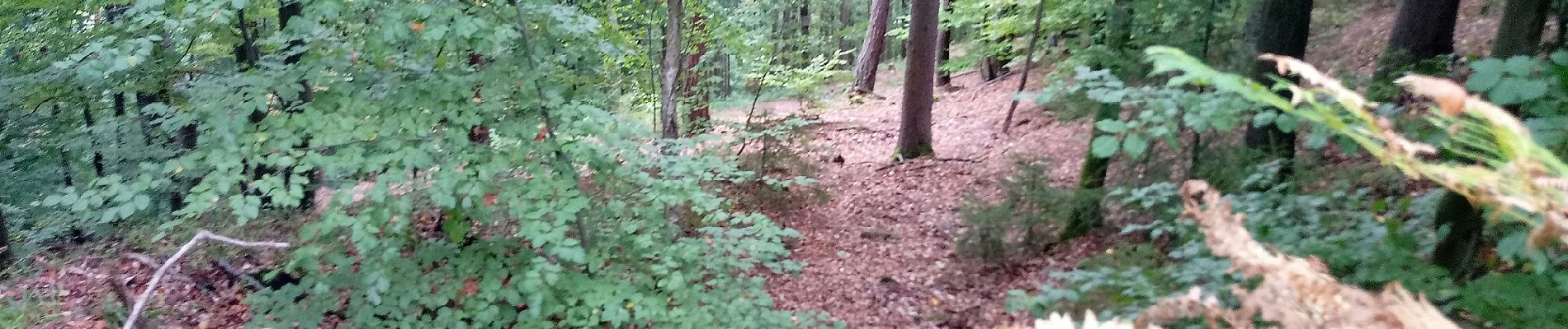
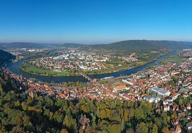
Ruta A pie de 3,2 km a descubrir en Baden-Wurtemberg, Main-Tauber-Kreis, Freudenberg. Esta ruta ha sido propuesta por SityTrail - itinéraires balisés pédestres.
Descripción
Symbol: blaues Schild mit weißer Schrift, in der Mitte durch eine weiße Linie getrennt. Obehalb "LT", darunter "1"
Sitio web: https://www.liebliches-taubertal.de/Aktiv/Wandern/Rundwanderungen/Wanderung-Nr-1-Zu-den-Heunesteinen.html
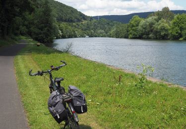
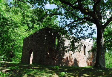
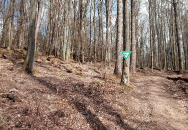
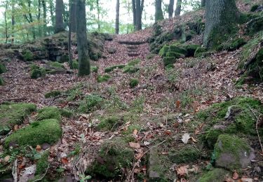
Localización
Comentarios
Excursiones cerca
![Excursión A pie Collenberg - Burgberg-Ausblick - Photo](https://media.geolcdn.com/t/375/260/47184e0d-c747-4127-bc7d-1a17777a0e98.jpeg&format=jpg&maxdim=2)
![A pie A pie](https://static1.geolcdn.com/sitytour/trail-icons/100.png)
A pie
![](/images/other/stat-length.png)
![](https://static1.geolcdn.com/siteimages/upload/files/16400158638029165_repeat_loop_refresh_sync_direction_icon.png)
![Excursión A pie Bürgstadt - Rundwanderweg Bürgstadt Stutz 3: Ringwall-Weg - Photo](https://media.geolcdn.com/t/375/260/859545fc-75c4-4048-bc9f-115ae79da6f9.jpeg&format=jpg&maxdim=2)
![A pie A pie](https://static1.geolcdn.com/sitytour/trail-icons/100.png)
A pie
![](/images/other/stat-length.png)
![](https://static1.geolcdn.com/siteimages/upload/files/16400158638029165_repeat_loop_refresh_sync_direction_icon.png)
![Excursión A pie Miltenberg - Rundwanderweg Miltenberg 4: Steinerner-Weg - Photo](https://media.geolcdn.com/t/375/260/ae05aa84-25a2-4da7-874b-c9e7394d0450.jpeg&format=jpg&maxdim=2)
![A pie A pie](https://static1.geolcdn.com/sitytour/trail-icons/100.png)
A pie
![](/images/other/stat-length.png)
![](https://static1.geolcdn.com/siteimages/upload/files/16400158638029165_repeat_loop_refresh_sync_direction_icon.png)
![Excursión A pie Miltenberg - Rundwanderweg Miltenberg 3: Grein-Berg-Weg - Photo](https://media.geolcdn.com/t/375/260/ae05aa84-25a2-4da7-874b-c9e7394d0450.jpeg&format=jpg&maxdim=2)
![A pie A pie](https://static1.geolcdn.com/sitytour/trail-icons/100.png)
A pie
![](/images/other/stat-length.png)
![](https://static1.geolcdn.com/siteimages/upload/files/16400158638029165_repeat_loop_refresh_sync_direction_icon.png)
![Excursión A pie Freudenberg - Rundwanderweg Ebenheid, Eb4, Winnengrund-Weg - Photo](https://media.geolcdn.com/t/375/260/d227ce58-2889-487b-8c66-0c05d20cef6d.jpeg&format=jpg&maxdim=2)
![A pie A pie](https://static1.geolcdn.com/sitytour/trail-icons/100.png)
A pie
![](/images/other/stat-length.png)
![](https://static1.geolcdn.com/siteimages/upload/files/16400158638029165_repeat_loop_refresh_sync_direction_icon.png)
![Excursión A pie Freudenberg - Rundwanderweg Ebenheid, Eb2, Hohbusch-Weg - Photo](https://media.geolcdn.com/t/375/260/f4bd72ff-557f-42b8-bbea-87c658ada1d9.jpeg&format=jpg&maxdim=2)
![A pie A pie](https://static1.geolcdn.com/sitytour/trail-icons/100.png)
A pie
![](/images/other/stat-length.png)
![](https://static1.geolcdn.com/siteimages/upload/files/16400158638029165_repeat_loop_refresh_sync_direction_icon.png)
![Excursión A pie Miltenberg - Rundwanderweg Miltenberg 2: Ottosteinweg - Photo](https://media.geolcdn.com/t/375/260/cf7cffd0-61f6-45dc-b7d3-1d128370df4d.jpeg&format=jpg&maxdim=2)
![A pie A pie](https://static1.geolcdn.com/sitytour/trail-icons/100.png)
A pie
![](/images/other/stat-length.png)
![](https://static1.geolcdn.com/siteimages/upload/files/16400158638029165_repeat_loop_refresh_sync_direction_icon.png)
![Excursión A pie Freudenberg - Hohenstein-Weg - Photo](https://media.geolcdn.com/t/375/260/ab6acd5a-3f98-480b-af95-2be7a0cd7d70.jpeg&format=jpg&maxdim=2)
![A pie A pie](https://static1.geolcdn.com/sitytour/trail-icons/100.png)
A pie
![](/images/other/stat-length.png)
![](https://static1.geolcdn.com/siteimages/upload/files/16400158638029165_repeat_loop_refresh_sync_direction_icon.png)
![Excursión A pie Freudenberg - Rundwanderweg Freudenberg Kreuzschleife 1: Schloss-Weg - Photo](https://media.geolcdn.com/t/375/260/50c50589-5405-4d87-b9da-51f18d12e24b.jpeg&format=jpg&maxdim=2)
![A pie A pie](https://static1.geolcdn.com/sitytour/trail-icons/100.png)
A pie
![](/images/other/stat-length.png)
![](https://static1.geolcdn.com/siteimages/upload/files/16400158638029165_repeat_loop_refresh_sync_direction_icon.png)