![](/images/other/stat-length.png)
![Excursión A pie Neualbenreuth - Alter Herrgott Weg - Photo](https://media.geolcdn.com/t/1900/400/da23ae0e-15a2-4ebb-81d9-23741e0bbc84.jpeg&format=pjpeg&maxdim=2)
Alter Herrgott Weg
SityTrail - itinéraires balisés pédestres
Tous les sentiers balisés d’Europe GUIDE+
![Longitud](/images/other/stat-length.png)
Longitud
5 km
![Altitud máxima](https://static1.geolcdn.com/siteimages/upload/files/1508320355ic_sort_altitude_max_24dp.png)
Altitud máxima
729 m
![Desnivel positivo](https://static1.geolcdn.com/siteimages/upload/files/1508320355ic_sort_den_pos_24dp.png)
Desnivel positivo
209 m
![Km-Effort](/images/other/stat-length.png)
Km-Effort
7,2 km
![Altitud mínima](https://static1.geolcdn.com/siteimages/upload/files/1508320355ic_sort_altitude_min_24dp.png)
Altitud mínima
542 m
![Desnivel negativo](https://static1.geolcdn.com/siteimages/upload/files/1508320355ic_sort_den_neg_24dp.png)
Desnivel negativo
28 m
![Boucle](https://static1.geolcdn.com/siteimages/upload/files/16400158638029165_repeat_loop_refresh_sync_direction_icon.png)
Boucle
No
Baliza
Fecha de creación :
2022-02-11 19:14:12.808
Última modificación :
2022-02-11 19:14:12.808
![A pie](https://static1.geolcdn.com/sitytour/trail-icons/100.png)
1h37
Dificultad : Fácil
![Escanee este código QR para abrir la excursión en la aplicación SityTrail](https://capi.geolives.com/qq0zvz2zws4bq2lad0pu/sitytour/trails/3100435/qr.png?size=200)
Aplicación GPS de excursión GRATIS
A propósito
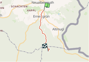
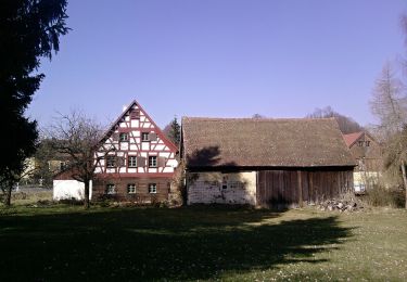
Ruta A pie de 5 km a descubrir en Baviera, Landkreis Tirschenreuth, Neualbenreuth. Esta ruta ha sido propuesta por SityTrail - itinéraires balisés pédestres.
Descripción
Trail created by Oberpfälzer Waldverein.
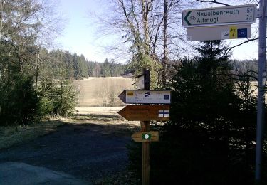
Symbol: Blauer Balken auf weißem Hintergrund
Sitio web: https://wandern-in-neualbenreuth.de/alter-herrgott-weg/
Localización
País:
Germany
Región :
Baviera
Departamento/provincia :
Landkreis Tirschenreuth
Municipio :
Neualbenreuth
Localidad:
Unknown
Salida:(Dec)
Salida:(UTM)
316717 ; 5538453 (33U) N.
Comentarios
Excursiones cerca
![Excursión A pie Lipová - CZ-6704 - Photo](https://media.geolcdn.com/t/375/260/8cb1f201-bee5-4835-9c64-1be594bf1fd9.jpeg&format=jpg&maxdim=2)
![A pie A pie](https://static1.geolcdn.com/sitytour/trail-icons/100.png)
CZ-6704
A pie
Fácil
Lipová,
Severozápad,
Karlovarský kraj,
Czech Republic
![](/images/other/stat-length.png)
6,3 km | 7,4 km-effort
1h 40min
![](https://static1.geolcdn.com/siteimages/upload/files/16400158638029165_repeat_loop_refresh_sync_direction_icon.png)
No
![Excursión A pie Lipová - naučná stezka Stebnický potok - Photo](https://media.geolcdn.com/t/375/260/76881798-26a7-4b4a-aabe-2dcf5c324b8e.jpeg&format=jpg&maxdim=2)
![A pie A pie](https://static1.geolcdn.com/sitytour/trail-icons/100.png)
naučná stezka Stebnický potok
A pie
Fácil
Lipová,
Severozápad,
Karlovarský kraj,
Czech Republic
![](/images/other/stat-length.png)
5 km | 6,5 km-effort
1h 28min
![](https://static1.geolcdn.com/siteimages/upload/files/16400158638029165_repeat_loop_refresh_sync_direction_icon.png)
No
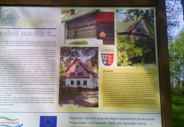
![Excursión A pie Lipová - [Ž] Dolní Žandov - Pod Dylení - Photo](https://media.geolcdn.com/t/375/260/3c075749-bc39-4d3d-bb5a-bf9983668a77.jpeg&format=jpg&maxdim=2)
![A pie A pie](https://static1.geolcdn.com/sitytour/trail-icons/100.png)
[Ž] Dolní Žandov - Pod Dylení
A pie
Fácil
Lipová,
Severozápad,
Karlovarský kraj,
Czech Republic
![](/images/other/stat-length.png)
7,3 km | 8,7 km-effort
1h 59min
![](https://static1.geolcdn.com/siteimages/upload/files/16400158638029165_repeat_loop_refresh_sync_direction_icon.png)
No
![Excursión A pie Neualbenreuth - Neualbenreuth: Auf stillen Waldpfaden zur Grenze - Photo](https://media.geolcdn.com/t/375/260/da23ae0e-15a2-4ebb-81d9-23741e0bbc84.jpeg&format=jpg&maxdim=2)
![A pie A pie](https://static1.geolcdn.com/sitytour/trail-icons/100.png)
Neualbenreuth: Auf stillen Waldpfaden zur Grenze
A pie
Medio
Neualbenreuth,
Baviera,
Landkreis Tirschenreuth,
Germany
![](/images/other/stat-length.png)
14,8 km | 20 km-effort
4h 36min
![](https://static1.geolcdn.com/siteimages/upload/files/16400158638029165_repeat_loop_refresh_sync_direction_icon.png)
Sí
![Excursión A pie Neualbenreuth - Alter Herrgott - Granatbrunnen - Photo](https://media.geolcdn.com/t/375/260/f00bb44f-3a31-494e-b91b-cb23ec59b052.jpeg&format=jpg&maxdim=2)
![A pie A pie](https://static1.geolcdn.com/sitytour/trail-icons/100.png)
Alter Herrgott - Granatbrunnen
A pie
Fácil
Neualbenreuth,
Baviera,
Landkreis Tirschenreuth,
Germany
![](/images/other/stat-length.png)
5,7 km | 7,6 km-effort
1h 43min
![](https://static1.geolcdn.com/siteimages/upload/files/16400158638029165_repeat_loop_refresh_sync_direction_icon.png)
No
![Excursión A pie Waldsassen - Muglbach Weg - Photo](https://media.geolcdn.com/t/375/260/e65b2066-a961-447a-bff6-6e75825cfedf.jpeg&format=jpg&maxdim=2)
![A pie A pie](https://static1.geolcdn.com/sitytour/trail-icons/100.png)
Muglbach Weg
A pie
Fácil
Waldsassen,
Baviera,
Landkreis Tirschenreuth,
Germany
![](/images/other/stat-length.png)
11,7 km | 15,3 km-effort
3h 28min
![](https://static1.geolcdn.com/siteimages/upload/files/16400158638029165_repeat_loop_refresh_sync_direction_icon.png)
No
![Excursión A pie Neualbenreuth - Ringelfelsen-Weg - Photo](https://media.geolcdn.com/t/375/260/95845725-0005-4d81-920c-73b4f09cdf34.jpeg&format=jpg&maxdim=2)
![A pie A pie](https://static1.geolcdn.com/sitytour/trail-icons/100.png)
Ringelfelsen-Weg
A pie
Fácil
Neualbenreuth,
Baviera,
Landkreis Tirschenreuth,
Germany
![](/images/other/stat-length.png)
11,2 km | 13,7 km-effort
3h 6min
![](https://static1.geolcdn.com/siteimages/upload/files/16400158638029165_repeat_loop_refresh_sync_direction_icon.png)
No
![Excursión A pie Neualbenreuth - Neualbenreuth: Wanderweg Sibyllenbad Gedankental - Photo](https://media.geolcdn.com/t/375/260/95845725-0005-4d81-920c-73b4f09cdf34.jpeg&format=jpg&maxdim=2)
![A pie A pie](https://static1.geolcdn.com/sitytour/trail-icons/100.png)
Neualbenreuth: Wanderweg Sibyllenbad Gedankental
A pie
Fácil
Neualbenreuth,
Baviera,
Landkreis Tirschenreuth,
Germany
![](/images/other/stat-length.png)
4,2 km | 5,2 km-effort
1h 10min
![](https://static1.geolcdn.com/siteimages/upload/files/16400158638029165_repeat_loop_refresh_sync_direction_icon.png)
Sí
![Excursión A pie Neualbenreuth - Neualbenreuth: Auf den Spuen der Waldsassener Äbte - Photo](https://media.geolcdn.com/t/375/260/5f042772-f8e8-470c-b546-2ed4e5c1411b.jpeg&format=jpg&maxdim=2)
![A pie A pie](https://static1.geolcdn.com/sitytour/trail-icons/100.png)
Neualbenreuth: Auf den Spuen der Waldsassener Äbte
A pie
Fácil
Neualbenreuth,
Baviera,
Landkreis Tirschenreuth,
Germany
![](/images/other/stat-length.png)
11 km | 14,2 km-effort
3h 14min
![](https://static1.geolcdn.com/siteimages/upload/files/16400158638029165_repeat_loop_refresh_sync_direction_icon.png)
Sí