


6,9 km | 8,8 km-effort
![Excursión A pie Buchholz (Westerwald) - [B3] Silberbergweg - Photo](https://media.geolcdn.com/t/1900/400/26598f31-7aa1-441d-a048-772ec0888cec.jpeg&format=pjpeg&maxdim=2)

Tous les sentiers balisés d’Europe GUIDE+


Aplicación GPS de excursión GRATIS
 SityTrail
IGN / Institutos geográficos
SityTrail World
El mundo es suyo
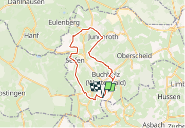
Ruta A pie de 11,1 km a descubrir en Renania-Palatinado, Landkreis Neuwied, Buchholz (Westerwald). Esta ruta ha sido propuesta por SityTrail - itinéraires balisés pédestres.
Buchholz, im schönen Asbacher Land gelegen, ist Ausgangspunkt zu dieser abwechslungsreichen Wanderung. An der Kirche im Ort starten einige ausgeschilderte...
Sitio web: https://www.ich-geh-wandern.de/auf-dem-silberbergweg-b3-durch-das-asbacher-land-bei-buchholz-westerwald
![Excursión A pie Buchholz (Westerwald) - [B3] Silberbergweg - Photo 1](https://media.geolcdn.com/t/2048/auto/6e073a21-cee7-42cd-9031-66f223a9a921.jpeg&format=jpg&maxdim=0 "Excursión A pie Buchholz (Westerwald) - [B3] Silberbergweg - Photo 1")
![Excursión A pie Buchholz (Westerwald) - [B3] Silberbergweg - Photo 2](https://media.geolcdn.com/t/2048/auto/072a4fc8-a748-4535-8268-8265ea4d93db.jpeg&format=jpg&maxdim=0 "Excursión A pie Buchholz (Westerwald) - [B3] Silberbergweg - Photo 2")
![Excursión A pie Buchholz (Westerwald) - [B3] Silberbergweg - Photo 3](https://media.geolcdn.com/t/2048/auto/5d468dbd-1fc6-4ac2-ac29-17ba2bfaa13f.jpeg&format=jpg&maxdim=0 "Excursión A pie Buchholz (Westerwald) - [B3] Silberbergweg - Photo 3")
![Excursión A pie Buchholz (Westerwald) - [B3] Silberbergweg - Photo 4](https://media.geolcdn.com/t/2048/auto/4754c0da-d612-4e7e-9f0e-57b90dfb63ab.jpeg&format=jpg&maxdim=0 "Excursión A pie Buchholz (Westerwald) - [B3] Silberbergweg - Photo 4")
![Excursión A pie Buchholz (Westerwald) - [B3] Silberbergweg - Photo 5](https://media.geolcdn.com/t/2048/auto/63b82438-9923-4245-8f71-c23970b21acb.jpeg&format=jpg&maxdim=0 "Excursión A pie Buchholz (Westerwald) - [B3] Silberbergweg - Photo 5")
![Excursión A pie Buchholz (Westerwald) - [B3] Silberbergweg - Photo 6](https://media.geolcdn.com/t/2048/auto/752dab43-9aaf-4e0c-b398-f6dcb0e5021f.jpeg&format=jpg&maxdim=0 "Excursión A pie Buchholz (Westerwald) - [B3] Silberbergweg - Photo 6")
![Excursión A pie Buchholz (Westerwald) - [B3] Silberbergweg - Photo 7](https://media.geolcdn.com/t/2048/auto/b82e1654-a92b-42d8-b749-be2b7cb34275.jpeg&format=jpg&maxdim=0 "Excursión A pie Buchholz (Westerwald) - [B3] Silberbergweg - Photo 7")
![Excursión A pie Buchholz (Westerwald) - [B3] Silberbergweg - Photo 8](https://media.geolcdn.com/t/2048/auto/26598f31-7aa1-441d-a048-772ec0888cec.jpeg&format=jpg&maxdim=0 "Excursión A pie Buchholz (Westerwald) - [B3] Silberbergweg - Photo 8")
![Excursión A pie Buchholz (Westerwald) - [B3] Silberbergweg - Photo 9](https://media.geolcdn.com/t/2048/auto/949ceed3-c41a-4956-b0a5-624a3cd2e834.jpeg&format=jpg&maxdim=0 "Excursión A pie Buchholz (Westerwald) - [B3] Silberbergweg - Photo 9")
![Excursión A pie Buchholz (Westerwald) - [B3] Silberbergweg - Photo 10](https://media.geolcdn.com/t/2048/auto/57a25f03-f60e-40dc-9056-2061b7fe1532.jpeg&format=jpg&maxdim=0 "Excursión A pie Buchholz (Westerwald) - [B3] Silberbergweg - Photo 10")
![Excursión A pie Windhagen - [W2] Windhagener Weg - Photo](https://media.geolcdn.com/t/375/260/adef9696-6d08-4cbb-94cd-bba75114ff6a.jpeg&format=jpg&maxdim=2)
A pie
![Excursión A pie Asbach - [A4] Mühlenweg - Photo](https://media.geolcdn.com/t/375/260/17f9fb3a-b4a7-45d7-a2b4-ea773ee9f1e5.jpeg&format=jpg&maxdim=2)
A pie
A pie
A pie
![Excursión A pie Buchholz (Westerwald) - [B2] Dreiherrensteinweg - Photo](https://media.geolcdn.com/t/375/260/aecd4644-6921-4b4a-8659-a9cc70680b9b.jpeg&format=jpg&maxdim=2)
A pie
A pie
![Excursión A pie Asbach - [B1] Barger Heck Weg - Photo](https://media.geolcdn.com/t/375/260/ext.jpg?maxdim=2&url=https%3A%2F%2Fstatic1.geolcdn.com%2Fsiteimages%2Fupload%2Ffiles%2F1545311037marcheuse_200dpi.jpg)
A pie