


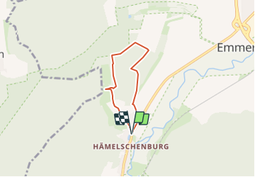

3,6 km | 5 km-effort

Tous les sentiers balisés d’Europe GUIDE+


Aplicación GPS de excursión GRATIS
 SityTrail
IGN / Institutos geográficos
SityTrail World
El mundo es suyo
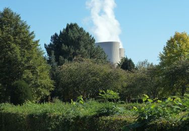
Ruta A pie de 4 km a descubrir en Baja Sajonia, Landkreis Hameln-Pyrmont, Emmerthal. Esta ruta ha sido propuesta por SityTrail - itinéraires balisés pédestres.
Symbol: blaue 6 auf gelbem Grund
Sitio web: https://pages.et4.de/de/westliches-weserbergland_neu/default/detail/Tour/A2609539766C1EAC575A8FA173FF632D/rundwanderweg-et6


A pie
A pie
A pie
A pie
A pie
A pie
A pie

A pie
A pie