![](/images/other/stat-length.png)
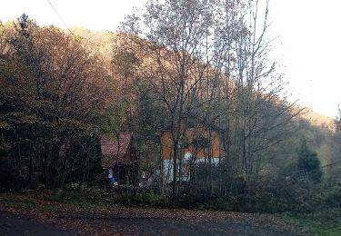
![Excursión A pie Faulbach - Schwarzer Keiler, Rundwanderweg Breitenbrunn - Photo](https://media.geolcdn.com/t/1900/400/ext.pjpeg?maxdim=2&url=https%3A%2F%2Fstatic1.geolcdn.com%2Fsiteimages%2Fupload%2Ffiles%2F1545311037marcheuse_200dpi.jpg)
Schwarzer Keiler, Rundwanderweg Breitenbrunn
SityTrail - itinéraires balisés pédestres
Tous les sentiers balisés d’Europe GUIDE+
![Longitud](/images/other/stat-length.png)
Longitud
9,2 km
![Altitud máxima](https://static1.geolcdn.com/siteimages/upload/files/1508320355ic_sort_altitude_max_24dp.png)
Altitud máxima
359 m
![Desnivel positivo](https://static1.geolcdn.com/siteimages/upload/files/1508320355ic_sort_den_pos_24dp.png)
Desnivel positivo
221 m
![Km-Effort](/images/other/stat-length.png)
Km-Effort
12,2 km
![Altitud mínima](https://static1.geolcdn.com/siteimages/upload/files/1508320355ic_sort_altitude_min_24dp.png)
Altitud mínima
194 m
![Desnivel negativo](https://static1.geolcdn.com/siteimages/upload/files/1508320355ic_sort_den_neg_24dp.png)
Desnivel negativo
220 m
![Boucle](https://static1.geolcdn.com/siteimages/upload/files/16400158638029165_repeat_loop_refresh_sync_direction_icon.png)
Boucle
Sí
Baliza
Fecha de creación :
2022-02-11 17:51:04.225
Última modificación :
2022-02-11 17:51:04.225
![A pie](https://static1.geolcdn.com/sitytour/trail-icons/100.png)
2h45
Dificultad : Fácil
![Escanee este código QR para abrir la excursión en la aplicación SityTrail](https://capi.geolives.com/qq0zvz2zws4bq2lad0pu/sitytour/trails/3098637/qr.png?size=200)
Aplicación GPS de excursión GRATIS
A propósito
Ruta A pie de 9,2 km a descubrir en Baviera, Landkreis Miltenberg, Faulbach. Esta ruta ha sido propuesta por SityTrail - itinéraires balisés pédestres.
Descripción
Trail created by Naturpark Spessart.
Symbol: Schwarzes Wildschwein auf weißem Grund
Localización
País:
Germany
Región :
Baviera
Departamento/provincia :
Landkreis Miltenberg
Municipio :
Faulbach
Localidad:
Unknown
Salida:(Dec)
Salida:(UTM)
532741 ; 5514658 (32U) N.
Comentarios
Excursiones cerca
![Excursión A pie Wertheim - Liebliches Taubertal – Ehemaliger Rundwanderweg 3 – Wein und Glaube - Photo](https://media.geolcdn.com/t/375/260/64281ffd-8dc4-4e28-9991-2cf77bad6a86.jpeg&format=jpg&maxdim=2)
![A pie A pie](https://static1.geolcdn.com/sitytour/trail-icons/100.png)
Liebliches Taubertal – Ehemaliger Rundwanderweg 3 – Wein und Glaube
A pie
Fácil
Wertheim,
Baden-Wurtemberg,
Main-Tauber-Kreis,
Germany
![](/images/other/stat-length.png)
11,5 km | 14,1 km-effort
3h 11min
![](https://static1.geolcdn.com/siteimages/upload/files/16400158638029165_repeat_loop_refresh_sync_direction_icon.png)
No
![Excursión A pie Marktheidenfeld - Ortswanderweg Marktheidenfeld 4 - Photo](https://media.geolcdn.com/t/375/260/bcd90cb3-c9a8-44d0-aa81-640096959061.jpeg&format=jpg&maxdim=2)
![A pie A pie](https://static1.geolcdn.com/sitytour/trail-icons/100.png)
Ortswanderweg Marktheidenfeld 4
A pie
Fácil
Marktheidenfeld,
Baviera,
Landkreis Main-Spessart,
Germany
![](/images/other/stat-length.png)
5 km | 5,9 km-effort
1h 20min
![](https://static1.geolcdn.com/siteimages/upload/files/16400158638029165_repeat_loop_refresh_sync_direction_icon.png)
No
![Excursión A pie Kreuzwertheim - Ortswanderweg Hasselberg 4 - Photo](https://media.geolcdn.com/t/375/260/92c854c0-566b-4860-a46a-cb631d0aa7e4.jpeg&format=jpg&maxdim=2)
![A pie A pie](https://static1.geolcdn.com/sitytour/trail-icons/100.png)
Ortswanderweg Hasselberg 4
A pie
Fácil
Kreuzwertheim,
Baviera,
Landkreis Main-Spessart,
Germany
![](/images/other/stat-length.png)
4 km | 5 km-effort
1h 7min
![](https://static1.geolcdn.com/siteimages/upload/files/16400158638029165_repeat_loop_refresh_sync_direction_icon.png)
No
![Excursión A pie Stadtprozelten - Roter Hase, Rundwanderweg Stadtprozelten - Photo](https://media.geolcdn.com/t/375/260/d197030e-bca5-4a87-8e6a-0abdd9e497c4.jpeg&format=jpg&maxdim=2)
![A pie A pie](https://static1.geolcdn.com/sitytour/trail-icons/100.png)
Roter Hase, Rundwanderweg Stadtprozelten
A pie
Fácil
Stadtprozelten,
Baviera,
Landkreis Miltenberg,
Germany
![](/images/other/stat-length.png)
3,9 km | 5,3 km-effort
1h 12min
![](https://static1.geolcdn.com/siteimages/upload/files/16400158638029165_repeat_loop_refresh_sync_direction_icon.png)
Sí
![Excursión A pie Hasloch - Kulturweg Haseltal - Photo](https://media.geolcdn.com/t/375/260/ea70e1a1-163a-44bc-a399-38629b5f1e0d.jpeg&format=jpg&maxdim=2)
![A pie A pie](https://static1.geolcdn.com/sitytour/trail-icons/100.png)
Kulturweg Haseltal
A pie
Fácil
Hasloch,
Baviera,
Landkreis Main-Spessart,
Germany
![](/images/other/stat-length.png)
7,6 km | 10,7 km-effort
2h 26min
![](https://static1.geolcdn.com/siteimages/upload/files/16400158638029165_repeat_loop_refresh_sync_direction_icon.png)
No
![Excursión A pie Freudenberg - Rundwanderweg Wessental, We1, Wildbach-Weg - Photo](https://media.geolcdn.com/t/375/260/11fa59e4-1bfd-4f8c-9bc2-f60c3fabebe3.jpeg&format=jpg&maxdim=2)
![A pie A pie](https://static1.geolcdn.com/sitytour/trail-icons/100.png)
Rundwanderweg Wessental, We1, Wildbach-Weg
A pie
Fácil
Freudenberg,
Baden-Wurtemberg,
Main-Tauber-Kreis,
Germany
![](/images/other/stat-length.png)
5,1 km | 6,9 km-effort
1h 34min
![](https://static1.geolcdn.com/siteimages/upload/files/16400158638029165_repeat_loop_refresh_sync_direction_icon.png)
Sí
![Excursión A pie Freudenberg - Rundwanderweg Boxtal, Bo2, Hossert-Weg - Photo](https://media.geolcdn.com/t/375/260/ab6acd5a-3f98-480b-af95-2be7a0cd7d70.jpeg&format=jpg&maxdim=2)
![A pie A pie](https://static1.geolcdn.com/sitytour/trail-icons/100.png)
Rundwanderweg Boxtal, Bo2, Hossert-Weg
A pie
Fácil
Freudenberg,
Baden-Wurtemberg,
Main-Tauber-Kreis,
Germany
![](/images/other/stat-length.png)
5,8 km | 8,8 km-effort
1h 59min
![](https://static1.geolcdn.com/siteimages/upload/files/16400158638029165_repeat_loop_refresh_sync_direction_icon.png)
Sí
![Excursión A pie Faulbach - Ortswanderweg Hasselberg 5 - Photo](https://media.geolcdn.com/t/375/260/c2ebfcb3-8b72-4784-8628-b6b5dad1c00f.jpeg&format=jpg&maxdim=2)
![A pie A pie](https://static1.geolcdn.com/sitytour/trail-icons/100.png)
Ortswanderweg Hasselberg 5
A pie
Fácil
Faulbach,
Baviera,
Landkreis Miltenberg,
Germany
![](/images/other/stat-length.png)
6,2 km | 8,4 km-effort
1h 55min
![](https://static1.geolcdn.com/siteimages/upload/files/16400158638029165_repeat_loop_refresh_sync_direction_icon.png)
No
![Excursión A pie Stadtprozelten - Ortswanderweg Stadtprozelten 3 - Photo](https://media.geolcdn.com/t/375/260/196a4cbc-1c1e-42e7-9e10-34d60b5d0a11.jpeg&format=jpg&maxdim=2)
![A pie A pie](https://static1.geolcdn.com/sitytour/trail-icons/100.png)
Ortswanderweg Stadtprozelten 3
A pie
Fácil
Stadtprozelten,
Baviera,
Landkreis Miltenberg,
Germany
![](/images/other/stat-length.png)
6 km | 9,1 km-effort
2h 4min
![](https://static1.geolcdn.com/siteimages/upload/files/16400158638029165_repeat_loop_refresh_sync_direction_icon.png)
No