


5,5 km | 8,2 km-effort
![Excursión A pie Detmold - Rundwanderweg [Gauseköte] - Photo](https://media.geolcdn.com/t/1900/400/b23ec4a7-b5cb-44c3-a014-f0b25ad95715.jpeg&format=pjpeg&maxdim=2)

Tous les sentiers balisés d’Europe GUIDE+


Aplicación GPS de excursión GRATIS
 SityTrail
IGN / Institutos geográficos
SityTrail World
El mundo es suyo
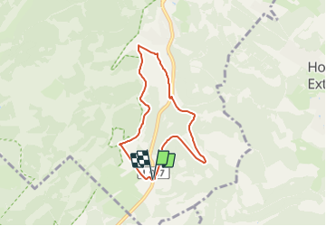
Ruta A pie de 5,5 km a descubrir en Renania del Norte-Westfalia, Kreis Lippe, Detmold. Esta ruta ha sido propuesta por SityTrail - itinéraires balisés pédestres.
Symbol: A2 white on black background
![Excursión A pie Detmold - Rundwanderweg [Gauseköte] - Photo 1](https://media.geolcdn.com/t/2048/auto/87cb3ef8-e183-40b6-a5fb-1d048ea0de82.jpeg&format=jpg&maxdim=0 "Excursión A pie Detmold - Rundwanderweg [Gauseköte] - Photo 1")
![Excursión A pie Detmold - Rundwanderweg [Gauseköte] - Photo 2](https://media.geolcdn.com/t/2048/auto/a659052c-632c-4ce6-8bde-33c67f8f5d42.jpeg&format=jpg&maxdim=0 "Excursión A pie Detmold - Rundwanderweg [Gauseköte] - Photo 2")
![Excursión A pie Detmold - Rundwanderweg [Gauseköte] - Photo 3](https://media.geolcdn.com/t/2048/auto/942a46f5-b833-42d1-abca-e99d682ca476.jpeg&format=jpg&maxdim=0 "Excursión A pie Detmold - Rundwanderweg [Gauseköte] - Photo 3")
![Excursión A pie Detmold - Rundwanderweg [Gauseköte] - Photo 4](https://media.geolcdn.com/t/2048/auto/de18bdda-0a35-4902-922b-ee0d76caf47b.jpeg&format=jpg&maxdim=0 "Excursión A pie Detmold - Rundwanderweg [Gauseköte] - Photo 4")
![Excursión A pie Detmold - Rundwanderweg [Gauseköte] - Photo 5](https://media.geolcdn.com/t/2048/auto/baaa8387-830e-42dc-93df-36633cf1f83e.jpeg&format=jpg&maxdim=0 "Excursión A pie Detmold - Rundwanderweg [Gauseköte] - Photo 5")
![Excursión A pie Detmold - Rundwanderweg [Gauseköte] - Photo 6](https://media.geolcdn.com/t/2048/auto/2917da53-3aac-4944-b0aa-5f8dd2fb7a08.jpeg&format=jpg&maxdim=0 "Excursión A pie Detmold - Rundwanderweg [Gauseköte] - Photo 6")
![Excursión A pie Detmold - Rundwanderweg [Gauseköte] - Photo 7](https://media.geolcdn.com/t/2048/auto/57b2c73f-c4da-4941-a84e-f380d81022a3.jpeg&format=jpg&maxdim=0 "Excursión A pie Detmold - Rundwanderweg [Gauseköte] - Photo 7")
![Excursión A pie Detmold - Rundwanderweg [Gauseköte] - Photo 8](https://media.geolcdn.com/t/2048/auto/fabe5ea6-8ae4-4bfb-9cb8-b4d3d97c2ba5.jpeg&format=jpg&maxdim=0 "Excursión A pie Detmold - Rundwanderweg [Gauseköte] - Photo 8")
![Excursión A pie Detmold - Rundwanderweg [Gauseköte] - Photo 9](https://media.geolcdn.com/t/2048/auto/ad7df9ed-bf7e-49d1-8cbd-216f86d7ca3d.jpeg&format=jpg&maxdim=0 "Excursión A pie Detmold - Rundwanderweg [Gauseköte] - Photo 9")
![Excursión A pie Detmold - Rundwanderweg [Gauseköte] - Photo 10](https://media.geolcdn.com/t/2048/auto/b23ec4a7-b5cb-44c3-a014-f0b25ad95715.jpeg&format=jpg&maxdim=0 "Excursión A pie Detmold - Rundwanderweg [Gauseköte] - Photo 10")
![Excursión A pie Detmold - Rundwanderweg A5 [Berlebeck] - Photo](https://media.geolcdn.com/t/375/260/09e96dc8-2a72-420e-af43-8a0b6d458613.jpeg&format=jpg&maxdim=2)
A pie
A pie
A pie
![Excursión A pie Horn-Bad Meinberg - Rundwanderweg A1 [Holzhausen-Externsteine] - Photo](https://media.geolcdn.com/t/375/260/917c6440-8043-45d4-9c08-101f3367a522.jpeg&format=jpg&maxdim=2)
A pie
![Excursión A pie Schlangen - Rundwanderweg 34 [Barnacken] - Photo](https://media.geolcdn.com/t/375/260/83e8c965-88dc-4fa7-9331-4da86113c518.jpeg&format=jpg&maxdim=2)
A pie
![Excursión A pie Horn-Bad Meinberg - Rundwanderweg A5 [Horn] - Photo](https://media.geolcdn.com/t/375/260/4fb4c3bc-36b1-4cb9-b69c-377d560ed1e3.jpeg&format=jpg&maxdim=2)
A pie
![Excursión A pie Horn-Bad Meinberg - Rundwanderweg A2 [Holzhausen-Externsteine] - Photo](https://media.geolcdn.com/t/375/260/496f2643-585c-4ec3-ad5f-48d37358ba78.jpeg&format=jpg&maxdim=2)
A pie
![Excursión A pie Detmold - Alter Postweg [Schlangen-Kreuzkrug bis Detmold] - Photo](https://media.geolcdn.com/t/375/260/9624b63f-e63d-4566-afac-fe6174b35d1f.jpeg&format=jpg&maxdim=2)
A pie
![Excursión A pie Horn-Bad Meinberg - Rundwanderweg A4 [Bauernkamp] - Photo](https://media.geolcdn.com/t/375/260/c79f5669-94e6-4aca-a5f1-993a25b95dc3.jpeg&format=jpg&maxdim=2)
A pie