![](/images/other/stat-length.png)
![Excursión A pie Bobenthal - Hirzeck-Gipfel-Steig - Photo](https://media.geolcdn.com/t/1900/400/fff086e2-3060-4491-a9c2-5e848399b322.jpeg&format=pjpeg&maxdim=2)
Hirzeck-Gipfel-Steig
SityTrail - itinéraires balisés pédestres
Tous les sentiers balisés d’Europe GUIDE+
![Longitud](/images/other/stat-length.png)
![Altitud máxima](https://static1.geolcdn.com/siteimages/upload/files/1508320355ic_sort_altitude_max_24dp.png)
![Desnivel positivo](https://static1.geolcdn.com/siteimages/upload/files/1508320355ic_sort_den_pos_24dp.png)
![Km-Effort](/images/other/stat-length.png)
![Altitud mínima](https://static1.geolcdn.com/siteimages/upload/files/1508320355ic_sort_altitude_min_24dp.png)
![Desnivel negativo](https://static1.geolcdn.com/siteimages/upload/files/1508320355ic_sort_den_neg_24dp.png)
![Boucle](https://static1.geolcdn.com/siteimages/upload/files/16400158638029165_repeat_loop_refresh_sync_direction_icon.png)
![A pie](https://static1.geolcdn.com/sitytour/trail-icons/100.png)
4h22
Dificultad : Fácil
![Escanee este código QR para abrir la excursión en la aplicación SityTrail](https://capi.geolives.com/qq0zvz2zws4bq2lad0pu/sitytour/trails/3097783/qr.png?size=200)
Aplicación GPS de excursión GRATIS
A propósito
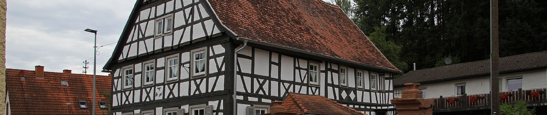
Ruta A pie de 14,1 km a descubrir en Renania-Palatinado, Südwestpfalz, Bobenthal. Esta ruta ha sido propuesta por SityTrail - itinéraires balisés pédestres.
Descripción
Trail created by Tourist Information Dahner Felsenland.
Symbol: Stlisiertes schwarzes H unter schwarzem Hügel auf weißem Grund mit schwarzer Unterschrift "Hirzeck-Gipfel-Steig"
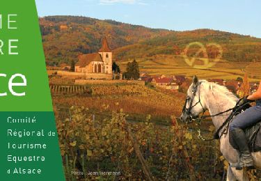
Localización
Comentarios
Excursiones cerca
![Excursión Paseo ecuestre Wingen - 2018-04-07 CRTE Alsace Loewenstein Hohenbourg Fleckenstein - Photo](https://media.geolcdn.com/t/375/260/70102c74-cde7-4712-ad3f-8ece0b83e7cb.jpg&format=jpg&maxdim=2)
![Paseo ecuestre Paseo ecuestre](https://static1.geolcdn.com/sitytour/trail-icons/301.png)
Paseo ecuestre
![](/images/other/stat-length.png)
![](https://static1.geolcdn.com/siteimages/upload/files/16400158638029165_repeat_loop_refresh_sync_direction_icon.png)
![Excursión A pie Wingen - Croix rouge - Photo](https://media.geolcdn.com/t/375/260/59ca20a7-ed62-4c6a-9fd9-47494a5cdd7a.jpeg&format=jpg&maxdim=2)
![A pie A pie](https://static1.geolcdn.com/sitytour/trail-icons/100.png)
![Excursión A pie Wingen - Anneau rouge - Photo](https://media.geolcdn.com/t/375/260/06df198a-1199-44ec-a8d9-2d9a150b410c.jpeg&format=jpg&maxdim=2)
![A pie A pie](https://static1.geolcdn.com/sitytour/trail-icons/100.png)
![Excursión A pie Wissembourg - Rotes Kreuz - Photo](https://media.geolcdn.com/t/375/260/68ad6046-667d-4bda-b0a1-354cff9d940f.jpeg&format=jpg&maxdim=2)
![A pie A pie](https://static1.geolcdn.com/sitytour/trail-icons/100.png)
![Excursión A pie Bobenthal - Hasenkopf-Runde - Photo](https://media.geolcdn.com/t/375/260/d8f83b19-46fe-4f0b-af1d-c304a05750ef.jpeg&format=jpg&maxdim=2)
![A pie A pie](https://static1.geolcdn.com/sitytour/trail-icons/100.png)
A pie
![](/images/other/stat-length.png)
![](https://static1.geolcdn.com/siteimages/upload/files/16400158638029165_repeat_loop_refresh_sync_direction_icon.png)
![Excursión A pie Nothweiler - Grenzgängerweg / Le sentier à saute frontier - Photo](https://media.geolcdn.com/t/375/260/0ec53861-ac09-45f6-98f4-4da71460fa1b.jpeg&format=jpg&maxdim=2)
![A pie A pie](https://static1.geolcdn.com/sitytour/trail-icons/100.png)
A pie
![](/images/other/stat-length.png)
![](https://static1.geolcdn.com/siteimages/upload/files/16400158638029165_repeat_loop_refresh_sync_direction_icon.png)
![Excursión A pie Wissembourg - Grenzland Tour Schweigen-Rechtenbach - Photo](https://media.geolcdn.com/t/375/260/bd736793-f493-4f0d-8fb5-8a1c3d8aadfb.jpeg&format=jpg&maxdim=2)
![A pie A pie](https://static1.geolcdn.com/sitytour/trail-icons/100.png)
A pie
![](/images/other/stat-length.png)
![](https://static1.geolcdn.com/siteimages/upload/files/16400158638029165_repeat_loop_refresh_sync_direction_icon.png)
![Excursión A pie Wingen - Rotes Kreuz Nothweiler - Lembach - Photo](https://media.geolcdn.com/t/375/260/0ec53861-ac09-45f6-98f4-4da71460fa1b.jpeg&format=jpg&maxdim=2)
![A pie A pie](https://static1.geolcdn.com/sitytour/trail-icons/100.png)
A pie
![](/images/other/stat-length.png)
![](https://static1.geolcdn.com/siteimages/upload/files/16400158638029165_repeat_loop_refresh_sync_direction_icon.png)
![Excursión A pie Wissembourg - Anneau jaune - Photo](https://media.geolcdn.com/t/375/260/55a6a0a6-0f10-4437-aabb-c766882fbdd8.jpeg&format=jpg&maxdim=2)
![A pie A pie](https://static1.geolcdn.com/sitytour/trail-icons/100.png)
A pie
![](/images/other/stat-length.png)
![](https://static1.geolcdn.com/siteimages/upload/files/16400158638029165_repeat_loop_refresh_sync_direction_icon.png)