![](/images/other/stat-length.png)
![Excursión A pie Mudau - Rundwanderweg Mudau 4: Rumpfener-Weg - Photo](https://media.geolcdn.com/t/1900/400/915eec28-041e-4d45-8b57-bca239237cc5.jpeg&format=pjpeg&maxdim=2)
Rundwanderweg Mudau 4: Rumpfener-Weg
SityTrail - itinéraires balisés pédestres
Tous les sentiers balisés d’Europe GUIDE+
![Longitud](/images/other/stat-length.png)
Longitud
11,8 km
![Altitud máxima](https://static1.geolcdn.com/siteimages/upload/files/1508320355ic_sort_altitude_max_24dp.png)
Altitud máxima
490 m
![Desnivel positivo](https://static1.geolcdn.com/siteimages/upload/files/1508320355ic_sort_den_pos_24dp.png)
Desnivel positivo
209 m
![Km-Effort](/images/other/stat-length.png)
Km-Effort
14,6 km
![Altitud mínima](https://static1.geolcdn.com/siteimages/upload/files/1508320355ic_sort_altitude_min_24dp.png)
Altitud mínima
402 m
![Desnivel negativo](https://static1.geolcdn.com/siteimages/upload/files/1508320355ic_sort_den_neg_24dp.png)
Desnivel negativo
205 m
![Boucle](https://static1.geolcdn.com/siteimages/upload/files/16400158638029165_repeat_loop_refresh_sync_direction_icon.png)
Boucle
No
Baliza
Fecha de creación :
2022-02-11 17:01:52.139
Última modificación :
2022-02-11 17:01:52.139
![A pie](https://static1.geolcdn.com/sitytour/trail-icons/100.png)
3h18
Dificultad : Fácil
![Escanee este código QR para abrir la excursión en la aplicación SityTrail](https://capi.geolives.com/qq0zvz2zws4bq2lad0pu/sitytour/trails/3097191/qr.png?size=200)
Aplicación GPS de excursión GRATIS
A propósito
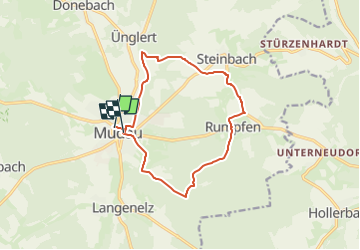
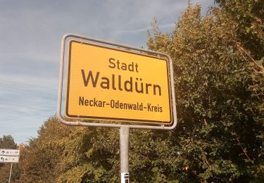
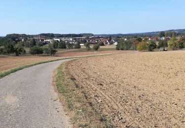
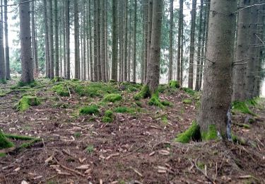
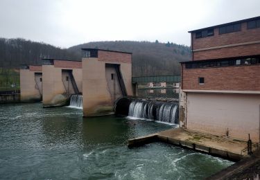
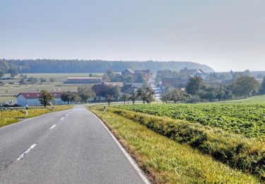
Ruta A pie de 11,8 km a descubrir en Baden-Wurtemberg, Neckar-Odenwald-Kreis, Mudau. Esta ruta ha sido propuesta por SityTrail - itinéraires balisés pédestres.
Descripción
Trail created by Odenwaldklub.
Symbol: Weiße 4 in einem oben offenen Kreis, darüber weißes M
Localización
País:
Germany
Región :
Baden-Wurtemberg
Departamento/provincia :
Neckar-Odenwald-Kreis
Municipio :
Mudau
Localidad:
Unknown
Salida:(Dec)
Salida:(UTM)
514674 ; 5486868 (32U) N.
Comentarios
Excursiones cerca
![Excursión A pie Erbach - Rundwanderweg Erbach 2: - Photo](https://media.geolcdn.com/t/375/260/c62c77d9-62fd-4bd6-a775-e1eb2b8297a7.jpeg&format=jpg&maxdim=2)
![A pie A pie](https://static1.geolcdn.com/sitytour/trail-icons/100.png)
Rundwanderweg Erbach 2:
A pie
Fácil
Erbach,
Hesse,
Odenwaldkreis,
Germany
![](/images/other/stat-length.png)
7,6 km | 10,4 km-effort
2h 21min
![](https://static1.geolcdn.com/siteimages/upload/files/16400158638029165_repeat_loop_refresh_sync_direction_icon.png)
Sí
![Excursión A pie Oberzent - Hohberg-Weg - Photo](https://media.geolcdn.com/t/375/260/9e9e148b-3a0c-4f82-9013-bb9b55b09ab3.jpeg&format=jpg&maxdim=2)
![A pie A pie](https://static1.geolcdn.com/sitytour/trail-icons/100.png)
Hohberg-Weg
A pie
Fácil
Oberzent,
Hesse,
Odenwaldkreis,
Germany
![](/images/other/stat-length.png)
10,8 km | 14,6 km-effort
3h 19min
![](https://static1.geolcdn.com/siteimages/upload/files/16400158638029165_repeat_loop_refresh_sync_direction_icon.png)
Sí
![Excursión A pie Walldürn - Biotoplehrpfad - Variante 3 - Über die Eiderbach zum Fledermausturm - Photo](https://media.geolcdn.com/t/375/260/d331c0f5-fec8-4e9f-adaa-1f1b1a6d56c6.jpeg&format=jpg&maxdim=2)
![A pie A pie](https://static1.geolcdn.com/sitytour/trail-icons/100.png)
Biotoplehrpfad - Variante 3 - Über die Eiderbach zum Fledermausturm
A pie
Fácil
Walldürn,
Baden-Wurtemberg,
Neckar-Odenwald-Kreis,
Germany
![](/images/other/stat-length.png)
4,4 km | 5,2 km-effort
1h 11min
![](https://static1.geolcdn.com/siteimages/upload/files/16400158638029165_repeat_loop_refresh_sync_direction_icon.png)
No
![Excursión A pie Walldürn - Biotoplehrpfad Walldürn - Photo](https://media.geolcdn.com/t/375/260/cfdbebf0-e900-484a-b402-9a1766e396d2.jpeg&format=jpg&maxdim=2)
![A pie A pie](https://static1.geolcdn.com/sitytour/trail-icons/100.png)
Biotoplehrpfad Walldürn
A pie
Fácil
Walldürn,
Baden-Wurtemberg,
Neckar-Odenwald-Kreis,
Germany
![](/images/other/stat-length.png)
8,7 km | 9,7 km-effort
2h 12min
![](https://static1.geolcdn.com/siteimages/upload/files/16400158638029165_repeat_loop_refresh_sync_direction_icon.png)
Sí
![Excursión A pie Buchen (Odenwald) - Rundwanderweg Waldhausen 4 Ortsrunde - Photo](https://media.geolcdn.com/t/375/260/65629220-5cbf-4990-91d4-da40696a3e23.jpeg&format=jpg&maxdim=2)
![A pie A pie](https://static1.geolcdn.com/sitytour/trail-icons/100.png)
Rundwanderweg Waldhausen 4 Ortsrunde
A pie
Fácil
Buchen (Odenwald),
Baden-Wurtemberg,
Neckar-Odenwald-Kreis,
Germany
![](/images/other/stat-length.png)
3,8 km | 4,4 km-effort
59min
![](https://static1.geolcdn.com/siteimages/upload/files/16400158638029165_repeat_loop_refresh_sync_direction_icon.png)
Sí
![Excursión A pie Buchen (Odenwald) - Rundwanderweg Waldhausen 1 Tannenbuckel-Weg - Photo](https://media.geolcdn.com/t/375/260/aba2c3f2-2747-4c23-8962-badc823c1b3b.jpeg&format=jpg&maxdim=2)
![A pie A pie](https://static1.geolcdn.com/sitytour/trail-icons/100.png)
Rundwanderweg Waldhausen 1 Tannenbuckel-Weg
A pie
Fácil
Buchen (Odenwald),
Baden-Wurtemberg,
Neckar-Odenwald-Kreis,
Germany
![](/images/other/stat-length.png)
5,7 km | 6,7 km-effort
1h 31min
![](https://static1.geolcdn.com/siteimages/upload/files/16400158638029165_repeat_loop_refresh_sync_direction_icon.png)
Sí
![Excursión A pie Buchen (Odenwald) - Rundwanderweg Waldhausen 2 Grauer-Forst-Weg - Photo](https://media.geolcdn.com/t/375/260/43f759de-271e-42a4-89f7-37a9e659078b.jpeg&format=jpg&maxdim=2)
![A pie A pie](https://static1.geolcdn.com/sitytour/trail-icons/100.png)
Rundwanderweg Waldhausen 2 Grauer-Forst-Weg
A pie
Fácil
Buchen (Odenwald),
Baden-Wurtemberg,
Neckar-Odenwald-Kreis,
Germany
![](/images/other/stat-length.png)
10,2 km | 12,8 km-effort
2h 54min
![](https://static1.geolcdn.com/siteimages/upload/files/16400158638029165_repeat_loop_refresh_sync_direction_icon.png)
Sí
![Excursión A pie Neckargerach - Mittelberg-Weg - Photo](https://media.geolcdn.com/t/375/260/1c3b814f-9e63-4bfe-b06f-f69211d7d50e.jpeg&format=jpg&maxdim=2)
![A pie A pie](https://static1.geolcdn.com/sitytour/trail-icons/100.png)
Mittelberg-Weg
A pie
Fácil
Neckargerach,
Baden-Wurtemberg,
Neckar-Odenwald-Kreis,
Germany
![](/images/other/stat-length.png)
5,8 km | 8,4 km-effort
1h 54min
![](https://static1.geolcdn.com/siteimages/upload/files/16400158638029165_repeat_loop_refresh_sync_direction_icon.png)
No
![Excursión A pie Eichenbühl - Rundwanderweg Eichenbühl Guggenberger Höhe 3: Scheidberg-Weg - Photo](https://media.geolcdn.com/t/375/260/16d29f94-7216-4037-93f8-379232627de3.jpeg&format=jpg&maxdim=2)
![A pie A pie](https://static1.geolcdn.com/sitytour/trail-icons/100.png)
Rundwanderweg Eichenbühl Guggenberger Höhe 3: Scheidberg-Weg
A pie
Fácil
Eichenbühl,
Baviera,
Landkreis Miltenberg,
Germany
![](/images/other/stat-length.png)
4,8 km | 6,1 km-effort
1h 22min
![](https://static1.geolcdn.com/siteimages/upload/files/16400158638029165_repeat_loop_refresh_sync_direction_icon.png)
Sí