![](/images/other/stat-length.png)
![Excursión A pie Frasdorf - SalzAlpenTour Chiemsee-Alpenland - Photo](https://media.geolcdn.com/t/1900/400/6c5f9f89-6d4a-4c8e-bcdd-20b6274103cb.jpeg&format=pjpeg&maxdim=2)
SalzAlpenTour Chiemsee-Alpenland
SityTrail - itinéraires balisés pédestres
Tous les sentiers balisés d’Europe GUIDE+
![Longitud](/images/other/stat-length.png)
![Altitud máxima](https://static1.geolcdn.com/siteimages/upload/files/1508320355ic_sort_altitude_max_24dp.png)
![Desnivel positivo](https://static1.geolcdn.com/siteimages/upload/files/1508320355ic_sort_den_pos_24dp.png)
![Km-Effort](/images/other/stat-length.png)
![Altitud mínima](https://static1.geolcdn.com/siteimages/upload/files/1508320355ic_sort_altitude_min_24dp.png)
![Desnivel negativo](https://static1.geolcdn.com/siteimages/upload/files/1508320355ic_sort_den_neg_24dp.png)
![Boucle](https://static1.geolcdn.com/siteimages/upload/files/16400158638029165_repeat_loop_refresh_sync_direction_icon.png)
![A pie](https://static1.geolcdn.com/sitytour/trail-icons/100.png)
19h27
Dificultad : Muy difícil
![Escanee este código QR para abrir la excursión en la aplicación SityTrail](https://capi.geolives.com/qq0zvz2zws4bq2lad0pu/sitytour/trails/3096232/qr.png?size=200)
Aplicación GPS de excursión GRATIS
A propósito
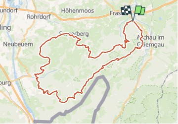
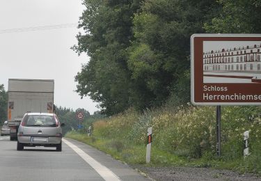
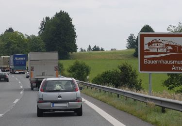
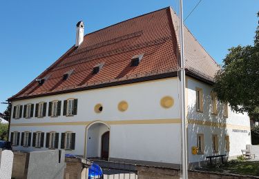
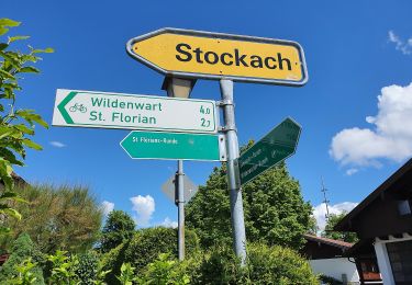
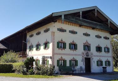
Ruta A pie de 49 km a descubrir en Baviera, Landkreis Rosenheim, Frasdorf. Esta ruta ha sido propuesta por SityTrail - itinéraires balisés pédestres.
Descripción
Symbol: Gelber Hintergrund mit den Silhouetten dreier Gipfel in blauer Farbe. Symbole sind an Bäumen gesprüht oder als Aufkleber auf bestehenden Wegweisern. Auf neuen gelben Blechschilder als "SalzAlpenTour Chiemsee-Alpenland" bezeichnet
Localización
Comentarios
Excursiones cerca
![Excursión A pie Aschau im Chiemgau - Wanderweg 10 - Aschau - Photo](https://media.geolcdn.com/t/375/260/93b3eb26-eb80-4cf9-86bf-ccd0a1b83df3.jpeg&format=jpg&maxdim=2)
![A pie A pie](https://static1.geolcdn.com/sitytour/trail-icons/100.png)
A pie
![](/images/other/stat-length.png)
![](https://static1.geolcdn.com/siteimages/upload/files/16400158638029165_repeat_loop_refresh_sync_direction_icon.png)
![Excursión A pie Prien am Chiemsee - Priener Postkartenweg - Photo](https://media.geolcdn.com/t/375/260/e02e5267-41a2-46b2-a4c0-10b7a412546e.jpeg&format=jpg&maxdim=2)
![A pie A pie](https://static1.geolcdn.com/sitytour/trail-icons/100.png)
A pie
![](/images/other/stat-length.png)
![](https://static1.geolcdn.com/siteimages/upload/files/16400158638029165_repeat_loop_refresh_sync_direction_icon.png)
![Excursión A pie Prien am Chiemsee - Rundweg 2 - Photo](https://media.geolcdn.com/t/375/260/e02e5267-41a2-46b2-a4c0-10b7a412546e.jpeg&format=jpg&maxdim=2)
![A pie A pie](https://static1.geolcdn.com/sitytour/trail-icons/100.png)
A pie
![](/images/other/stat-length.png)
![](https://static1.geolcdn.com/siteimages/upload/files/16400158638029165_repeat_loop_refresh_sync_direction_icon.png)
![Excursión A pie Frasdorf - Pfaffinger-Runde - Photo](https://media.geolcdn.com/t/375/260/a5698fd7-ec09-415c-8c68-e6c9afe0a1f0.jpeg&format=jpg&maxdim=2)
![A pie A pie](https://static1.geolcdn.com/sitytour/trail-icons/100.png)
A pie
![](/images/other/stat-length.png)
![](https://static1.geolcdn.com/siteimages/upload/files/16400158638029165_repeat_loop_refresh_sync_direction_icon.png)
![Excursión A pie Frasdorf - Geigeralm-Runde - Photo](https://media.geolcdn.com/t/375/260/6cc2e3eb-14b7-4d09-ac1d-1bfd502e327d.jpeg&format=jpg&maxdim=2)
![A pie A pie](https://static1.geolcdn.com/sitytour/trail-icons/100.png)
A pie
![](/images/other/stat-length.png)
![](https://static1.geolcdn.com/siteimages/upload/files/16400158638029165_repeat_loop_refresh_sync_direction_icon.png)
![Excursión A pie Frasdorf - Herzogweg - Photo](https://media.geolcdn.com/t/375/260/9b520f38-837e-4f82-bec5-3443748c6377.jpeg&format=jpg&maxdim=2)
![A pie A pie](https://static1.geolcdn.com/sitytour/trail-icons/100.png)
A pie
![](/images/other/stat-length.png)
![](https://static1.geolcdn.com/siteimages/upload/files/16400158638029165_repeat_loop_refresh_sync_direction_icon.png)
![Excursión A pie Frasdorf - St. Florians-Runde - Photo](https://media.geolcdn.com/t/375/260/51fd970b-0a7a-4cb5-a278-c7660f303ba5.jpeg&format=jpg&maxdim=2)
![A pie A pie](https://static1.geolcdn.com/sitytour/trail-icons/100.png)
A pie
![](/images/other/stat-length.png)
![](https://static1.geolcdn.com/siteimages/upload/files/16400158638029165_repeat_loop_refresh_sync_direction_icon.png)
![Excursión A pie Frasdorf - Wildenwarter-Runde - Photo](https://media.geolcdn.com/t/375/260/84a2d114-d2df-497f-a9c6-189f656ef06e.jpeg&format=jpg&maxdim=2)
![A pie A pie](https://static1.geolcdn.com/sitytour/trail-icons/100.png)
A pie
![](/images/other/stat-length.png)
![](https://static1.geolcdn.com/siteimages/upload/files/16400158638029165_repeat_loop_refresh_sync_direction_icon.png)
![Excursión A pie Frasdorf - Sonnseitn-Runde - Photo](https://media.geolcdn.com/t/375/260/84a2d114-d2df-497f-a9c6-189f656ef06e.jpeg&format=jpg&maxdim=2)
![A pie A pie](https://static1.geolcdn.com/sitytour/trail-icons/100.png)
A pie
![](/images/other/stat-length.png)
![](https://static1.geolcdn.com/siteimages/upload/files/16400158638029165_repeat_loop_refresh_sync_direction_icon.png)