![](/images/other/stat-length.png)
![Excursión A pie Wetter - Extratour Gisonenpfad - Photo](https://media.geolcdn.com/t/1900/400/ext.pjpeg?maxdim=2&url=https%3A%2F%2Fmedia.geolcdn.com%2Ff%2F50e7b00a-ff6b-4f18-bc7b-20f9b76f94b8.jpeg)
Extratour Gisonenpfad
SityTrail - itinéraires balisés pédestres
Tous les sentiers balisés d’Europe PRO
![Longitud](/images/other/stat-length.png)
Longitud
14 km
![Altitud máxima](https://static1.geolcdn.com/siteimages/upload/files/1508320355ic_sort_altitude_max_24dp.png)
Altitud máxima
447 m
![Desnivel positivo](https://static1.geolcdn.com/siteimages/upload/files/1508320355ic_sort_den_pos_24dp.png)
Desnivel positivo
344 m
![Km-Effort](/images/other/stat-length.png)
Km-Effort
18,5 km
![Altitud mínima](https://static1.geolcdn.com/siteimages/upload/files/1508320355ic_sort_altitude_min_24dp.png)
Altitud mínima
230 m
![Desnivel negativo](https://static1.geolcdn.com/siteimages/upload/files/1508320355ic_sort_den_neg_24dp.png)
Desnivel negativo
344 m
![Boucle](https://static1.geolcdn.com/siteimages/upload/files/16400158638029165_repeat_loop_refresh_sync_direction_icon.png)
Boucle
Sí
Baliza
Fecha de creación :
2022-02-11 16:08:36.622
Última modificación :
2022-02-11 16:08:36.622
![A pie](https://static1.geolcdn.com/sitytour/trail-icons/100.png)
4h12
Dificultad : Fácil
![Escanee este código QR para abrir la excursión en la aplicación SityTrail](https://capi.geolives.com/qq0zvz2zws4bq2lad0pu/sitytour/trails/3095810/qr.png?size=200)
Aplicación GPS de excursión GRATIS
A propósito
Ruta A pie de 14 km a descubrir en Hesse, Landkreis Marburg-Biedenkopf, Wetter. Esta ruta ha sido propuesta por SityTrail - itinéraires balisés pédestres.
Descripción
Trail created by Wanderfreunde Treisbach.
Symbol: Rotes GP auf weißem Spiegel
Localización
País:
Germany
Región :
Hesse
Departamento/provincia :
Landkreis Marburg-Biedenkopf
Municipio :
Wetter
Localidad:
Unknown
Salida:(Dec)
Salida:(UTM)
475019 ; 5640407 (32U) N.
Comentarios
Excursiones cerca
![Excursión A pie Dautphetal - Hollende Rundweg - Photo](https://media.geolcdn.com/t/375/260/ext.jpg?maxdim=2&url=https%3A%2F%2Fmedia.geolcdn.com%2Ff%2F50e7b00a-ff6b-4f18-bc7b-20f9b76f94b8.jpeg)
![A pie A pie](https://static1.geolcdn.com/sitytour/trail-icons/100.png)
Hollende Rundweg
A pie
Fácil
Dautphetal,
Hesse,
Landkreis Marburg-Biedenkopf,
Germany
![](/images/other/stat-length.png)
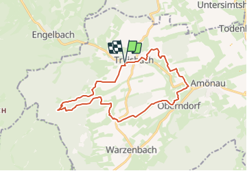
10,3 km | 14,1 km-effort
3h 12min
![](https://static1.geolcdn.com/siteimages/upload/files/16400158638029165_repeat_loop_refresh_sync_direction_icon.png)
No
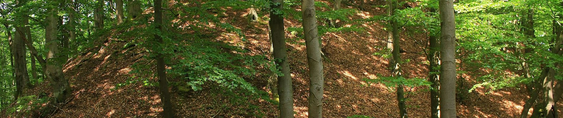
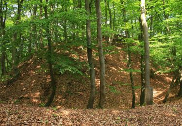
![Excursión A pie Wetter - [W2] Kleine Wollenbergrunde (Wetschaft Senke) - Photo](https://media.geolcdn.com/t/375/260/ext.jpg?maxdim=2&url=https%3A%2F%2Fmedia.geolcdn.com%2Ff%2Fdaed682b-00fa-4e8a-8c85-f140ab90c6d6.jpeg)
![A pie A pie](https://static1.geolcdn.com/sitytour/trail-icons/100.png)
[W2] Kleine Wollenbergrunde (Wetschaft Senke)
A pie
Fácil
Wetter,
Hesse,
Landkreis Marburg-Biedenkopf,
Germany
![](/images/other/stat-length.png)
4,4 km | 5,9 km-effort
1h 20min
![](https://static1.geolcdn.com/siteimages/upload/files/16400158638029165_repeat_loop_refresh_sync_direction_icon.png)
No
![Excursión A pie Wetter - [W1] Wollenberg Rundwanderweg - Photo](https://media.geolcdn.com/t/375/260/ext.jpg?maxdim=2&url=https%3A%2F%2Fmedia.geolcdn.com%2Ff%2Fdaed682b-00fa-4e8a-8c85-f140ab90c6d6.jpeg)
![A pie A pie](https://static1.geolcdn.com/sitytour/trail-icons/100.png)
[W1] Wollenberg Rundwanderweg
A pie
Medio
Wetter,
Hesse,
Landkreis Marburg-Biedenkopf,
Germany
![](/images/other/stat-length.png)
16 km | 21 km-effort
4h 51min
![](https://static1.geolcdn.com/siteimages/upload/files/16400158638029165_repeat_loop_refresh_sync_direction_icon.png)
No
![Excursión A pie Dautphetal - Lahnhöhen-Extratour - Photo](https://media.geolcdn.com/t/375/260/ext.jpg?maxdim=2&url=https%3A%2F%2Fmedia.geolcdn.com%2Ff%2Fc0d511c7-e0ad-4328-a124-aba342f31e32.jpeg)
![A pie A pie](https://static1.geolcdn.com/sitytour/trail-icons/100.png)
Lahnhöhen-Extratour
A pie
Muy difícil
Dautphetal,
Hesse,
Landkreis Marburg-Biedenkopf,
Germany
![](/images/other/stat-length.png)
38 km | 54 km-effort
12h 19min
![](https://static1.geolcdn.com/siteimages/upload/files/16400158638029165_repeat_loop_refresh_sync_direction_icon.png)
Sí