![](/images/other/stat-length.png)
![Excursión A pie Hanau - Wolfgang - Rundwanderweg Ahorn - Photo](https://media.geolcdn.com/t/1900/400/582999f3-e5b8-4ba5-8b9c-1d0ab3958527.jpeg&format=pjpeg&maxdim=2)
Wolfgang - Rundwanderweg Ahorn
SityTrail - itinéraires balisés pédestres
Tous les sentiers balisés d’Europe GUIDE+
![Longitud](/images/other/stat-length.png)
Longitud
13,1 km
![Altitud máxima](https://static1.geolcdn.com/siteimages/upload/files/1508320355ic_sort_altitude_max_24dp.png)
Altitud máxima
190 m
![Desnivel positivo](https://static1.geolcdn.com/siteimages/upload/files/1508320355ic_sort_den_pos_24dp.png)
Desnivel positivo
114 m
![Km-Effort](/images/other/stat-length.png)
Km-Effort
14,6 km
![Altitud mínima](https://static1.geolcdn.com/siteimages/upload/files/1508320355ic_sort_altitude_min_24dp.png)
Altitud mínima
115 m
![Desnivel negativo](https://static1.geolcdn.com/siteimages/upload/files/1508320355ic_sort_den_neg_24dp.png)
Desnivel negativo
114 m
![Boucle](https://static1.geolcdn.com/siteimages/upload/files/16400158638029165_repeat_loop_refresh_sync_direction_icon.png)
Boucle
Sí
Baliza
Fecha de creación :
2022-02-11 15:41:11.641
Última modificación :
2022-02-11 15:41:11.641
![A pie](https://static1.geolcdn.com/sitytour/trail-icons/100.png)
3h18
Dificultad : Fácil
![Escanee este código QR para abrir la excursión en la aplicación SityTrail](https://capi.geolives.com/qq0zvz2zws4bq2lad0pu/sitytour/trails/3095050/qr.png?size=200)
Aplicación GPS de excursión GRATIS
A propósito
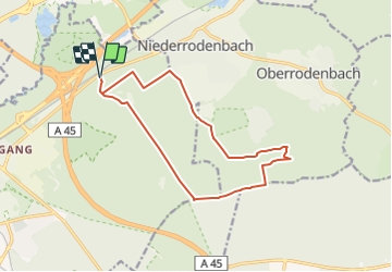
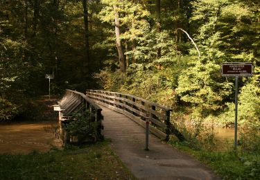
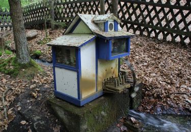
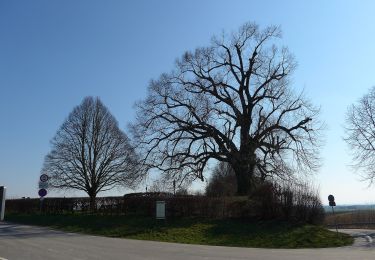
Ruta A pie de 13,1 km a descubrir en Hesse, Main-Kinzig-Kreis, Hanau. Esta ruta ha sido propuesta por SityTrail - itinéraires balisés pédestres.
Descripción
Trail created by Naturpark Spessart.
Symbol: Grünes Ahornblatt auf weißem Hintergrund
Sitio web: http://www.naturpark-spessart.de/wandern/rundwanderwege/rundwege_61_149.php
Localización
País:
Germany
Región :
Hesse
Departamento/provincia :
Main-Kinzig-Kreis
Municipio :
Hanau
Localidad:
Wolfgang
Salida:(Dec)
Salida:(UTM)
499459 ; 5553860 (32U) N.
Comentarios
Excursiones cerca
![Excursión A pie Bruchköbel - 5-Sterne-Wanderweg Bruchköbel - Photo](https://media.geolcdn.com/t/375/260/46cd4dbc-faa0-41bf-9855-f30e6c57040a.jpeg&format=jpg&maxdim=2)
![A pie A pie](https://static1.geolcdn.com/sitytour/trail-icons/100.png)
5-Sterne-Wanderweg Bruchköbel
A pie
Difícil
Bruchköbel,
Hesse,
Main-Kinzig-Kreis,
Germany
![](/images/other/stat-length.png)
29 km | 33 km-effort
7h 31min
![](https://static1.geolcdn.com/siteimages/upload/files/16400158638029165_repeat_loop_refresh_sync_direction_icon.png)
Sí
![Excursión A pie Hanau - Spessartspuren - Niederrodenbach - Barbarossaquelle und Klosterruine - Photo](https://media.geolcdn.com/t/375/260/582999f3-e5b8-4ba5-8b9c-1d0ab3958527.jpeg&format=jpg&maxdim=2)
![A pie A pie](https://static1.geolcdn.com/sitytour/trail-icons/100.png)
Spessartspuren - Niederrodenbach - Barbarossaquelle und Klosterruine
A pie
Fácil
Hanau,
Hesse,
Main-Kinzig-Kreis,
Germany
![](/images/other/stat-length.png)
10 km | 11,4 km-effort
2h 35min
![](https://static1.geolcdn.com/siteimages/upload/files/16400158638029165_repeat_loop_refresh_sync_direction_icon.png)
No
![Excursión A pie Hanau - Hanau - Rundwanderweg Eichhörnchen - Photo](https://media.geolcdn.com/t/375/260/2960a50f-fd5e-4719-9361-c8030ee2c31c.jpeg&format=jpg&maxdim=2)
![A pie A pie](https://static1.geolcdn.com/sitytour/trail-icons/100.png)
Hanau - Rundwanderweg Eichhörnchen
A pie
Fácil
Hanau,
Hesse,
Main-Kinzig-Kreis,
Germany
![](/images/other/stat-length.png)
3,5 km | 4,1 km-effort
55min
![](https://static1.geolcdn.com/siteimages/upload/files/16400158638029165_repeat_loop_refresh_sync_direction_icon.png)
No
![Excursión A pie Hanau - Hanau - Rundwanderweg Specht - Photo](https://media.geolcdn.com/t/375/260/2960a50f-fd5e-4719-9361-c8030ee2c31c.jpeg&format=jpg&maxdim=2)
![A pie A pie](https://static1.geolcdn.com/sitytour/trail-icons/100.png)
Hanau - Rundwanderweg Specht
A pie
Fácil
Hanau,
Hesse,
Main-Kinzig-Kreis,
Germany
![](/images/other/stat-length.png)
3,3 km | 3,7 km-effort
50min
![](https://static1.geolcdn.com/siteimages/upload/files/16400158638029165_repeat_loop_refresh_sync_direction_icon.png)
No
![Excursión A pie Alzenau - Ortswanderweg Alzenau 6 - Photo](https://media.geolcdn.com/t/375/260/7d03b839-bebf-4325-8b7c-8cb104d05654.jpeg&format=jpg&maxdim=2)
![A pie A pie](https://static1.geolcdn.com/sitytour/trail-icons/100.png)
Ortswanderweg Alzenau 6
A pie
Fácil
Alzenau,
Baviera,
Landkreis Aschaffenburg,
Germany
![](/images/other/stat-length.png)
4,8 km | 5,4 km-effort
1h 13min
![](https://static1.geolcdn.com/siteimages/upload/files/16400158638029165_repeat_loop_refresh_sync_direction_icon.png)
No
![Excursión A pie Hanau - Rodenbach - Rundwanderweg Eichenblatt - Photo](https://media.geolcdn.com/t/375/260/582999f3-e5b8-4ba5-8b9c-1d0ab3958527.jpeg&format=jpg&maxdim=2)
![A pie A pie](https://static1.geolcdn.com/sitytour/trail-icons/100.png)
Rodenbach - Rundwanderweg Eichenblatt
A pie
Fácil
Hanau,
Hesse,
Main-Kinzig-Kreis,
Germany
![](/images/other/stat-length.png)
4,8 km | 5,3 km-effort
1h 12min
![](https://static1.geolcdn.com/siteimages/upload/files/16400158638029165_repeat_loop_refresh_sync_direction_icon.png)
Sí
![Excursión A pie Hanau - Wolfgang - Rundwanderweg Keiler - Photo](https://media.geolcdn.com/t/375/260/582999f3-e5b8-4ba5-8b9c-1d0ab3958527.jpeg&format=jpg&maxdim=2)
![A pie A pie](https://static1.geolcdn.com/sitytour/trail-icons/100.png)
Wolfgang - Rundwanderweg Keiler
A pie
Fácil
Hanau,
Hesse,
Main-Kinzig-Kreis,
Germany
![](/images/other/stat-length.png)
8,3 km | 9 km-effort
2h 2min
![](https://static1.geolcdn.com/siteimages/upload/files/16400158638029165_repeat_loop_refresh_sync_direction_icon.png)
Sí
![Excursión A pie Bruchköbel - Bruchköbel Wanderweg 2 - Photo](https://media.geolcdn.com/t/375/260/46cd4dbc-faa0-41bf-9855-f30e6c57040a.jpeg&format=jpg&maxdim=2)
![A pie A pie](https://static1.geolcdn.com/sitytour/trail-icons/100.png)
Bruchköbel Wanderweg 2
A pie
Fácil
Bruchköbel,
Hesse,
Main-Kinzig-Kreis,
Germany
![](/images/other/stat-length.png)
4,1 km | 4,5 km-effort
1h 1min
![](https://static1.geolcdn.com/siteimages/upload/files/16400158638029165_repeat_loop_refresh_sync_direction_icon.png)
No
![Excursión A pie Bruchköbel - Bruchköbel Wanderweg 1 - Photo](https://media.geolcdn.com/t/375/260/74d9462d-cacd-4476-a52c-aaf1e56ba893.jpeg&format=jpg&maxdim=2)
![A pie A pie](https://static1.geolcdn.com/sitytour/trail-icons/100.png)
Bruchköbel Wanderweg 1
A pie
Fácil
Bruchköbel,
Hesse,
Main-Kinzig-Kreis,
Germany
![](/images/other/stat-length.png)
11,1 km | 12,7 km-effort
2h 53min
![](https://static1.geolcdn.com/siteimages/upload/files/16400158638029165_repeat_loop_refresh_sync_direction_icon.png)
No