![](/images/other/stat-length.png)
![Excursión A pie Schnaittach - Osternohe – Hohenstein - Photo](https://media.geolcdn.com/t/1900/400/23b981c0-88bd-4d2c-ac42-c5a479f4e1f2.jpeg&format=pjpeg&maxdim=2)
Osternohe – Hohenstein
SityTrail - itinéraires balisés pédestres
Tous les sentiers balisés d’Europe GUIDE+
![Longitud](/images/other/stat-length.png)
Longitud
7,9 km
![Altitud máxima](https://static1.geolcdn.com/siteimages/upload/files/1508320355ic_sort_altitude_max_24dp.png)
Altitud máxima
585 m
![Desnivel positivo](https://static1.geolcdn.com/siteimages/upload/files/1508320355ic_sort_den_pos_24dp.png)
Desnivel positivo
405 m
![Km-Effort](/images/other/stat-length.png)
Km-Effort
12,6 km
![Altitud mínima](https://static1.geolcdn.com/siteimages/upload/files/1508320355ic_sort_altitude_min_24dp.png)
Altitud mínima
392 m
![Desnivel negativo](https://static1.geolcdn.com/siteimages/upload/files/1508320355ic_sort_den_neg_24dp.png)
Desnivel negativo
214 m
![Boucle](https://static1.geolcdn.com/siteimages/upload/files/16400158638029165_repeat_loop_refresh_sync_direction_icon.png)
Boucle
No
Baliza
Fecha de creación :
2022-02-11 13:19:46.186
Última modificación :
2022-02-11 13:19:46.186
![A pie](https://static1.geolcdn.com/sitytour/trail-icons/100.png)
2h52
Dificultad : Fácil
![Escanee este código QR para abrir la excursión en la aplicación SityTrail](https://capi.geolives.com/qq0zvz2zws4bq2lad0pu/sitytour/trails/3089990/qr.png?size=200)
Aplicación GPS de excursión GRATIS
A propósito
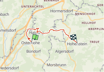
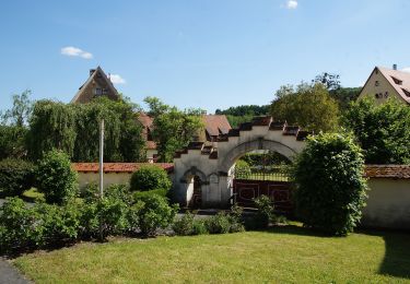
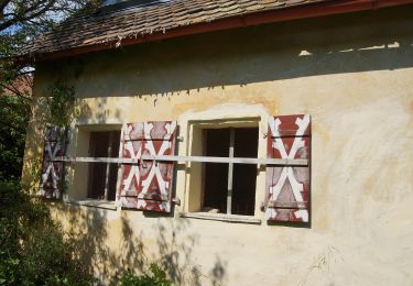
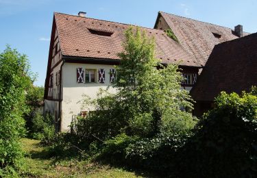
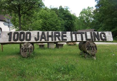
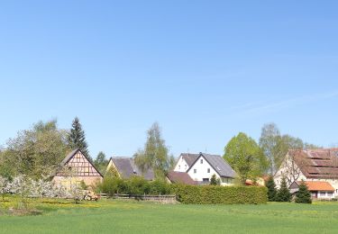
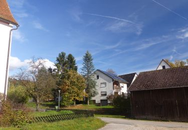
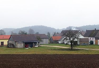
Ruta A pie de 7,9 km a descubrir en Baviera, Landkreis Nürnberger Land, Schnaittach. Esta ruta ha sido propuesta por SityTrail - itinéraires balisés pédestres.
Descripción
Trail created by Verkehrsverein Schnaittachtal e.V..
geprüft (Feb. 2015, by cycling_zno)
Symbol: weisse 4 auf blauem Grund
Localización
País:
Germany
Región :
Baviera
Departamento/provincia :
Landkreis Nürnberger Land
Municipio :
Schnaittach
Localidad:
Unknown
Salida:(Dec)
Salida:(UTM)
671248 ; 5495393 (32U) N.
Comentarios
Excursiones cerca
![Excursión A pie Kirchensittenbach - Kirchensittenbach 4a - Photo](https://media.geolcdn.com/t/375/260/814dae09-5fb1-442e-abdf-4f3252bdd922.jpeg&format=jpg&maxdim=2)
![A pie A pie](https://static1.geolcdn.com/sitytour/trail-icons/100.png)
Kirchensittenbach 4a
A pie
Fácil
Kirchensittenbach,
Baviera,
Landkreis Nürnberger Land,
Germany
![](/images/other/stat-length.png)
4,1 km | 6,1 km-effort
1h 23min
![](https://static1.geolcdn.com/siteimages/upload/files/16400158638029165_repeat_loop_refresh_sync_direction_icon.png)
No
![Excursión A pie Kirchensittenbach - Kirchensittenbach 4 - Photo](https://media.geolcdn.com/t/375/260/143d5234-ad74-4965-bef0-21d79ad60f89.jpeg&format=jpg&maxdim=2)
![A pie A pie](https://static1.geolcdn.com/sitytour/trail-icons/100.png)
Kirchensittenbach 4
A pie
Fácil
Kirchensittenbach,
Baviera,
Landkreis Nürnberger Land,
Germany
![](/images/other/stat-length.png)
6,2 km | 9,1 km-effort
2h 3min
![](https://static1.geolcdn.com/siteimages/upload/files/16400158638029165_repeat_loop_refresh_sync_direction_icon.png)
Sí
![Excursión A pie Kirchensittenbach - Kirchensittenbach 3 - Photo](https://media.geolcdn.com/t/375/260/0a2f4069-1436-4b4e-8f0f-cc1a0a762c2a.jpeg&format=jpg&maxdim=2)
![A pie A pie](https://static1.geolcdn.com/sitytour/trail-icons/100.png)
Kirchensittenbach 3
A pie
Fácil
Kirchensittenbach,
Baviera,
Landkreis Nürnberger Land,
Germany
![](/images/other/stat-length.png)
8,5 km | 12 km-effort
2h 43min
![](https://static1.geolcdn.com/siteimages/upload/files/16400158638029165_repeat_loop_refresh_sync_direction_icon.png)
Sí
![Excursión A pie Kirchensittenbach - Kirchensittenbach 1 - Photo](https://media.geolcdn.com/t/375/260/ecf22806-f952-4517-a5bd-f1b223beb6a6.jpeg&format=jpg&maxdim=2)
![A pie A pie](https://static1.geolcdn.com/sitytour/trail-icons/100.png)
Kirchensittenbach 1
A pie
Fácil
Kirchensittenbach,
Baviera,
Landkreis Nürnberger Land,
Germany
![](/images/other/stat-length.png)
12,5 km | 17,2 km-effort
3h 54min
![](https://static1.geolcdn.com/siteimages/upload/files/16400158638029165_repeat_loop_refresh_sync_direction_icon.png)
No
![Excursión A pie Kirchensittenbach - Oberkrumbach-Kleedorf - Photo](https://media.geolcdn.com/t/375/260/43473ef1-7005-47bb-9daa-75911118c670.jpeg&format=jpg&maxdim=2)
![A pie A pie](https://static1.geolcdn.com/sitytour/trail-icons/100.png)
Oberkrumbach-Kleedorf
A pie
Fácil
Kirchensittenbach,
Baviera,
Landkreis Nürnberger Land,
Germany
![](/images/other/stat-length.png)
6 km | 8,5 km-effort
1h 56min
![](https://static1.geolcdn.com/siteimages/upload/files/16400158638029165_repeat_loop_refresh_sync_direction_icon.png)
No
![Excursión A pie Simmelsdorf - Simmelsdorfer Rundwanderweg Rot 7 - Photo](https://media.geolcdn.com/t/375/260/6c570f5b-0d96-4962-a9b4-b7e7fcad2afe.jpeg&format=jpg&maxdim=2)
![A pie A pie](https://static1.geolcdn.com/sitytour/trail-icons/100.png)
Simmelsdorfer Rundwanderweg Rot 7
A pie
Fácil
Simmelsdorf,
Baviera,
Landkreis Nürnberger Land,
Germany
![](/images/other/stat-length.png)
4,6 km | 6,5 km-effort
1h 29min
![](https://static1.geolcdn.com/siteimages/upload/files/16400158638029165_repeat_loop_refresh_sync_direction_icon.png)
No
![Excursión A pie Simmelsdorf - Simmelsdorfer Rundwanderweg Blau 4 - Photo](https://media.geolcdn.com/t/375/260/d73e4444-d775-496b-99b0-2b50714ef2fe.jpeg&format=jpg&maxdim=2)
![A pie A pie](https://static1.geolcdn.com/sitytour/trail-icons/100.png)
Simmelsdorfer Rundwanderweg Blau 4
A pie
Fácil
Simmelsdorf,
Baviera,
Landkreis Nürnberger Land,
Germany
![](/images/other/stat-length.png)
4,9 km | 6,9 km-effort
1h 33min
![](https://static1.geolcdn.com/siteimages/upload/files/16400158638029165_repeat_loop_refresh_sync_direction_icon.png)
Sí
![Excursión A pie Schnaittach - Reingrub – Osternohe - Photo](https://media.geolcdn.com/t/375/260/abff5f7e-aafe-437f-9d3a-bf04e660ea77.jpeg&format=jpg&maxdim=2)
![A pie A pie](https://static1.geolcdn.com/sitytour/trail-icons/100.png)
Reingrub – Osternohe
A pie
Fácil
Schnaittach,
Baviera,
Landkreis Nürnberger Land,
Germany
![](/images/other/stat-length.png)
4,6 km | 6,7 km-effort
1h 31min
![](https://static1.geolcdn.com/siteimages/upload/files/16400158638029165_repeat_loop_refresh_sync_direction_icon.png)
No
![Excursión A pie Betzenstein - Rundweg Illafeld - Photo](https://media.geolcdn.com/t/375/260/e338e439-61af-480b-bc87-97c3d409e5a3.jpeg&format=jpg&maxdim=2)
![A pie A pie](https://static1.geolcdn.com/sitytour/trail-icons/100.png)
Rundweg Illafeld
A pie
Fácil
Betzenstein,
Baviera,
Landkreis Bayreuth,
Germany
![](/images/other/stat-length.png)
10,9 km | 15,4 km-effort
3h 30min
![](https://static1.geolcdn.com/siteimages/upload/files/16400158638029165_repeat_loop_refresh_sync_direction_icon.png)
Sí