


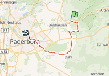

9,9 km | 13,7 km-effort


Tous les sentiers balisés d’Europe GUIDE+


Aplicación GPS de excursión GRATIS
 SityTrail
IGN / Institutos geográficos
SityTrail World
El mundo es suyo
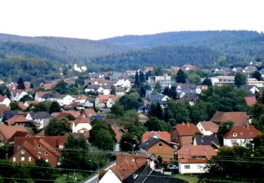
Ruta A pie de 16,4 km a descubrir en Renania del Norte-Westfalia, Kreis Paderborn, Paderborn. Esta ruta ha sido propuesta por SityTrail - itinéraires balisés pédestres.
Trail created by EGV.
Symbol: white horizontal bar on black background


A pie
A pie
A pie

A pie
A pie
A pie

A pie
A pie
![Excursión A pie Altenbeken - Rundwanderweg A2 [Altenbeken: Wienackenstraße] - Photo](https://media.geolcdn.com/t/375/260/ea5b2970-5dee-4d29-acc7-0d66cb0103a9.jpeg&format=jpg&maxdim=2)
A pie