![](/images/other/stat-length.png)
![Excursión A pie Neukirchen bei Sulzbach-Rosenberg - Rundwanderweg No.7 Neunkirchen - Photo](https://media.geolcdn.com/t/1900/400/33355fdf-7d85-4c28-911e-b48bad872eaa.jpeg&format=pjpeg&maxdim=2)
Rundwanderweg No.7 Neunkirchen
SityTrail - itinéraires balisés pédestres
Tous les sentiers balisés d’Europe GUIDE+
![Longitud](/images/other/stat-length.png)
Longitud
4,3 km
![Altitud máxima](https://static1.geolcdn.com/siteimages/upload/files/1508320355ic_sort_altitude_max_24dp.png)
Altitud máxima
518 m
![Desnivel positivo](https://static1.geolcdn.com/siteimages/upload/files/1508320355ic_sort_den_pos_24dp.png)
Desnivel positivo
59 m
![Km-Effort](/images/other/stat-length.png)
Km-Effort
5,3 km
![Altitud mínima](https://static1.geolcdn.com/siteimages/upload/files/1508320355ic_sort_altitude_min_24dp.png)
Altitud mínima
436 m
![Desnivel negativo](https://static1.geolcdn.com/siteimages/upload/files/1508320355ic_sort_den_neg_24dp.png)
Desnivel negativo
129 m
![Boucle](https://static1.geolcdn.com/siteimages/upload/files/16400158638029165_repeat_loop_refresh_sync_direction_icon.png)
Boucle
No
Baliza
Fecha de creación :
2022-02-11 13:10:39.706
Última modificación :
2022-02-11 13:10:39.706
![A pie](https://static1.geolcdn.com/sitytour/trail-icons/100.png)
1h12
Dificultad : Fácil
![Escanee este código QR para abrir la excursión en la aplicación SityTrail](https://capi.geolives.com/qq0zvz2zws4bq2lad0pu/sitytour/trails/3089387/qr.png?size=200)
Aplicación GPS de excursión GRATIS
A propósito
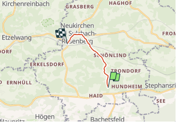
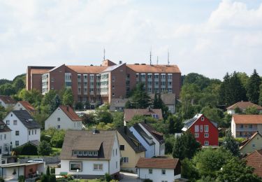
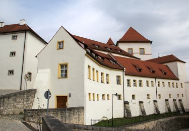
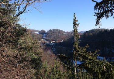
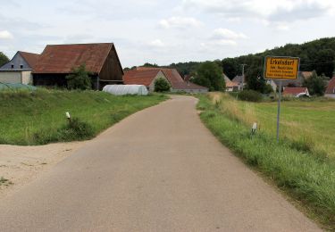
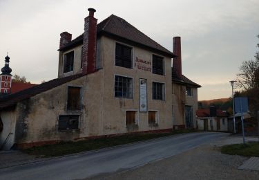
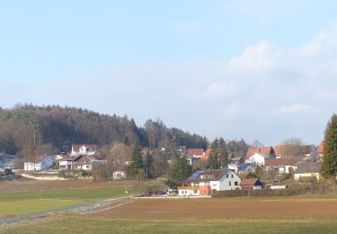
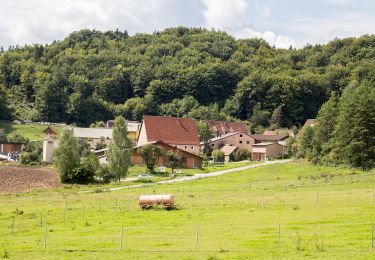
Ruta A pie de 4,3 km a descubrir en Baviera, Landkreis Amberg-Sulzbach, Neukirchen bei Sulzbach-Rosenberg. Esta ruta ha sido propuesta por SityTrail - itinéraires balisés pédestres.
Descripción
Trail created by Gemeinde Neukirchen b.Sulzbach-Rosenberg.
geprüft (Jan. 2015 by cycling_zno)
Symbol: Schwarze 7 mit Kreis auf weissem Grund
Localización
País:
Germany
Región :
Baviera
Departamento/provincia :
Landkreis Amberg-Sulzbach
Municipio :
Neukirchen bei Sulzbach-Rosenberg
Localidad:
Unknown
Salida:(Dec)
Salida:(UTM)
691842 ; 5486962 (32U) N.
Comentarios
Excursiones cerca
![Excursión A pie Neukirchen bei Sulzbach-Rosenberg - Neukirchen-Fichtelbrunn - Photo](https://media.geolcdn.com/t/375/260/33355fdf-7d85-4c28-911e-b48bad872eaa.jpeg&format=jpg&maxdim=2)
![A pie A pie](https://static1.geolcdn.com/sitytour/trail-icons/100.png)
Neukirchen-Fichtelbrunn
A pie
Fácil
Neukirchen bei Sulzbach-Rosenberg,
Baviera,
Landkreis Amberg-Sulzbach,
Germany
![](/images/other/stat-length.png)
12,3 km | 16,5 km-effort
3h 44min
![](https://static1.geolcdn.com/siteimages/upload/files/16400158638029165_repeat_loop_refresh_sync_direction_icon.png)
No
![Excursión A pie Sulzbach-Rosenberg - Sulzbach-Rosenberg 4 - Photo](https://media.geolcdn.com/t/375/260/0e9bc950-75ba-44f2-b78d-a2fe50eb5742.jpeg&format=jpg&maxdim=2)
![A pie A pie](https://static1.geolcdn.com/sitytour/trail-icons/100.png)
Sulzbach-Rosenberg 4
A pie
Fácil
Sulzbach-Rosenberg,
Baviera,
Landkreis Amberg-Sulzbach,
Germany
![](/images/other/stat-length.png)
6,8 km | 8,4 km-effort
1h 54min
![](https://static1.geolcdn.com/siteimages/upload/files/16400158638029165_repeat_loop_refresh_sync_direction_icon.png)
No
![Excursión A pie Illschwang - Sulzbach-Rosenberg 2 - Photo](https://media.geolcdn.com/t/375/260/ad7d812f-f55d-4f7d-8bc9-2f27aec6365f.jpeg&format=jpg&maxdim=2)
![A pie A pie](https://static1.geolcdn.com/sitytour/trail-icons/100.png)
Sulzbach-Rosenberg 2
A pie
Fácil
Illschwang,
Baviera,
Landkreis Amberg-Sulzbach,
Germany
![](/images/other/stat-length.png)
4,7 km | 6,1 km-effort
1h 23min
![](https://static1.geolcdn.com/siteimages/upload/files/16400158638029165_repeat_loop_refresh_sync_direction_icon.png)
No
![Excursión A pie Sulzbach-Rosenberg - Sulzbach-Rosenberg 1 - Photo](https://media.geolcdn.com/t/375/260/93e029c8-2d76-4932-984e-3f4817cd0756.jpeg&format=jpg&maxdim=2)
![A pie A pie](https://static1.geolcdn.com/sitytour/trail-icons/100.png)
Sulzbach-Rosenberg 1
A pie
Fácil
Sulzbach-Rosenberg,
Baviera,
Landkreis Amberg-Sulzbach,
Germany
![](/images/other/stat-length.png)
12,7 km | 16 km-effort
3h 38min
![](https://static1.geolcdn.com/siteimages/upload/files/16400158638029165_repeat_loop_refresh_sync_direction_icon.png)
Sí
![Excursión A pie Weigendorf - Rundwanderweg Weigendorf - Photo](https://media.geolcdn.com/t/375/260/fb07430b-fd86-4351-a47f-01af0c5d578c.jpeg&format=jpg&maxdim=2)
![A pie A pie](https://static1.geolcdn.com/sitytour/trail-icons/100.png)
Rundwanderweg Weigendorf
A pie
Fácil
Weigendorf,
Baviera,
Landkreis Amberg-Sulzbach,
Germany
![](/images/other/stat-length.png)
3,3 km | 5,3 km-effort
1h 11min
![](https://static1.geolcdn.com/siteimages/upload/files/16400158638029165_repeat_loop_refresh_sync_direction_icon.png)
No
![Excursión A pie Weigendorf - Rundwanderweg Roter Punkt Ernhüll - Photo](https://media.geolcdn.com/t/375/260/2fc42541-9f46-44c9-86a3-0a08ca12a8a3.jpeg&format=jpg&maxdim=2)
![A pie A pie](https://static1.geolcdn.com/sitytour/trail-icons/100.png)
Rundwanderweg Roter Punkt Ernhüll
A pie
Fácil
Weigendorf,
Baviera,
Landkreis Amberg-Sulzbach,
Germany
![](/images/other/stat-length.png)
6,6 km | 8,5 km-effort
1h 55min
![](https://static1.geolcdn.com/siteimages/upload/files/16400158638029165_repeat_loop_refresh_sync_direction_icon.png)
Sí
![Excursión A pie Etzelwang - Schlösser Runde - Photo](https://media.geolcdn.com/t/375/260/51f3c2e8-6f4f-489a-8b8b-3ac9ee2ac017.jpeg&format=jpg&maxdim=2)
![A pie A pie](https://static1.geolcdn.com/sitytour/trail-icons/100.png)
Schlösser Runde
A pie
Fácil
Etzelwang,
Baviera,
Landkreis Amberg-Sulzbach,
Germany
![](/images/other/stat-length.png)
3,8 km | 5,4 km-effort
1h 13min
![](https://static1.geolcdn.com/siteimages/upload/files/16400158638029165_repeat_loop_refresh_sync_direction_icon.png)
Sí
![Excursión A pie Etzelwang - Kirchenreinbach Runde - Photo](https://media.geolcdn.com/t/375/260/2e627a59-4617-48a6-bae1-459e94fb1a30.jpeg&format=jpg&maxdim=2)
![A pie A pie](https://static1.geolcdn.com/sitytour/trail-icons/100.png)
Kirchenreinbach Runde
A pie
Fácil
Etzelwang,
Baviera,
Landkreis Amberg-Sulzbach,
Germany
![](/images/other/stat-length.png)
7 km | 9,5 km-effort
2h 9min
![](https://static1.geolcdn.com/siteimages/upload/files/16400158638029165_repeat_loop_refresh_sync_direction_icon.png)
Sí
![Excursión A pie Etzelwang - Resen Runde - Photo](https://media.geolcdn.com/t/375/260/e41b1a86-a948-4f6f-9fa5-d8bb904baa1b.jpeg&format=jpg&maxdim=2)
![A pie A pie](https://static1.geolcdn.com/sitytour/trail-icons/100.png)
Resen Runde
A pie
Fácil
Etzelwang,
Baviera,
Landkreis Amberg-Sulzbach,
Germany
![](/images/other/stat-length.png)
7,7 km | 10,4 km-effort
2h 21min
![](https://static1.geolcdn.com/siteimages/upload/files/16400158638029165_repeat_loop_refresh_sync_direction_icon.png)
Sí