![](/images/other/stat-length.png)
![Excursión A pie Heuvelland - Kemmelberg wandelroute - Photo](https://media.geolcdn.com/t/1900/400/e1bcc212-763f-4467-b0b8-b765654be94a.jpeg&format=pjpeg&maxdim=2)
Kemmelberg wandelroute
SityTrail - itinéraires balisés pédestres
Tous les sentiers balisés d’Europe GUIDE+
![Longitud](/images/other/stat-length.png)
![Altitud máxima](https://static1.geolcdn.com/siteimages/upload/files/1508320355ic_sort_altitude_max_24dp.png)
![Desnivel positivo](https://static1.geolcdn.com/siteimages/upload/files/1508320355ic_sort_den_pos_24dp.png)
![Km-Effort](/images/other/stat-length.png)
![Altitud mínima](https://static1.geolcdn.com/siteimages/upload/files/1508320355ic_sort_altitude_min_24dp.png)
![Desnivel negativo](https://static1.geolcdn.com/siteimages/upload/files/1508320355ic_sort_den_neg_24dp.png)
![Boucle](https://static1.geolcdn.com/siteimages/upload/files/16400158638029165_repeat_loop_refresh_sync_direction_icon.png)
![A pie](https://static1.geolcdn.com/sitytour/trail-icons/100.png)
2h36
Dificultad : Fácil
![Escanee este código QR para abrir la excursión en la aplicación SityTrail](https://capi.geolives.com/qq0zvz2zws4bq2lad0pu/sitytour/trails/3083364/qr.png?size=200)
Aplicación GPS de excursión GRATIS
A propósito
Ruta A pie de 8,9 km a descubrir en Flandes, Flandes Occidental, Heuvelland. Esta ruta ha sido propuesta por SityTrail - itinéraires balisés pédestres.
Descripción
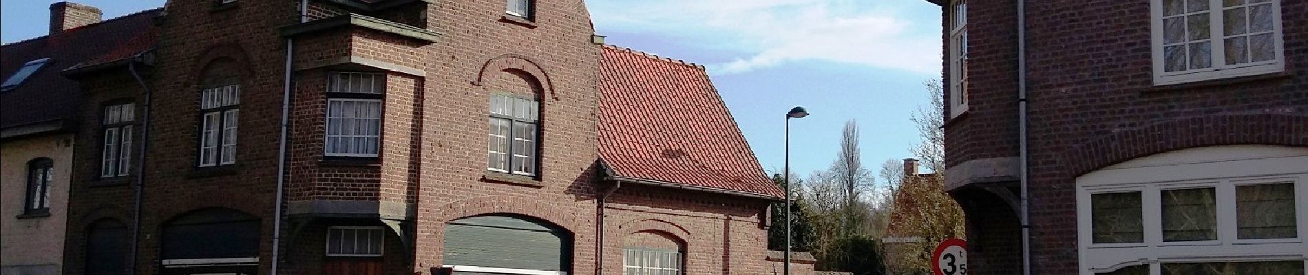
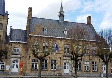
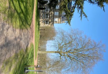
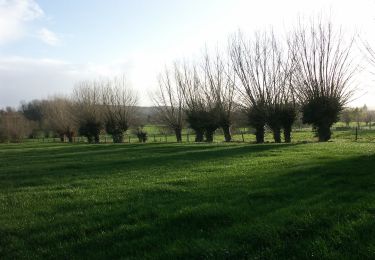
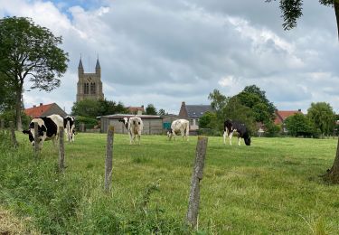
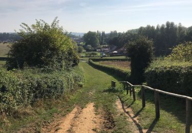
Bewandel de omgeving van de Kemmelberg. Het landschap is er heel heuvelachtig en biedt oneindige vergezichten. Je start in de dorpskom van Kemmel (Heuvelland) en via het gemeentelijk domein De Warande ga je naar de voet van de heuvelrug. Langs veldwegen stap je verder naar de Monteberg (131 m). Daarna gaat het steil bergop naar de top van de Kemmelberg. Boven wacht een uniek
Localización
Comentarios
Excursiones cerca
![Excursión Senderismo Heuvelland - Loker - Le Mont Rouge - Photo](https://media.geolcdn.com/t/375/260/ext.jpg?maxdim=2&url=https%3A%2F%2Fservices.sitytrail.com%2FGeolivesWS%2FDownloadMedia.ashx%3FTrailID%3D106138%26Media%3D10379_6.jpg)
![Senderismo Senderismo](https://static1.geolcdn.com/sitytour/trail-icons/101.png)
Senderismo
![](/images/other/stat-length.png)
![](https://static1.geolcdn.com/siteimages/upload/files/16400158638029165_repeat_loop_refresh_sync_direction_icon.png)
![Excursión A pie Heuvelland - Kraters en Mijnen - Photo](https://media.geolcdn.com/t/375/260/aaf8f233-f3c6-4670-9899-0548e3a6df10.jpeg&format=jpg&maxdim=2)
![A pie A pie](https://static1.geolcdn.com/sitytour/trail-icons/100.png)
A pie
![](/images/other/stat-length.png)
![](https://static1.geolcdn.com/siteimages/upload/files/16400158638029165_repeat_loop_refresh_sync_direction_icon.png)
![Excursión A pie Heuvelland - Geuzen wandelroute - Photo](https://media.geolcdn.com/t/375/260/a748d58f-6dfe-4ad8-b887-8505015b63cc.jpeg&format=jpg&maxdim=2)
![A pie A pie](https://static1.geolcdn.com/sitytour/trail-icons/100.png)
A pie
![](/images/other/stat-length.png)
![](https://static1.geolcdn.com/siteimages/upload/files/16400158638029165_repeat_loop_refresh_sync_direction_icon.png)
![Excursión Senderismo Heuvelland - Dranouter 12,3 km - Photo](https://media.geolcdn.com/t/375/260/ab62849d-d2cc-4c63-a20f-7ad369b5fc0f.jpg&format=jpg&maxdim=2)
![Senderismo Senderismo](https://static1.geolcdn.com/sitytour/trail-icons/101.png)
Senderismo
![](/images/other/stat-length.png)
![](https://static1.geolcdn.com/siteimages/upload/files/16400158638029165_repeat_loop_refresh_sync_direction_icon.png)
![Excursión Senderismo Heuvelland - Kemmel 16,8 km - Photo](https://media.geolcdn.com/t/375/260/35efd325-6d2d-445a-be71-1af85c252386.jpg&format=jpg&maxdim=2)
![Senderismo Senderismo](https://static1.geolcdn.com/sitytour/trail-icons/101.png)
Senderismo
![](/images/other/stat-length.png)
![](https://static1.geolcdn.com/siteimages/upload/files/16400158638029165_repeat_loop_refresh_sync_direction_icon.png)
![Excursión A pie Poperinge - Zevekotepad Reningelst - Photo](https://media.geolcdn.com/t/375/260/e710de02-cc8e-495b-9106-bd054237c804.jpeg&format=jpg&maxdim=2)
![A pie A pie](https://static1.geolcdn.com/sitytour/trail-icons/100.png)
A pie
![](/images/other/stat-length.png)
![](https://static1.geolcdn.com/siteimages/upload/files/16400158638029165_repeat_loop_refresh_sync_direction_icon.png)
![Excursión Senderismo Heuvelland - Loker 18,2 km - Photo](https://media.geolcdn.com/t/375/260/95fcaf9d-4059-4e0a-91b3-686074f6c894.jpg&format=jpg&maxdim=2)
![Senderismo Senderismo](https://static1.geolcdn.com/sitytour/trail-icons/101.png)
Senderismo
![](/images/other/stat-length.png)
![](https://static1.geolcdn.com/siteimages/upload/files/16400158638029165_repeat_loop_refresh_sync_direction_icon.png)
![Excursión Senderismo Heuvelland - Nieuwekerke Bailleul 17,5 km - Photo](https://media.geolcdn.com/t/375/260/9e8e5b67-08f2-434d-8359-01cf5462426a.jpg&format=jpg&maxdim=2)
![Senderismo Senderismo](https://static1.geolcdn.com/sitytour/trail-icons/101.png)
Senderismo
![](/images/other/stat-length.png)
![](https://static1.geolcdn.com/siteimages/upload/files/16400158638029165_repeat_loop_refresh_sync_direction_icon.png)
![Excursión Senderismo Heuvelland - Kemmel Dranouter 21 km - Photo](https://media.geolcdn.com/t/375/260/dc67270b-3bd6-42f0-9f11-f5a0fb775182.jpg&format=jpg&maxdim=2)
![Senderismo Senderismo](https://static1.geolcdn.com/sitytour/trail-icons/101.png)
Senderismo
![](/images/other/stat-length.png)
![](https://static1.geolcdn.com/siteimages/upload/files/16400158638029165_repeat_loop_refresh_sync_direction_icon.png)