![](/images/other/stat-length.png)
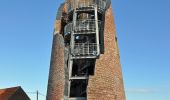
![Excursión A pie Houthulst - Heuvelpad - Photo](https://media.geolcdn.com/t/1900/400/23488ba0-0b87-40ab-9447-aa412dd804ee.jpeg&format=pjpeg&maxdim=2)
Heuvelpad
SityTrail - itinéraires balisés pédestres
Tous les sentiers balisés d’Europe GUIDE+
![Longitud](/images/other/stat-length.png)
Longitud
6,6 km
![Altitud máxima](https://static1.geolcdn.com/siteimages/upload/files/1508320355ic_sort_altitude_max_24dp.png)
Altitud máxima
38 m
![Desnivel positivo](https://static1.geolcdn.com/siteimages/upload/files/1508320355ic_sort_den_pos_24dp.png)
Desnivel positivo
60 m
![Km-Effort](/images/other/stat-length.png)
Km-Effort
7,4 km
![Altitud mínima](https://static1.geolcdn.com/siteimages/upload/files/1508320355ic_sort_altitude_min_24dp.png)
Altitud mínima
13 m
![Desnivel negativo](https://static1.geolcdn.com/siteimages/upload/files/1508320355ic_sort_den_neg_24dp.png)
Desnivel negativo
57 m
![Boucle](https://static1.geolcdn.com/siteimages/upload/files/16400158638029165_repeat_loop_refresh_sync_direction_icon.png)
Boucle
Sí
Baliza
Fecha de creación :
2022-02-09 14:24:33.708
Última modificación :
2022-02-09 17:52:55.955
![A pie](https://static1.geolcdn.com/sitytour/trail-icons/100.png)
1h41
Dificultad : Fácil
![Escanee este código QR para abrir la excursión en la aplicación SityTrail](https://capi.geolives.com/qq0zvz2zws4bq2lad0pu/sitytour/trails/3083138/qr.png?size=200)
Aplicación GPS de excursión GRATIS
A propósito
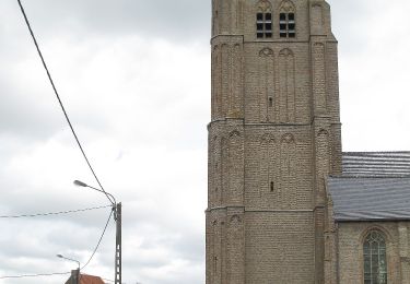
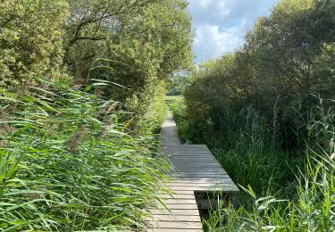
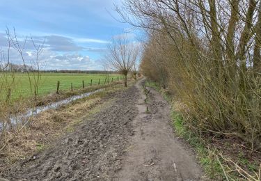
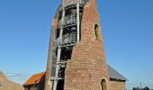
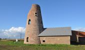
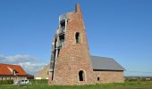
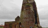
Ruta A pie de 6,6 km a descubrir en Flandes, Flandes Occidental, Houthulst. Esta ruta ha sido propuesta por SityTrail - itinéraires balisés pédestres.
Descripción
Trail created by Gemeente Klerken.
Sitio web: https://www.klerken.be/toerisme/folder_heuvelpad.pdf
Localización
País:
Belgium
Región :
Flandes
Departamento/provincia :
Flandes Occidental
Municipio :
Houthulst
Localidad:
Klerken
Salida:(Dec)
Salida:(UTM)
494620 ; 5649080 (31U) N.
Comentarios
Excursiones cerca
![Excursión A pie Diksmuide - Erfgoedwandelroute Diksmuide - Photo](https://media.geolcdn.com/t/375/260/06c2e298-822d-4e20-8819-af80da61ea90.jpeg&format=jpg&maxdim=2)
![A pie A pie](https://static1.geolcdn.com/sitytour/trail-icons/100.png)
Erfgoedwandelroute Diksmuide
A pie
Fácil
Diksmuide,
Flandes,
Flandes Occidental,
Belgium
![](/images/other/stat-length.png)
3,1 km | 3,3 km-effort
44min
![](https://static1.geolcdn.com/siteimages/upload/files/16400158638029165_repeat_loop_refresh_sync_direction_icon.png)
Sí
![Excursión A pie Diksmuide - Bethoosterse Broeken - Photo](https://media.geolcdn.com/t/375/260/ed9a6477-74f3-4ba5-abba-795b815eef09.jpeg&format=jpg&maxdim=2)
![A pie A pie](https://static1.geolcdn.com/sitytour/trail-icons/100.png)
Bethoosterse Broeken
A pie
Fácil
Diksmuide,
Flandes,
Flandes Occidental,
Belgium
![](/images/other/stat-length.png)
9,3 km | 9,9 km-effort
2h 14min
![](https://static1.geolcdn.com/siteimages/upload/files/16400158638029165_repeat_loop_refresh_sync_direction_icon.png)
Sí
![Excursión Senderismo Diksmuide - Blanquaart 19 km - Photo](https://media.geolcdn.com/t/375/260/072813cc-8841-4431-a823-680798617db4.jpg&format=jpg&maxdim=2)
![Senderismo Senderismo](https://static1.geolcdn.com/sitytour/trail-icons/101.png)
Blanquaart 19 km
Senderismo
Fácil
(1)
Diksmuide,
Flandes,
Flandes Occidental,
Belgium
![](/images/other/stat-length.png)
18,8 km | 19,9 km-effort
4h 56min
![](https://static1.geolcdn.com/siteimages/upload/files/16400158638029165_repeat_loop_refresh_sync_direction_icon.png)
Sí
![Excursión Senderismo Diksmuide - Blankaart 24 km - Photo](https://media.geolcdn.com/t/375/260/2d2f1a7e-0bcb-4863-ae42-25c9db3f9317.jpg&format=jpg&maxdim=2)
![Senderismo Senderismo](https://static1.geolcdn.com/sitytour/trail-icons/101.png)
Blankaart 24 km
Senderismo
Fácil
Diksmuide,
Flandes,
Flandes Occidental,
Belgium
![](/images/other/stat-length.png)
24 km | 25 km-effort
5h 29min
![](https://static1.geolcdn.com/siteimages/upload/files/16400158638029165_repeat_loop_refresh_sync_direction_icon.png)
Sí
![Excursión Senderismo Diksmuide - Dixmude 20-09-20 - Photo](https://media.geolcdn.com/t/375/260/ext.jpg?maxdim=2&url=https%3A%2F%2Fstatic1.geolcdn.com%2Fsiteimages%2Fupload%2Ffiles%2F1553511878bg_sport_marche.png)
![Senderismo Senderismo](https://static1.geolcdn.com/sitytour/trail-icons/101.png)
Dixmude 20-09-20
Senderismo
Muy fácil
Diksmuide,
Flandes,
Flandes Occidental,
Belgium
![](/images/other/stat-length.png)
7,5 km | 7,9 km-effort
2h 5min
![](https://static1.geolcdn.com/siteimages/upload/files/16400158638029165_repeat_loop_refresh_sync_direction_icon.png)
Sí
![Excursión Senderismo Diksmuide - Dixmude 19-09-20 - Photo](https://media.geolcdn.com/t/375/260/ext.jpg?maxdim=2&url=https%3A%2F%2Fstatic1.geolcdn.com%2Fsiteimages%2Fupload%2Ffiles%2F1553511878bg_sport_marche.png)
![Senderismo Senderismo](https://static1.geolcdn.com/sitytour/trail-icons/101.png)
Dixmude 19-09-20
Senderismo
Fácil
Diksmuide,
Flandes,
Flandes Occidental,
Belgium
![](/images/other/stat-length.png)
10,5 km | 11 km-effort
2h 55min
![](https://static1.geolcdn.com/siteimages/upload/files/16400158638029165_repeat_loop_refresh_sync_direction_icon.png)
Sí
![Excursión Senderismo Diksmuide - Woumen spaarbekken De Blankaart Merkem - 10 km RT - Photo](https://media.geolcdn.com/t/375/260/ext.jpg?maxdim=2&url=https%3A%2F%2Fstatic1.geolcdn.com%2Fsiteimages%2Fupload%2Ffiles%2F1553511878bg_sport_marche.png)
![Senderismo Senderismo](https://static1.geolcdn.com/sitytour/trail-icons/101.png)
Woumen spaarbekken De Blankaart Merkem - 10 km RT
Senderismo
Muy fácil
Diksmuide,
Flandes,
Flandes Occidental,
Belgium
![](/images/other/stat-length.png)
9,8 km | 10,4 km-effort
Desconocido
![](https://static1.geolcdn.com/siteimages/upload/files/16400158638029165_repeat_loop_refresh_sync_direction_icon.png)
Sí
![Excursión Senderismo Houthulst - Houthulst het Vrijbos - 14 km RT - Photo](https://media.geolcdn.com/t/375/260/ext.jpg?maxdim=2&url=https%3A%2F%2Fstatic1.geolcdn.com%2Fsiteimages%2Fupload%2Ffiles%2F1553511878bg_sport_marche.png)
![Senderismo Senderismo](https://static1.geolcdn.com/sitytour/trail-icons/101.png)
Houthulst het Vrijbos - 14 km RT
Senderismo
Muy fácil
Houthulst,
Flandes,
Flandes Occidental,
Belgium
![](/images/other/stat-length.png)
14,3 km | 15,8 km-effort
Desconocido
![](https://static1.geolcdn.com/siteimages/upload/files/16400158638029165_repeat_loop_refresh_sync_direction_icon.png)
Sí
![Excursión Senderismo Diksmuide - Diksmuide langs Ijzer en Beerst - 13 km RT - Photo](https://media.geolcdn.com/t/375/260/ext.jpg?maxdim=2&url=https%3A%2F%2Fstatic1.geolcdn.com%2Fsiteimages%2Fupload%2Ffiles%2F1553511878bg_sport_marche.png)
![Senderismo Senderismo](https://static1.geolcdn.com/sitytour/trail-icons/101.png)
Diksmuide langs Ijzer en Beerst - 13 km RT
Senderismo
Muy fácil
Diksmuide,
Flandes,
Flandes Occidental,
Belgium
![](/images/other/stat-length.png)
13,2 km | 13,7 km-effort
Desconocido
![](https://static1.geolcdn.com/siteimages/upload/files/16400158638029165_repeat_loop_refresh_sync_direction_icon.png)
Sí