


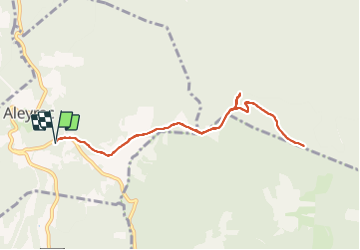

9,8 km | 13,6 km-effort


Usuario


Aplicación GPS de excursión GRATIS
 SityTrail
IGN / Institutos geográficos
SityTrail World
El mundo es suyo
Ruta Senderismo de 9 km a descubrir en Auvergne-Rhône-Alpes, Drôme, Aleyrac. Esta ruta ha sido propuesta por parastat.
Pour s'entraîner.
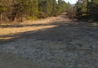
La montée au serre pelé n'a pas d’intérêt: broussailles et pas de vue.
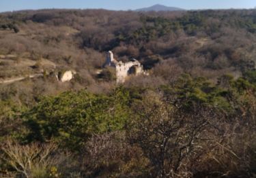
Une partie ventée.

Senderismo

Senderismo

Senderismo

Senderismo

Senderismo

Senderismo

Senderismo
Senderismo
Senderismo