![](/images/other/stat-length.png)
![Excursión Senderismo Godewaersvelde - Mont des Cats - Photo](https://media.geolcdn.com/t/1900/400/f7eaba71-a3db-4c2a-8b5b-0dd16d92cd81.jpg&format=pjpeg&maxdim=2)
Mont des Cats
Greg813
Usuario
![Longitud](/images/other/stat-length.png)
Longitud
8,9 km
![Altitud máxima](https://static1.geolcdn.com/siteimages/upload/files/1508320355ic_sort_altitude_max_24dp.png)
Altitud máxima
169 m
![Desnivel positivo](https://static1.geolcdn.com/siteimages/upload/files/1508320355ic_sort_den_pos_24dp.png)
Desnivel positivo
189 m
![Km-Effort](/images/other/stat-length.png)
Km-Effort
11,4 km
![Altitud mínima](https://static1.geolcdn.com/siteimages/upload/files/1508320355ic_sort_altitude_min_24dp.png)
Altitud mínima
40 m
![Desnivel negativo](https://static1.geolcdn.com/siteimages/upload/files/1508320355ic_sort_den_neg_24dp.png)
Desnivel negativo
189 m
![Boucle](https://static1.geolcdn.com/siteimages/upload/files/16400158638029165_repeat_loop_refresh_sync_direction_icon.png)
Boucle
Sí
Fecha de creación :
2022-01-30 13:20:13.316
Última modificación :
2022-02-13 17:52:52.042
![Senderismo](https://static1.geolcdn.com/sitytour/trail-icons/101.png)
1h51
Dificultad : Medio
![Escanee este código QR para abrir la excursión en la aplicación SityTrail](https://capi.geolives.com/qq0zvz2zws4bq2lad0pu/sitytour/trails/3069908/qr.png?size=200)
Aplicación GPS de excursión GRATIS
A propósito
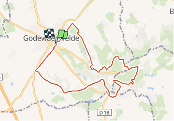
Ruta Senderismo de 8,9 km a descubrir en Alta Francia, Norte, Godewaersvelde. Esta ruta ha sido propuesta por Greg813.
Descripción
Randonnée avec Mettons le Monde en Marche depuis Godewaersvelde jusqu'au monastère du Mont des Cats.
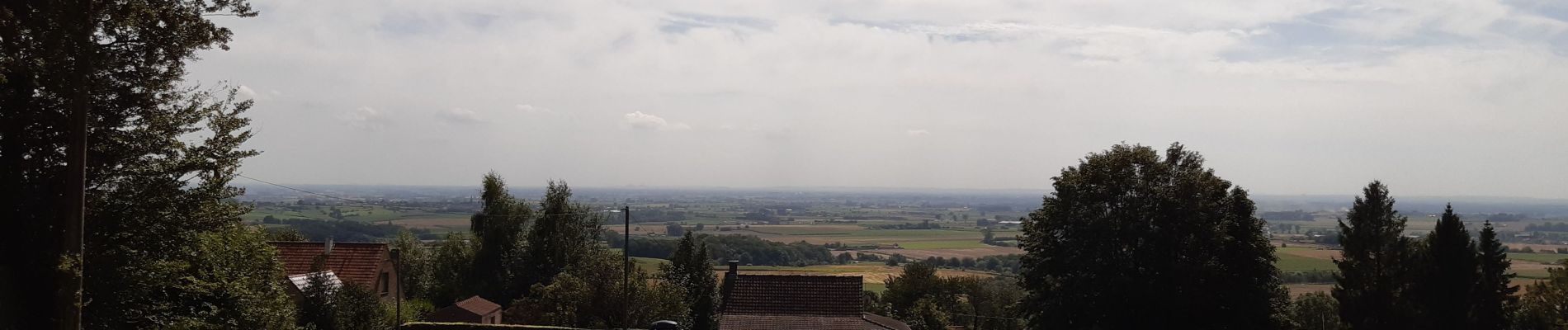
Pour d'autres photos, voir le site de l'association :
https://mmm-rando.org/godewaersvelde-2022/
Localización
País:
France
Región :
Alta Francia
Departamento/provincia :
Norte
Municipio :
Godewaersvelde
Localidad:
Unknown
Salida:(Dec)
Salida:(UTM)
474959 ; 5626819 (31U) N.
Comentarios
Excursiones cerca
![Excursión Senderismo Eecke - Circuit du Klockhuis (Grande boucle) - Eecke - Photo](https://media.geolcdn.com/t/375/260/ext.jpg?maxdim=2&url=https%3A%2F%2Fservices.sitytrail.com%2FGeolivesWS%2FDownloadMedia.ashx%3FTrailID%3D191613%26Media%3D15253_3.jpg)
![Senderismo Senderismo](https://static1.geolcdn.com/sitytour/trail-icons/101.png)
Circuit du Klockhuis (Grande boucle) - Eecke
Senderismo
Difícil
(2)
Eecke,
Alta Francia,
Norte,
France
![](/images/other/stat-length.png)
15 km | 16,5 km-effort
3h 45min
![](https://static1.geolcdn.com/siteimages/upload/files/16400158638029165_repeat_loop_refresh_sync_direction_icon.png)
Sí
![Excursión Senderismo Berthen - Autour du monastère - Godewaersvelde - Photo](https://media.geolcdn.com/t/375/260/ext.jpg?maxdim=2&url=https%3A%2F%2Fservices.sitytrail.com%2FGeolivesWS%2FDownloadMedia.ashx%3FTrailID%3D111182%26Media%3D6625_1.jpg)
![Senderismo Senderismo](https://static1.geolcdn.com/sitytour/trail-icons/101.png)
Autour du monastère - Godewaersvelde
Senderismo
Difícil
(4)
Berthen,
Alta Francia,
Norte,
France
![](/images/other/stat-length.png)
11,8 km | 15,6 km-effort
3h 0min
![](https://static1.geolcdn.com/siteimages/upload/files/16400158638029165_repeat_loop_refresh_sync_direction_icon.png)
Sí
![Excursión Senderismo Steenvoorde - Steenvorde Cassel 17 km - Photo](https://media.geolcdn.com/t/375/260/d605630e-39f4-49fe-bb3b-4650e249a5bb.jpg&format=jpg&maxdim=2)
![Senderismo Senderismo](https://static1.geolcdn.com/sitytour/trail-icons/101.png)
Steenvorde Cassel 17 km
Senderismo
Muy difícil
Steenvoorde,
Alta Francia,
Norte,
France
![](/images/other/stat-length.png)
17 km | 19,9 km-effort
4h 31min
![](https://static1.geolcdn.com/siteimages/upload/files/16400158638029165_repeat_loop_refresh_sync_direction_icon.png)
Sí
![Excursión Senderismo Boeschepe - Boeschepe - Photo](https://media.geolcdn.com/t/375/260/6c0906d5-5117-4202-927a-8c802fc11963.jpg&format=jpg&maxdim=2)
![Senderismo Senderismo](https://static1.geolcdn.com/sitytour/trail-icons/101.png)
Boeschepe
Senderismo
Difícil
Boeschepe,
Alta Francia,
Norte,
France
![](/images/other/stat-length.png)
10,6 km | 13 km-effort
2h 26min
![](https://static1.geolcdn.com/siteimages/upload/files/16400158638029165_repeat_loop_refresh_sync_direction_icon.png)
No
![Excursión A pie Poperinge - Helleketelbos - Photo](https://media.geolcdn.com/t/375/260/0c8cf86c-730c-4042-b9e4-e508bb684d2d.jpeg&format=jpg&maxdim=2)
![A pie A pie](https://static1.geolcdn.com/sitytour/trail-icons/100.png)
Helleketelbos
A pie
Fácil
Poperinge,
Flandes,
Flandes Occidental,
Belgium
![](/images/other/stat-length.png)
10,8 km | 12,5 km-effort
2h 49min
![](https://static1.geolcdn.com/siteimages/upload/files/16400158638029165_repeat_loop_refresh_sync_direction_icon.png)
Sí
![Excursión Senderismo Steenvoorde - Steenvoorde 20 km - Photo](https://media.geolcdn.com/t/375/260/13209c13-682a-4334-a39b-be10d4a222e0.jpg&format=jpg&maxdim=2)
![Senderismo Senderismo](https://static1.geolcdn.com/sitytour/trail-icons/101.png)
Steenvoorde 20 km
Senderismo
Medio
Steenvoorde,
Alta Francia,
Norte,
France
![](/images/other/stat-length.png)
20 km | 24 km-effort
5h 44min
![](https://static1.geolcdn.com/siteimages/upload/files/16400158638029165_repeat_loop_refresh_sync_direction_icon.png)
Sí
![Excursión Senderismo Boeschepe - Monts des Flandres CAF LILLE week-end des estaminets 2 - Photo](https://media.geolcdn.com/t/375/260/ext.jpg?maxdim=2&url=https%3A%2F%2Fservices.sitytrail.com%2FGeolivesWS%2FDownloadMedia.ashx%3FTrailID%3D541149%26Media%3Dfix__20160320134319.jpg)
![Senderismo Senderismo](https://static1.geolcdn.com/sitytour/trail-icons/101.png)
Monts des Flandres CAF LILLE week-end des estaminets 2
Senderismo
Fácil
Boeschepe,
Alta Francia,
Norte,
France
![](/images/other/stat-length.png)
21 km | 26 km-effort
5h 34min
![](https://static1.geolcdn.com/siteimages/upload/files/16400158638029165_repeat_loop_refresh_sync_direction_icon.png)
Sí
![Excursión Senderismo Boeschepe - Week-end des estaminets CAF1 - Photo](https://media.geolcdn.com/t/375/260/ext.jpg?maxdim=2&url=https%3A%2F%2Fservices.sitytrail.com%2FGeolivesWS%2FDownloadMedia.ashx%3FTrailID%3D541147%26Media%3Dfix__20160319140516.jpg)
![Senderismo Senderismo](https://static1.geolcdn.com/sitytour/trail-icons/101.png)
Week-end des estaminets CAF1
Senderismo
Fácil
Boeschepe,
Alta Francia,
Norte,
France
![](/images/other/stat-length.png)
16,7 km | 21 km-effort
4h 32min
![](https://static1.geolcdn.com/siteimages/upload/files/16400158638029165_repeat_loop_refresh_sync_direction_icon.png)
Sí
![Excursión Senderismo Berthen - Balade des Katts - Photo](https://media.geolcdn.com/t/375/260/ext.jpg?maxdim=2&url=https%3A%2F%2Fservices.sitytrail.com%2FGeolivesWS%2FDownloadMedia.ashx%3FTrailID%3D202865%26Media%3De0bfffa3-cb95-4d1f-b064-23d12b092453.jpg)
![Senderismo Senderismo](https://static1.geolcdn.com/sitytour/trail-icons/101.png)
Balade des Katts
Senderismo
Muy fácil
(3)
Berthen,
Alta Francia,
Norte,
France
![](/images/other/stat-length.png)
4,8 km | 6,4 km-effort
Desconocido
![](https://static1.geolcdn.com/siteimages/upload/files/16400158638029165_repeat_loop_refresh_sync_direction_icon.png)
Sí