![](/images/other/stat-length.png)
![Excursión Senderismo Saint-Mathieu-de-Tréviers - stecroix - Photo](https://media.geolcdn.com/t/1900/400/e64ffde2-d819-4266-8805-e35ca32b0629.jpg&format=pjpeg&maxdim=2)
stecroix
v.rabot
Usuario
![Longitud](/images/other/stat-length.png)
![Altitud máxima](https://static1.geolcdn.com/siteimages/upload/files/1508320355ic_sort_altitude_max_24dp.png)
![Desnivel positivo](https://static1.geolcdn.com/siteimages/upload/files/1508320355ic_sort_den_pos_24dp.png)
![Km-Effort](/images/other/stat-length.png)
![Altitud mínima](https://static1.geolcdn.com/siteimages/upload/files/1508320355ic_sort_altitude_min_24dp.png)
![Desnivel negativo](https://static1.geolcdn.com/siteimages/upload/files/1508320355ic_sort_den_neg_24dp.png)
![Boucle](https://static1.geolcdn.com/siteimages/upload/files/16400158638029165_repeat_loop_refresh_sync_direction_icon.png)
![Senderismo](https://static1.geolcdn.com/sitytour/trail-icons/101.png)
4h10
Dificultad : Medio
![Escanee este código QR para abrir la excursión en la aplicación SityTrail](https://capi.geolives.com/qq0zvz2zws4bq2lad0pu/sitytour/trails/3067293/qr.png?size=200)
Aplicación GPS de excursión GRATIS
A propósito
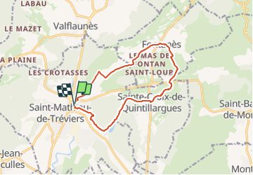
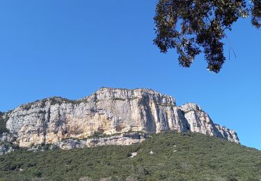
Ruta Senderismo de 13,3 km a descubrir en Occitania, Hérault, Saint-Mathieu-de-Tréviers. Esta ruta ha sido propuesta por v.rabot.
Descripción
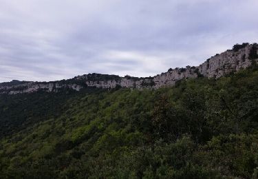
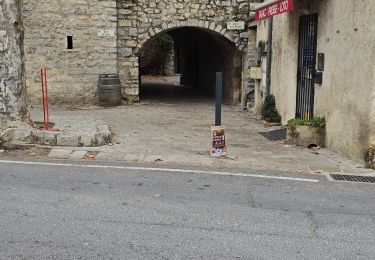
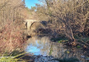
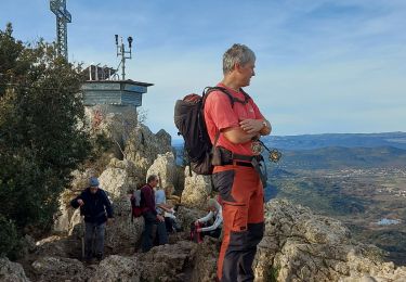
Randonnée passant au départ sur le chemin de la Vielle pour éviter d'aller chercher le carrefour à l'EST où on loge la grande route, route très peu fréquentée. Belle vue sur le Puech de Mourgues près du château d'eau, mais la montée juste avant demande un petit effort.
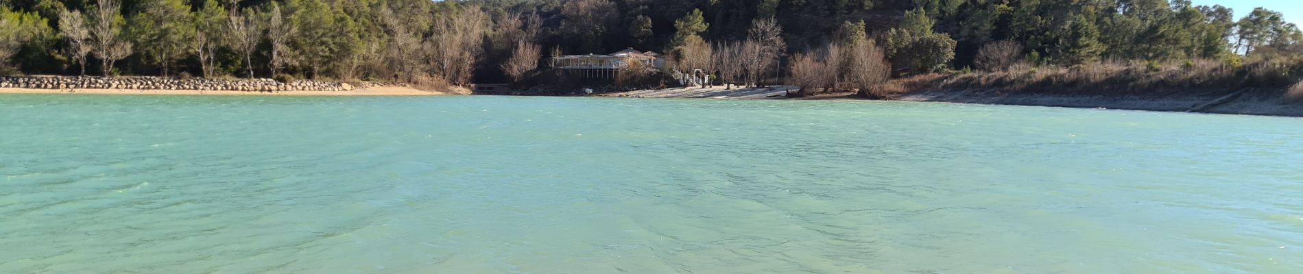
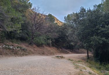
Randonnée sans aucune difficulté
Localización
Comentarios
Excursiones cerca
![Excursión Senderismo Valflaunès - l hortus - Photo](https://media.geolcdn.com/t/375/260/ext.jpg?maxdim=2&url=https%3A%2F%2Fservices.sitytrail.com%2FGeolivesWS%2FDownloadMedia.ashx%3FTrailID%3D557567%26Media%3Dfix__20160417104921.jpg)
![Senderismo Senderismo](https://static1.geolcdn.com/sitytour/trail-icons/101.png)
Senderismo
![](/images/other/stat-length.png)
![](https://static1.geolcdn.com/siteimages/upload/files/16400158638029165_repeat_loop_refresh_sync_direction_icon.png)
![Excursión Senderismo Sainte-Croix-de-Quintillargues - Ste Croix de Quintillargues - Photo](https://media.geolcdn.com/t/375/260/ext.jpg?maxdim=2&url=https%3A%2F%2Fstatic1.geolcdn.com%2Fsiteimages%2Fupload%2Ffiles%2F1553511878bg_sport_marche.png)
![Senderismo Senderismo](https://static1.geolcdn.com/sitytour/trail-icons/101.png)
Senderismo
![](/images/other/stat-length.png)
![](https://static1.geolcdn.com/siteimages/upload/files/16400158638029165_repeat_loop_refresh_sync_direction_icon.png)
![Excursión Senderismo Valflaunès - 3 les falaises de l'Hortus du 20/01/2025 - Photo](https://media.geolcdn.com/t/375/260/f6f0891e-d644-41eb-bb85-0eb1282e6889.jpg&format=jpg&maxdim=2)
![Senderismo Senderismo](https://static1.geolcdn.com/sitytour/trail-icons/101.png)
Senderismo
![](/images/other/stat-length.png)
![](https://static1.geolcdn.com/siteimages/upload/files/16400158638029165_repeat_loop_refresh_sync_direction_icon.png)
![Excursión Senderismo Valflaunès - l'Hortus crêtes - Photo](https://media.geolcdn.com/t/375/260/8ba1a285-4e0d-4a16-95c0-7302eff43924.jpg&format=jpg&maxdim=2)
![Senderismo Senderismo](https://static1.geolcdn.com/sitytour/trail-icons/101.png)
Senderismo
![](/images/other/stat-length.png)
![](https://static1.geolcdn.com/siteimages/upload/files/16400158638029165_repeat_loop_refresh_sync_direction_icon.png)
![Excursión Senderismo Les Matelles - Matelles_St-Jean-de-cucules - Photo](https://media.geolcdn.com/t/375/260/4f08b422-0369-44bd-a1db-b500a88dc597.jpg&format=jpg&maxdim=2)
![Senderismo Senderismo](https://static1.geolcdn.com/sitytour/trail-icons/101.png)
Senderismo
![](/images/other/stat-length.png)
![](https://static1.geolcdn.com/siteimages/upload/files/16400158638029165_repeat_loop_refresh_sync_direction_icon.png)
![Excursión Senderismo Valflaunès - L'hortus et château de Vivourès - Photo](https://media.geolcdn.com/t/375/260/d44f13ad-be4c-4470-90dd-904594bb1650.jpg&format=jpg&maxdim=2)
![Senderismo Senderismo](https://static1.geolcdn.com/sitytour/trail-icons/101.png)
Senderismo
![](/images/other/stat-length.png)
![](https://static1.geolcdn.com/siteimages/upload/files/16400158638029165_repeat_loop_refresh_sync_direction_icon.png)
![Excursión sport Fontanès - Fontanes - Photo](https://media.geolcdn.com/t/375/260/1d9c4f50-de68-4de6-a46d-3eba75c7d0ac.jpg&format=jpg&maxdim=2)
![Excursión Senderismo Vacquières - chapelle D'Aleyrac vers vacquieres parc du duc - Photo](https://media.geolcdn.com/t/375/260/1016cbc1-84d7-4082-b269-d91c1919b57d.jpg&format=jpg&maxdim=2)
![Senderismo Senderismo](https://static1.geolcdn.com/sitytour/trail-icons/101.png)
Senderismo
![](/images/other/stat-length.png)
![](https://static1.geolcdn.com/siteimages/upload/files/16400158638029165_repeat_loop_refresh_sync_direction_icon.png)
![Excursión Senderismo Saint-Mathieu-de-Tréviers - Autour du pic saint loup - Photo](https://media.geolcdn.com/t/375/260/f3f4b421-c7e4-49f6-aba4-bbc18a39b773.jpg&format=jpg&maxdim=2)
![Senderismo Senderismo](https://static1.geolcdn.com/sitytour/trail-icons/101.png)
Senderismo
![](/images/other/stat-length.png)
![](https://static1.geolcdn.com/siteimages/upload/files/16400158638029165_repeat_loop_refresh_sync_direction_icon.png)