![](/images/other/stat-length.png)
![Excursión Senderismo Saint-Mathieu-de-Tréviers - st_mathieu_treviers_tour_Sales_Lac_Ceceles - Photo](https://media.geolcdn.com/t/1900/400/7d500790-db26-4784-ae8b-78ebd94f8bbd.jpg&format=pjpeg&maxdim=2)
st_mathieu_treviers_tour_Sales_Lac_Ceceles
v.rabot
Usuario
![Longitud](/images/other/stat-length.png)
![Altitud máxima](https://static1.geolcdn.com/siteimages/upload/files/1508320355ic_sort_altitude_max_24dp.png)
![Desnivel positivo](https://static1.geolcdn.com/siteimages/upload/files/1508320355ic_sort_den_pos_24dp.png)
![Km-Effort](/images/other/stat-length.png)
![Altitud mínima](https://static1.geolcdn.com/siteimages/upload/files/1508320355ic_sort_altitude_min_24dp.png)
![Desnivel negativo](https://static1.geolcdn.com/siteimages/upload/files/1508320355ic_sort_den_neg_24dp.png)
![Boucle](https://static1.geolcdn.com/siteimages/upload/files/16400158638029165_repeat_loop_refresh_sync_direction_icon.png)
![Senderismo](https://static1.geolcdn.com/sitytour/trail-icons/101.png)
5h29
Dificultad : Medio
![Escanee este código QR para abrir la excursión en la aplicación SityTrail](https://capi.geolives.com/qq0zvz2zws4bq2lad0pu/sitytour/trails/3058116/qr.png?size=200)
Aplicación GPS de excursión GRATIS
A propósito
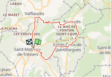
Ruta Senderismo de 16,6 km a descubrir en Occitania, Hérault, Saint-Mathieu-de-Tréviers. Esta ruta ha sido propuesta por v.rabot.
Descripción
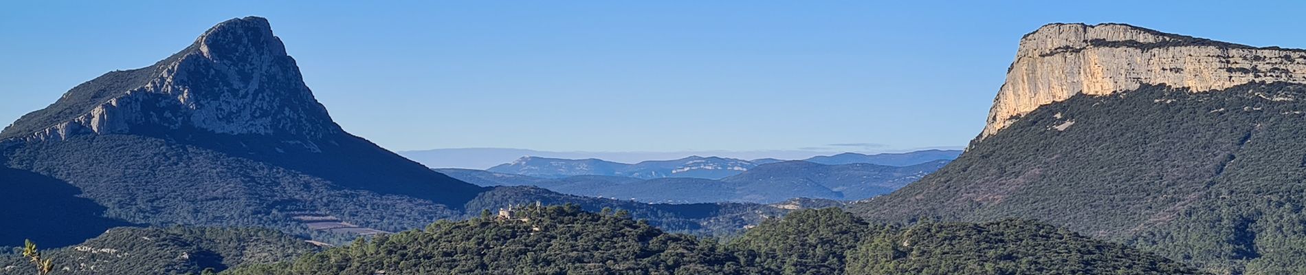
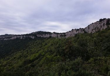
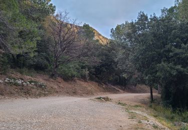
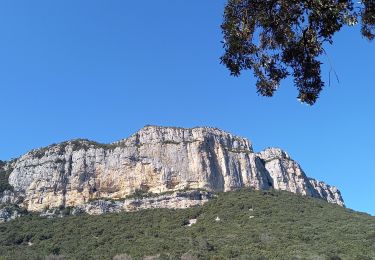
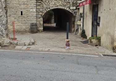
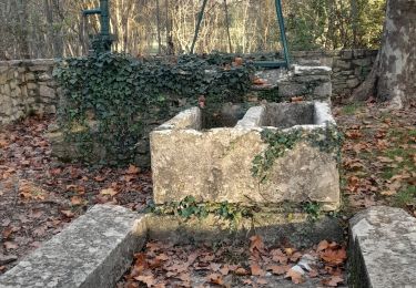
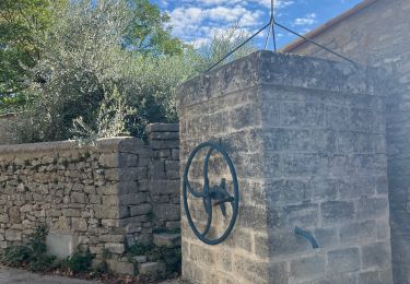
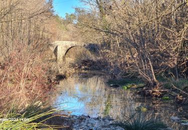
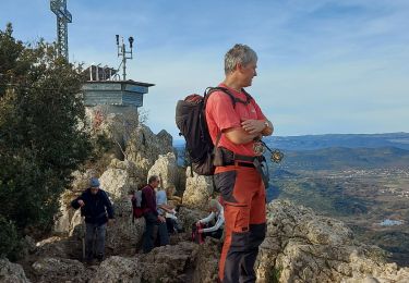
Le chemin montant aux tours de Sales est caillouteux et nécessitent de bonnes chaussures. Les bâtons sont bienvenus. Après la traversée des vignobles du château de la roque, on gagne Fontanès puis on se dirige vers saint croix de Quintillargues. Après avoir traversé la D1, il faut avancer à travers la garrigue pour rejoindre la spirale, de même pour rejoindre sainte croix de Quintillargues. Passage au lac de Cécélés puis retour à Saint Mathieu de Tréviers.
Localización
Comentarios
Excursiones cerca
![Excursión Senderismo Valflaunès - l hortus - Photo](https://media.geolcdn.com/t/375/260/ext.jpg?maxdim=2&url=https%3A%2F%2Fservices.sitytrail.com%2FGeolivesWS%2FDownloadMedia.ashx%3FTrailID%3D557567%26Media%3Dfix__20160417104921.jpg)
![Senderismo Senderismo](https://static1.geolcdn.com/sitytour/trail-icons/101.png)
Senderismo
![](/images/other/stat-length.png)
![](https://static1.geolcdn.com/siteimages/upload/files/16400158638029165_repeat_loop_refresh_sync_direction_icon.png)
![Excursión Senderismo Sainte-Croix-de-Quintillargues - Ste Croix de Quintillargues - Photo](https://media.geolcdn.com/t/375/260/ext.jpg?maxdim=2&url=https%3A%2F%2Fstatic1.geolcdn.com%2Fsiteimages%2Fupload%2Ffiles%2F1553511878bg_sport_marche.png)
![Senderismo Senderismo](https://static1.geolcdn.com/sitytour/trail-icons/101.png)
Senderismo
![](/images/other/stat-length.png)
![](https://static1.geolcdn.com/siteimages/upload/files/16400158638029165_repeat_loop_refresh_sync_direction_icon.png)
![Excursión Senderismo Valflaunès - 3 les falaises de l'Hortus du 20/01/2025 - Photo](https://media.geolcdn.com/t/375/260/f6f0891e-d644-41eb-bb85-0eb1282e6889.jpg&format=jpg&maxdim=2)
![Senderismo Senderismo](https://static1.geolcdn.com/sitytour/trail-icons/101.png)
Senderismo
![](/images/other/stat-length.png)
![](https://static1.geolcdn.com/siteimages/upload/files/16400158638029165_repeat_loop_refresh_sync_direction_icon.png)
![Excursión Senderismo Valflaunès - l'Hortus crêtes - Photo](https://media.geolcdn.com/t/375/260/8ba1a285-4e0d-4a16-95c0-7302eff43924.jpg&format=jpg&maxdim=2)
![Senderismo Senderismo](https://static1.geolcdn.com/sitytour/trail-icons/101.png)
Senderismo
![](/images/other/stat-length.png)
![](https://static1.geolcdn.com/siteimages/upload/files/16400158638029165_repeat_loop_refresh_sync_direction_icon.png)
![Excursión Senderismo Les Matelles - Matelles_St-Jean-de-cucules - Photo](https://media.geolcdn.com/t/375/260/4f08b422-0369-44bd-a1db-b500a88dc597.jpg&format=jpg&maxdim=2)
![Senderismo Senderismo](https://static1.geolcdn.com/sitytour/trail-icons/101.png)
Senderismo
![](/images/other/stat-length.png)
![](https://static1.geolcdn.com/siteimages/upload/files/16400158638029165_repeat_loop_refresh_sync_direction_icon.png)
![Excursión Senderismo Valflaunès - L'hortus et château de Vivourès - Photo](https://media.geolcdn.com/t/375/260/d44f13ad-be4c-4470-90dd-904594bb1650.jpg&format=jpg&maxdim=2)
![Senderismo Senderismo](https://static1.geolcdn.com/sitytour/trail-icons/101.png)
Senderismo
![](/images/other/stat-length.png)
![](https://static1.geolcdn.com/siteimages/upload/files/16400158638029165_repeat_loop_refresh_sync_direction_icon.png)
![Excursión sport Fontanès - Fontanes - Photo](https://media.geolcdn.com/t/375/260/1d9c4f50-de68-4de6-a46d-3eba75c7d0ac.jpg&format=jpg&maxdim=2)
![Excursión Senderismo Vacquières - chapelle D'Aleyrac vers vacquieres parc du duc - Photo](https://media.geolcdn.com/t/375/260/1016cbc1-84d7-4082-b269-d91c1919b57d.jpg&format=jpg&maxdim=2)
![Senderismo Senderismo](https://static1.geolcdn.com/sitytour/trail-icons/101.png)
Senderismo
![](/images/other/stat-length.png)
![](https://static1.geolcdn.com/siteimages/upload/files/16400158638029165_repeat_loop_refresh_sync_direction_icon.png)
![Excursión Senderismo Saint-Mathieu-de-Tréviers - Autour du pic saint loup - Photo](https://media.geolcdn.com/t/375/260/f3f4b421-c7e4-49f6-aba4-bbc18a39b773.jpg&format=jpg&maxdim=2)
![Senderismo Senderismo](https://static1.geolcdn.com/sitytour/trail-icons/101.png)
Senderismo
![](/images/other/stat-length.png)
![](https://static1.geolcdn.com/siteimages/upload/files/16400158638029165_repeat_loop_refresh_sync_direction_icon.png)