![](/images/other/stat-length.png)
![Excursión Senderismo Bormes-les-Mimosas - SityTrail - Barrage du Trapan - Estagnol - Pellegrin - Photo](https://media.geolcdn.com/t/1900/400/ebe11e5b-c00f-4172-b479-00c30bf032ed.jpg&format=pjpeg&maxdim=2)
SityTrail - Barrage du Trapan - Estagnol - Pellegrin
affinetataille
Usuario GUIDE
![Longitud](/images/other/stat-length.png)
![Altitud máxima](https://static1.geolcdn.com/siteimages/upload/files/1508320355ic_sort_altitude_max_24dp.png)
![Desnivel positivo](https://static1.geolcdn.com/siteimages/upload/files/1508320355ic_sort_den_pos_24dp.png)
![Km-Effort](/images/other/stat-length.png)
![Altitud mínima](https://static1.geolcdn.com/siteimages/upload/files/1508320355ic_sort_altitude_min_24dp.png)
![Desnivel negativo](https://static1.geolcdn.com/siteimages/upload/files/1508320355ic_sort_den_neg_24dp.png)
![Boucle](https://static1.geolcdn.com/siteimages/upload/files/16400158638029165_repeat_loop_refresh_sync_direction_icon.png)
![Senderismo](https://static1.geolcdn.com/sitytour/trail-icons/101.png)
4h00
Dificultad : Fácil
![Escanee este código QR para abrir la excursión en la aplicación SityTrail](https://capi.geolives.com/qq0zvz2zws4bq2lad0pu/sitytour/trails/3046798/qr.png?size=200)
Aplicación GPS de excursión GRATIS
A propósito
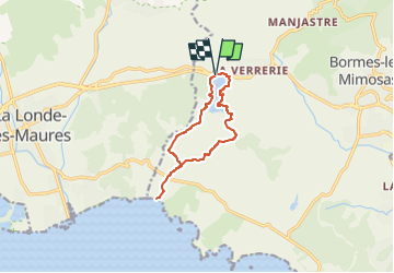
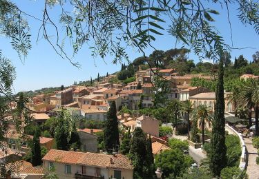
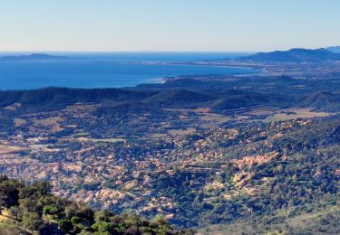
Ruta Senderismo de 10,3 km a descubrir en Provenza-Alpes-Costa Azul, Var, Bormes-les-Mimosas. Esta ruta ha sido propuesta por affinetataille.
Descripción
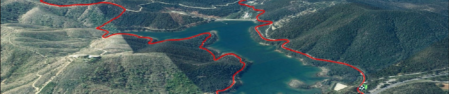
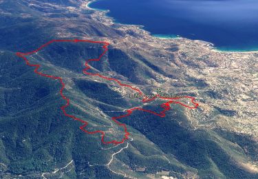
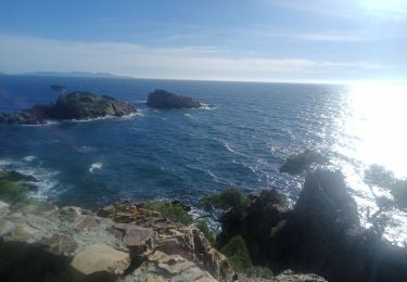
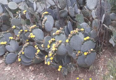
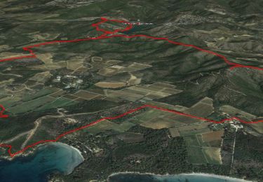
La sortie de ce jeudi 11 02 2021: Le barrage du Trapan et le tour du domaine de Leoube en passant par les plages de l'Estagnol et du Pellegrin. Magnifique parcours avec de superbes points de vue et surtout des chemins bordés de mimosas en fleur magnifiques...
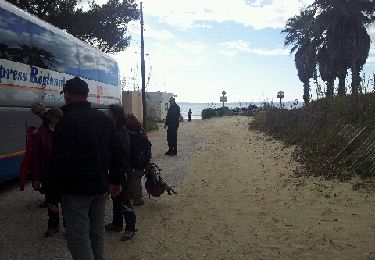
Localización
Comentarios
Excursiones cerca
![Senderismo Senderismo](https://static1.geolcdn.com/sitytour/trail-icons/101.png)
Senderismo
![](/images/other/stat-length.png)
![](https://static1.geolcdn.com/siteimages/upload/files/16400158638029165_repeat_loop_refresh_sync_direction_icon.png)
![Excursión Senderismo Bormes-les-Mimosas - SityTrail - Bormes les Mimosas - ND de Constance - Cols de Gratteloup et Landon - Photo](https://media.geolcdn.com/t/375/260/c3cd69d2-66a0-450a-95c5-e8005107dd21.jpg&format=jpg&maxdim=2)
![Senderismo Senderismo](https://static1.geolcdn.com/sitytour/trail-icons/101.png)
Senderismo
![](/images/other/stat-length.png)
![](https://static1.geolcdn.com/siteimages/upload/files/16400158638029165_repeat_loop_refresh_sync_direction_icon.png)
![Excursión Senderismo La Londe-les-Maures - la londe des maures- fort de bregancon - Photo](https://media.geolcdn.com/t/375/260/ext.jpg?maxdim=2&url=https%3A%2F%2Fservices.sitytrail.com%2FGeolivesWS%2FDownloadMedia.ashx%3FTrailID%3D174341%26Media%3D20130208144246.jpeg)
![Senderismo Senderismo](https://static1.geolcdn.com/sitytour/trail-icons/101.png)
Senderismo
![](/images/other/stat-length.png)
![](https://static1.geolcdn.com/siteimages/upload/files/16400158638029165_repeat_loop_refresh_sync_direction_icon.png)
![Excursión Senderismo Bormes-les-Mimosas - Bormes les Mimosas et la Forêt des Maures - Photo](https://media.geolcdn.com/t/375/260/ext.jpg?maxdim=2&url=https%3A%2F%2Fservices.sitytrail.com%2FGeolivesWS%2FDownloadMedia.ashx%3FTrailID%3D103786%26Media%3D6556_2.jpg)
![Senderismo Senderismo](https://static1.geolcdn.com/sitytour/trail-icons/101.png)
Senderismo
![](/images/other/stat-length.png)
![](https://static1.geolcdn.com/siteimages/upload/files/16400158638029165_repeat_loop_refresh_sync_direction_icon.png)
![Excursión Senderismo Bormes-les-Mimosas - Tour de Bormes - Photo](https://media.geolcdn.com/t/375/260/ext.jpg?maxdim=2&url=https%3A%2F%2Fstatic1.geolcdn.com%2Fsiteimages%2Fupload%2Ffiles%2F1553511878bg_sport_marche.png)
![Senderismo Senderismo](https://static1.geolcdn.com/sitytour/trail-icons/101.png)
Senderismo
![](/images/other/stat-length.png)
![](https://static1.geolcdn.com/siteimages/upload/files/16400158638029165_repeat_loop_refresh_sync_direction_icon.png)
![Excursión Ruta Bormes-les-Mimosas - Pointe du Diable et de Estagnol - Photo](https://media.geolcdn.com/t/375/260/ea478b0f-bf14-4a5a-bcc7-6189a705ccc7.jpg&format=jpg&maxdim=2)
![Ruta Ruta](https://static1.geolcdn.com/sitytour/trail-icons/104.png)
Ruta
![](/images/other/stat-length.png)
![](https://static1.geolcdn.com/siteimages/upload/files/16400158638029165_repeat_loop_refresh_sync_direction_icon.png)
![Excursión Senderismo Bormes-les-Mimosas - Bormes les Mimosas Les 3 Cols - Photo](https://media.geolcdn.com/t/375/260/23bdb278-92e8-4d98-83cb-eb5b5435fc48.jpg&format=jpg&maxdim=2)
![Senderismo Senderismo](https://static1.geolcdn.com/sitytour/trail-icons/101.png)
Senderismo
![](/images/other/stat-length.png)
![](https://static1.geolcdn.com/siteimages/upload/files/16400158638029165_repeat_loop_refresh_sync_direction_icon.png)
![Excursión Senderismo Bormes-les-Mimosas - SityTrail - Bormes les Mimosas - Cap Léoube - Photo](https://media.geolcdn.com/t/375/260/313e00c8-6453-4b42-83e0-fd33fc6b49b0.jpg&format=jpg&maxdim=2)
![Senderismo Senderismo](https://static1.geolcdn.com/sitytour/trail-icons/101.png)
Senderismo
![](/images/other/stat-length.png)
![](https://static1.geolcdn.com/siteimages/upload/files/16400158638029165_repeat_loop_refresh_sync_direction_icon.png)
![Excursión Senderismo Bormes-les-Mimosas - Col du Gratteloup - Piste domaniale Sud - Cols de Labade et Landon - Pierre d'Avenon - GR51/90 - Photo](https://media.geolcdn.com/t/375/260/a68a068d-d9c5-4471-8f2a-bbfabcb93eed.jpg&format=jpg&maxdim=2)
![Senderismo Senderismo](https://static1.geolcdn.com/sitytour/trail-icons/101.png)
Senderismo
![](/images/other/stat-length.png)
![](https://static1.geolcdn.com/siteimages/upload/files/16400158638029165_repeat_loop_refresh_sync_direction_icon.png)