![](/images/other/stat-length.png)
![Excursión Senderismo Viols-le-Fort - violslefort-avens-drailles - Photo](https://media.geolcdn.com/t/1900/400/dd6f2ad8-df1c-4748-a0a9-80b2f0a0cc4c.jpg&format=pjpeg&maxdim=2)
violslefort-avens-drailles
v.rabot
Usuario
![Longitud](/images/other/stat-length.png)
![Altitud máxima](https://static1.geolcdn.com/siteimages/upload/files/1508320355ic_sort_altitude_max_24dp.png)
![Desnivel positivo](https://static1.geolcdn.com/siteimages/upload/files/1508320355ic_sort_den_pos_24dp.png)
![Km-Effort](/images/other/stat-length.png)
![Altitud mínima](https://static1.geolcdn.com/siteimages/upload/files/1508320355ic_sort_altitude_min_24dp.png)
![Desnivel negativo](https://static1.geolcdn.com/siteimages/upload/files/1508320355ic_sort_den_neg_24dp.png)
![Boucle](https://static1.geolcdn.com/siteimages/upload/files/16400158638029165_repeat_loop_refresh_sync_direction_icon.png)
![Senderismo](https://static1.geolcdn.com/sitytour/trail-icons/101.png)
3h30
Dificultad : Medio
![Escanee este código QR para abrir la excursión en la aplicación SityTrail](https://capi.geolives.com/qq0zvz2zws4bq2lad0pu/sitytour/trails/3043086/qr.png?size=200)
Aplicación GPS de excursión GRATIS
A propósito
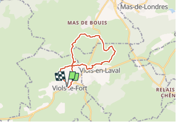
Ruta Senderismo de 13,1 km a descubrir en Occitania, Hérault, Viols-le-Fort. Esta ruta ha sido propuesta por v.rabot.
Descripción
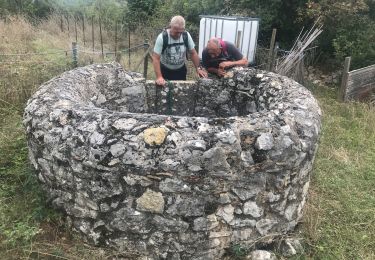
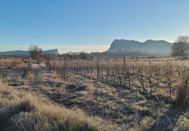
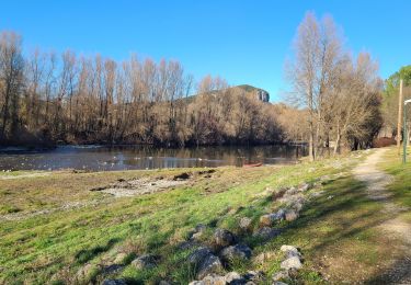
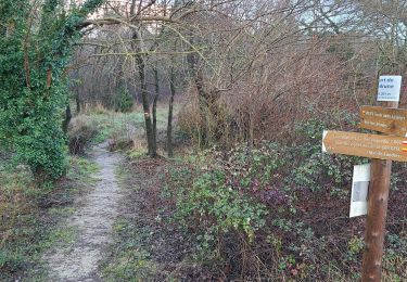
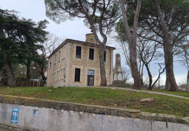
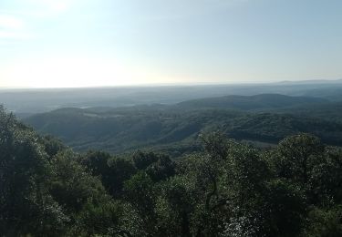
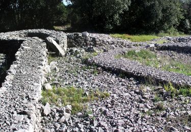
Attention le parking de Viols le Fort est fermé le vendredi, possibilité de se garer au parking du domaine des Roussières près de Viols en Laval. Passage près d'un aven avant de traverser le domaine des Roussières, passage au village préhistorique, si vous voulez le visiter renseignez vous sur les horaires et les dates d'ouverture. On rejoint l'aven Vidal (Mauvaise position sur la carte IGN) en passant on peut voir un autre aven qui n'est pas mentionné sur la carte. Sur la partie Village préhistorique, aven Vidal on emprunte un petit layon faiblement marqué, soyez attentif pour ne pas le perdre. Il n'y a pas de source au 9km mais un puit voir la photo. On passe par les tombes et le dolmen avant de rejoindre Viols le Fort. Les chemins sont très caillouteux et les bâtons sont bienvenus.
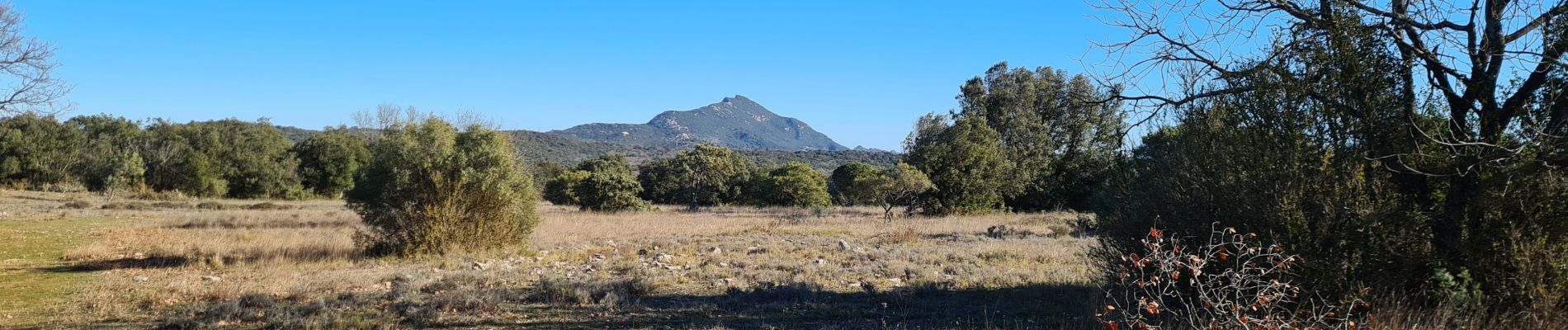
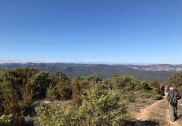
Localización
Comentarios
Excursiones cerca
![Excursión Senderismo Viols-en-Laval - Fontaine Terou - Photo](https://media.geolcdn.com/t/375/260/893d4ed9-6474-41c2-a5cc-5fad7e67044e.jpg&format=jpg&maxdim=2)
![Senderismo Senderismo](https://static1.geolcdn.com/sitytour/trail-icons/101.png)
Senderismo
![](/images/other/stat-length.png)
![](https://static1.geolcdn.com/siteimages/upload/files/16400158638029165_repeat_loop_refresh_sync_direction_icon.png)
![Excursión Senderismo Saint-Martin-de-Londres - l'ouradou - Photo](https://media.geolcdn.com/t/375/260/ext.jpg?maxdim=2&url=https%3A%2F%2Fservices.sitytrail.com%2FGeolivesWS%2FDownloadMedia.ashx%3FTrailID%3D860187%26Media%3D20171107114231.jpg)
![Senderismo Senderismo](https://static1.geolcdn.com/sitytour/trail-icons/101.png)
Senderismo
![](/images/other/stat-length.png)
![](https://static1.geolcdn.com/siteimages/upload/files/16400158638029165_repeat_loop_refresh_sync_direction_icon.png)
![Excursión Senderismo Mas-de-Londres - 2 Mas de Londres par la Jasse du 18-01-2025 - Photo](https://media.geolcdn.com/t/375/260/192185da-9693-40df-bfdc-9922ac5fb37b.jpg&format=jpg&maxdim=2)
![Senderismo Senderismo](https://static1.geolcdn.com/sitytour/trail-icons/101.png)
Senderismo
![](/images/other/stat-length.png)
![](https://static1.geolcdn.com/siteimages/upload/files/16400158638029165_repeat_loop_refresh_sync_direction_icon.png)
![Excursión Senderismo Mas-de-Londres - A Mas de Londres à Saint Bauzille de Putois par le GR 60 du 17-01-2025 - Photo](https://media.geolcdn.com/t/375/260/b8a71293-24db-4889-bcb9-e61559e24369.jpg&format=jpg&maxdim=2)
![Senderismo Senderismo](https://static1.geolcdn.com/sitytour/trail-icons/101.png)
Senderismo
![](/images/other/stat-length.png)
![](https://static1.geolcdn.com/siteimages/upload/files/16400158638029165_repeat_loop_refresh_sync_direction_icon.png)
![Excursión Senderismo Viols-en-Laval - Viols-en-Laval - Cazarils - Montagne de Labat - Paillas - Photo](https://media.geolcdn.com/t/375/260/ext.jpg?maxdim=2&url=https%3A%2F%2Fstatic1.geolcdn.com%2Fsiteimages%2Fupload%2Ffiles%2F1553511878bg_sport_marche.png)
![Senderismo Senderismo](https://static1.geolcdn.com/sitytour/trail-icons/101.png)
Senderismo
![](/images/other/stat-length.png)
![](https://static1.geolcdn.com/siteimages/upload/files/16400158638029165_repeat_loop_refresh_sync_direction_icon.png)
![Excursión Senderismo Mas-de-Londres - 4 Mas de Londres - La Liquière - La Borie du 23-01-2025 - Photo](https://media.geolcdn.com/t/375/260/05102a87-29f6-4667-8235-12dc17719fa1.jpg&format=jpg&maxdim=2)
![Senderismo Senderismo](https://static1.geolcdn.com/sitytour/trail-icons/101.png)
Senderismo
![](/images/other/stat-length.png)
![](https://static1.geolcdn.com/siteimages/upload/files/16400158638029165_repeat_loop_refresh_sync_direction_icon.png)
![Excursión Senderismo Mas-de-Londres - 1 Mas de Londres par la Borie du 14/01/2025 - Photo](https://media.geolcdn.com/t/375/260/9f35497f-19ee-4dfe-a684-9fc067c1b5db.jpg&format=jpg&maxdim=2)
![Senderismo Senderismo](https://static1.geolcdn.com/sitytour/trail-icons/101.png)
Senderismo
![](/images/other/stat-length.png)
![](https://static1.geolcdn.com/siteimages/upload/files/16400158638029165_repeat_loop_refresh_sync_direction_icon.png)
![Excursión Senderismo Mas-de-Londres - Mas de Londres - le Pic St Loup du 05-02-2024 - Photo](https://media.geolcdn.com/t/375/260/90f4b040-789d-4f87-a4f4-7259fa742c13.jpg&format=jpg&maxdim=2)
![Senderismo Senderismo](https://static1.geolcdn.com/sitytour/trail-icons/101.png)
Senderismo
![](/images/other/stat-length.png)
![](https://static1.geolcdn.com/siteimages/upload/files/16400158638029165_repeat_loop_refresh_sync_direction_icon.png)
![Excursión A pie Viols-le-Fort - Circuit des dolmens de Viols-le-Fort à Cantagrils - Photo](https://media.geolcdn.com/t/375/260/d74710c8-bef1-40ab-9dbc-f47723e0e65e.jpeg&format=jpg&maxdim=2)
![A pie A pie](https://static1.geolcdn.com/sitytour/trail-icons/100.png)
A pie
![](/images/other/stat-length.png)
![](https://static1.geolcdn.com/siteimages/upload/files/16400158638029165_repeat_loop_refresh_sync_direction_icon.png)