![](/images/other/stat-length.png)
![Excursión Senderismo Seillans - Bories de Seillans, la Camandre, vallon des combes longues - Photo](https://media.geolcdn.com/t/1900/400/9e152e07-be81-4aca-8140-01ab0859ae30.jpg&format=pjpeg&maxdim=2)
Bories de Seillans, la Camandre, vallon des combes longues
domi06
Usuario
![Longitud](/images/other/stat-length.png)
![Altitud máxima](https://static1.geolcdn.com/siteimages/upload/files/1508320355ic_sort_altitude_max_24dp.png)
![Desnivel positivo](https://static1.geolcdn.com/siteimages/upload/files/1508320355ic_sort_den_pos_24dp.png)
![Km-Effort](/images/other/stat-length.png)
![Altitud mínima](https://static1.geolcdn.com/siteimages/upload/files/1508320355ic_sort_altitude_min_24dp.png)
![Desnivel negativo](https://static1.geolcdn.com/siteimages/upload/files/1508320355ic_sort_den_neg_24dp.png)
![Boucle](https://static1.geolcdn.com/siteimages/upload/files/16400158638029165_repeat_loop_refresh_sync_direction_icon.png)
![Senderismo](https://static1.geolcdn.com/sitytour/trail-icons/101.png)
5h30
Dificultad : Fácil
![Escanee este código QR para abrir la excursión en la aplicación SityTrail](https://capi.geolives.com/qq0zvz2zws4bq2lad0pu/sitytour/trails/3030041/qr.png?size=200)
Aplicación GPS de excursión GRATIS
A propósito
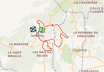
Ruta Senderismo de 16,4 km a descubrir en Provenza-Alpes-Costa Azul, Var, Seillans. Esta ruta ha sido propuesta por domi06.
Descripción
Partir du parking du bas recommandé pour la visite du village.
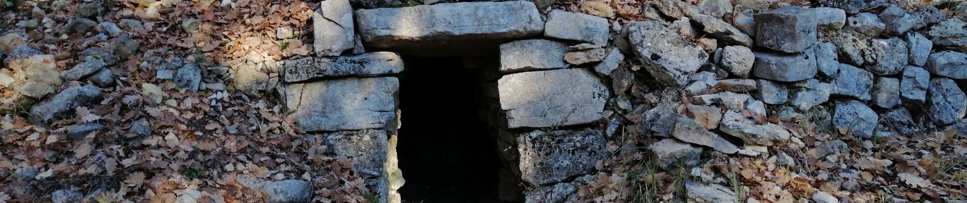
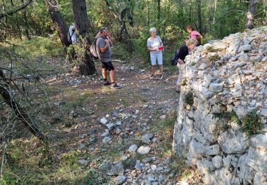
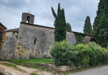
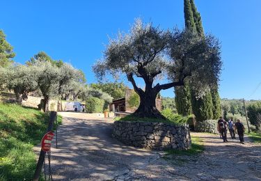
Commencer par la visite des 4 bories. Soit en aller-retour, soit faire une boucle Après la quatrième Borie, possibilité de faire une boucle qui traverse le riou de la Rouvière, puis une zone boisée, poursuivre à droite par la petite route des Bouques et déboucher sur la D53. La prendre à droite sur 500m en restant bien sur le bas-côté droit.Au niveau de la Maisonnette de l'ancien garde Barrière bifurquer à droite sur l'ancienne voie ferrée. Passer sous un pont puis sur un pont, longer la ferme des Cairns et rejoindre la chapelle de l'Ormeau.
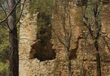
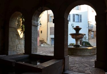
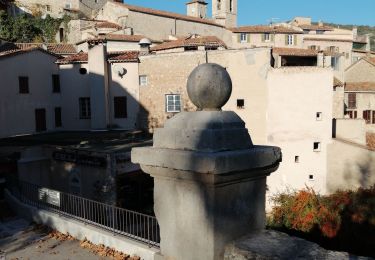
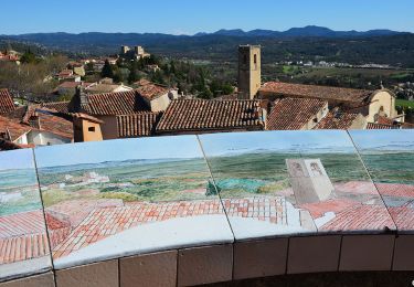
Traverser la D19, emprunter l'ancienne voie ferrée par une petite route goudronnée de 4km. Vous verrez un superbe habitat de pierres calcaires entouré de magnifiques restanques couvertes d'oliviers parfois centenaires. Atteindre un petit sentier qui vous permettra de longer dans la forêt le joli cours d'eau de la Camandre . Reprendre une petite route goudronnée, puis suivre un chemin boisé qui borde le terrain militaire du Canjuers avant d'arriver au village. Une visite s'impose car Seillans fait partie des plus beaux villages de France.
Localización
Comentarios
Excursiones cerca
![Excursión Senderismo Fayence - Fayence. Le circuit des trois chapelles - Photo](https://media.geolcdn.com/t/375/260/441da39e-224e-4e50-b6f0-490d073d6503.jpg&format=jpg&maxdim=2)
![Senderismo Senderismo](https://static1.geolcdn.com/sitytour/trail-icons/101.png)
Senderismo
![](/images/other/stat-length.png)
![](https://static1.geolcdn.com/siteimages/upload/files/16400158638029165_repeat_loop_refresh_sync_direction_icon.png)
![Excursión Senderismo Seillans - z seillans 03-10-23 - Photo](https://media.geolcdn.com/t/375/260/14f0fa50-1112-40e8-b814-f7d4ea93bf43.jpg&format=jpg&maxdim=2)
![Senderismo Senderismo](https://static1.geolcdn.com/sitytour/trail-icons/101.png)
Senderismo
![](/images/other/stat-length.png)
![](https://static1.geolcdn.com/siteimages/upload/files/16400158638029165_repeat_loop_refresh_sync_direction_icon.png)
![Excursión Senderismo Fayence - FAYENCE - TOUR DES CHAPELLES - Photo](https://media.geolcdn.com/t/375/260/e73cd254-a552-492e-8747-dfbc8bfa6c7b.jpg&format=jpg&maxdim=2)
![Senderismo Senderismo](https://static1.geolcdn.com/sitytour/trail-icons/101.png)
Senderismo
![](/images/other/stat-length.png)
![](https://static1.geolcdn.com/siteimages/upload/files/16400158638029165_repeat_loop_refresh_sync_direction_icon.png)
![Excursión Senderismo Seillans - La Pigne - Photo](https://media.geolcdn.com/t/375/260/c2efac09-daf0-46db-8bd0-b025f5018efe.jpg&format=jpg&maxdim=2)
![Senderismo Senderismo](https://static1.geolcdn.com/sitytour/trail-icons/101.png)
Senderismo
![](/images/other/stat-length.png)
![](https://static1.geolcdn.com/siteimages/upload/files/16400158638029165_repeat_loop_refresh_sync_direction_icon.png)
![Senderismo Senderismo](https://static1.geolcdn.com/sitytour/trail-icons/101.png)
Senderismo
![](/images/other/stat-length.png)
![](https://static1.geolcdn.com/siteimages/upload/files/16400158638029165_repeat_loop_refresh_sync_direction_icon.png)
![Excursión Senderismo Seillans - Seillans Circuit des Pignes - Photo](https://media.geolcdn.com/t/375/260/f6a5cdd0-96d0-41a9-9548-f0b8b9eb030d.jpg&format=jpg&maxdim=2)
![Senderismo Senderismo](https://static1.geolcdn.com/sitytour/trail-icons/101.png)
Senderismo
![](/images/other/stat-length.png)
![](https://static1.geolcdn.com/siteimages/upload/files/16400158638029165_repeat_loop_refresh_sync_direction_icon.png)
![Senderismo Senderismo](https://static1.geolcdn.com/sitytour/trail-icons/101.png)
Senderismo
![](/images/other/stat-length.png)
![](https://static1.geolcdn.com/siteimages/upload/files/16400158638029165_repeat_loop_refresh_sync_direction_icon.png)
![Excursión Senderismo Seillans - 20190327 rando réelle Seillans - Photo](https://media.geolcdn.com/t/375/260/ebb31106-6760-4c85-ad9f-1b1597c6cca8.jpg&format=jpg&maxdim=2)
![Senderismo Senderismo](https://static1.geolcdn.com/sitytour/trail-icons/101.png)
Senderismo
![](/images/other/stat-length.png)
![](https://static1.geolcdn.com/siteimages/upload/files/16400158638029165_repeat_loop_refresh_sync_direction_icon.png)
![Excursión Senderismo Fayence - fayence vallon de la camandre - Photo](https://media.geolcdn.com/t/375/260/7a999e91-02c0-4273-b84d-c13a0bbf95f5.jpg&format=jpg&maxdim=2)
![Senderismo Senderismo](https://static1.geolcdn.com/sitytour/trail-icons/101.png)
Senderismo
![](/images/other/stat-length.png)
![](https://static1.geolcdn.com/siteimages/upload/files/16400158638029165_repeat_loop_refresh_sync_direction_icon.png)