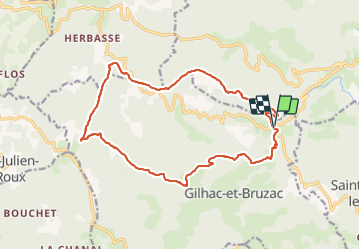
![](/images/other/stat-length.png)
![Excursión Senderismo Unknown - Gilhac et Bruzac - Photo](https://media.geolcdn.com/t/1900/400/551bf316-8a83-4ef1-91f0-f74ec142bac0.jpg&format=pjpeg&maxdim=2)
Gilhac et Bruzac
AIGUIER
Usuario
![Longitud](/images/other/stat-length.png)
![Altitud máxima](https://static1.geolcdn.com/siteimages/upload/files/1508320355ic_sort_altitude_max_24dp.png)
![Desnivel positivo](https://static1.geolcdn.com/siteimages/upload/files/1508320355ic_sort_den_pos_24dp.png)
![Km-Effort](/images/other/stat-length.png)
![Altitud mínima](https://static1.geolcdn.com/siteimages/upload/files/1508320355ic_sort_altitude_min_24dp.png)
![Desnivel negativo](https://static1.geolcdn.com/siteimages/upload/files/1508320355ic_sort_den_neg_24dp.png)
![Boucle](https://static1.geolcdn.com/siteimages/upload/files/16400158638029165_repeat_loop_refresh_sync_direction_icon.png)
![Senderismo](https://static1.geolcdn.com/sitytour/trail-icons/101.png)
8h04
Dificultad : Medio
![Escanee este código QR para abrir la excursión en la aplicación SityTrail](https://capi.geolives.com/qq0zvz2zws4bq2lad0pu/sitytour/trails/3017732/qr.png?size=200)
Aplicación GPS de excursión GRATIS
A propósito
Ruta Senderismo de 17,9 km a descubrir en Auvergne-Rhône-Alpes, Ardecha. Esta ruta ha sido propuesta por AIGUIER.
Descripción
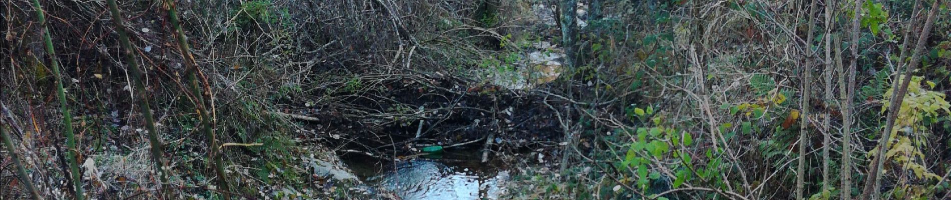
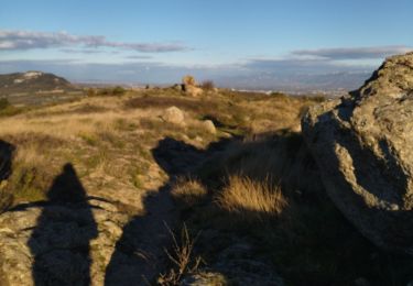
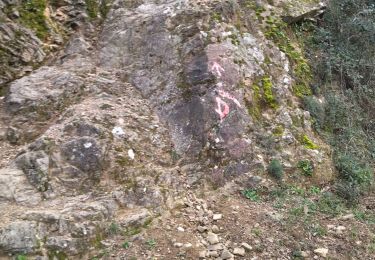
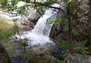
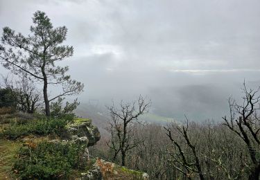
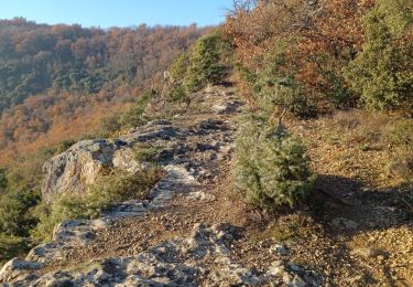
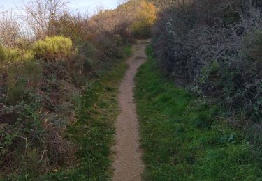
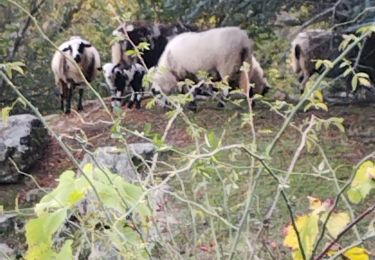
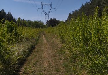
Rando aux paysages divers, petits cours d’eau magnifiques. Belles pistes forestières, des boisements aux essences multiples. Des passages risqués au dessus de ruisseaux. Une dure journée pour les 14 Curieux qui ont marchés sous un ciel gris, puis du soleil et pour finir du grésil et de la pluie, mais satisfait de leur journée.
Localización
Comentarios
Excursiones cerca
![Excursión Senderismo Toulaud - 07 l'embroye zel 22.11.2024 - Photo](https://media.geolcdn.com/t/375/260/3eda46e6-363b-4cc8-80cc-ecb0005ecd9e.jpg&format=jpg&maxdim=2)
![Senderismo Senderismo](https://static1.geolcdn.com/sitytour/trail-icons/101.png)
Senderismo
![](/images/other/stat-length.png)
![](https://static1.geolcdn.com/siteimages/upload/files/16400158638029165_repeat_loop_refresh_sync_direction_icon.png)
![Excursión Senderismo Toulaud - 07 toulaud - Photo](https://media.geolcdn.com/t/375/260/89acc3af-3d99-4629-8f1e-c7b281476088.jpg&format=jpg&maxdim=2)
![Senderismo Senderismo](https://static1.geolcdn.com/sitytour/trail-icons/101.png)
Senderismo
![](/images/other/stat-length.png)
![](https://static1.geolcdn.com/siteimages/upload/files/16400158638029165_repeat_loop_refresh_sync_direction_icon.png)
![Excursión Senderismo - boucle rotisson col de mure - Photo](https://media.geolcdn.com/t/375/260/ext.jpg?maxdim=2&url=https%3A%2F%2Fstatic1.geolcdn.com%2Fsiteimages%2Fupload%2Ffiles%2F1553511878bg_sport_marche.png)
![Senderismo Senderismo](https://static1.geolcdn.com/sitytour/trail-icons/101.png)
Senderismo
![](/images/other/stat-length.png)
![](https://static1.geolcdn.com/siteimages/upload/files/16400158638029165_repeat_loop_refresh_sync_direction_icon.png)
![Excursión Senderismo Toulaud - l'Embroye - Photo](https://media.geolcdn.com/t/375/260/cb947bb6-7dc1-43ba-a067-9c4f7f015103.jpg&format=jpg&maxdim=2)
![Senderismo Senderismo](https://static1.geolcdn.com/sitytour/trail-icons/101.png)
Senderismo
![](/images/other/stat-length.png)
![](https://static1.geolcdn.com/siteimages/upload/files/16400158638029165_repeat_loop_refresh_sync_direction_icon.png)
![Excursión Senderismo Saint-Georges-les-Bains - Saint Georges les Bains - Photo](https://media.geolcdn.com/t/375/260/e93486d4-d5f4-4b3e-8536-d4298013ea4d.jpg&format=jpg&maxdim=2)
![Senderismo Senderismo](https://static1.geolcdn.com/sitytour/trail-icons/101.png)
Senderismo
![](/images/other/stat-length.png)
![](https://static1.geolcdn.com/siteimages/upload/files/16400158638029165_repeat_loop_refresh_sync_direction_icon.png)
![Excursión Senderismo Saint-Georges-les-Bains - col de Rotison - Photo](https://media.geolcdn.com/t/375/260/8c3d1009-c72f-4ec6-bf61-7a2fde476dc2.jpg&format=jpg&maxdim=2)
![Senderismo Senderismo](https://static1.geolcdn.com/sitytour/trail-icons/101.png)
Senderismo
![](/images/other/stat-length.png)
![](https://static1.geolcdn.com/siteimages/upload/files/16400158638029165_repeat_loop_refresh_sync_direction_icon.png)
![Excursión Senderismo Toulaud - 07 gorges embroye - Photo](https://media.geolcdn.com/t/375/260/d81e90ab-1575-4c8f-b98f-1b96e0b43ac1.jpg&format=jpg&maxdim=2)
![Senderismo Senderismo](https://static1.geolcdn.com/sitytour/trail-icons/101.png)
Senderismo
![](/images/other/stat-length.png)
![](https://static1.geolcdn.com/siteimages/upload/files/16400158638029165_repeat_loop_refresh_sync_direction_icon.png)
![Excursión Senderismo Toulaud - Gorges de l'Embroye - Photo](https://media.geolcdn.com/t/375/260/050f228b-bc3c-4cca-b6f5-b260ca37e31b.jpg&format=jpg&maxdim=2)
![Senderismo Senderismo](https://static1.geolcdn.com/sitytour/trail-icons/101.png)
Senderismo
![](/images/other/stat-length.png)
![](https://static1.geolcdn.com/siteimages/upload/files/16400158638029165_repeat_loop_refresh_sync_direction_icon.png)
![Excursión Senderismo Charmes-sur-Rhône - 07 charmes sur rhone - Photo](https://media.geolcdn.com/t/375/260/7e1c43db-e74f-48e2-93d2-c295ffca5a20.jpg&format=jpg&maxdim=2)
![Senderismo Senderismo](https://static1.geolcdn.com/sitytour/trail-icons/101.png)
Senderismo
![](/images/other/stat-length.png)
![](https://static1.geolcdn.com/siteimages/upload/files/16400158638029165_repeat_loop_refresh_sync_direction_icon.png)