![](/images/other/stat-length.png)
![Excursión Senderismo Pomponne - Le Ru de Bouillon, l'Aqueduc de la Dhuis et la Marne - Photo](https://media.geolcdn.com/t/1900/400/ext.pjpeg?maxdim=2&url=https%3A%2F%2Fstatic1.geolcdn.com%2Fsiteimages%2Fupload%2Ffiles%2F1553511878bg_sport_marche.png)
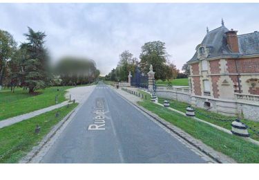
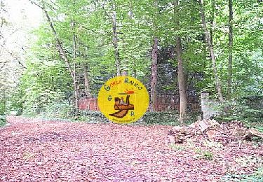
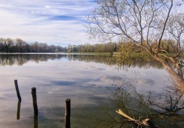
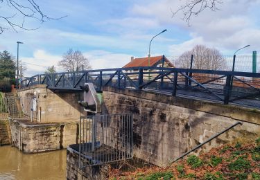
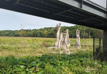
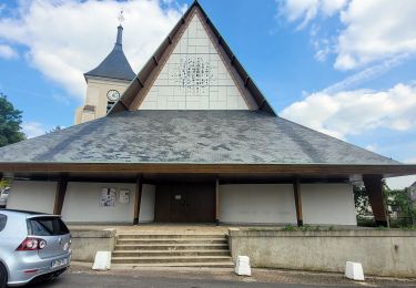
Le Ru de Bouillon, l'Aqueduc de la Dhuis et la Marne
Les 1000 pattes
Club randonnées SERVON
![Longitud](/images/other/stat-length.png)
Longitud
10 km
![Altitud máxima](https://static1.geolcdn.com/siteimages/upload/files/1508320355ic_sort_altitude_max_24dp.png)
Altitud máxima
117 m
![Desnivel positivo](https://static1.geolcdn.com/siteimages/upload/files/1508320355ic_sort_den_pos_24dp.png)
Desnivel positivo
124 m
![Km-Effort](/images/other/stat-length.png)
Km-Effort
11,7 km
![Altitud mínima](https://static1.geolcdn.com/siteimages/upload/files/1508320355ic_sort_altitude_min_24dp.png)
Altitud mínima
39 m
![Desnivel negativo](https://static1.geolcdn.com/siteimages/upload/files/1508320355ic_sort_den_neg_24dp.png)
Desnivel negativo
125 m
![Boucle](https://static1.geolcdn.com/siteimages/upload/files/16400158638029165_repeat_loop_refresh_sync_direction_icon.png)
Boucle
Sí
Fecha de creación :
2021-12-01 13:37:48.579
Última modificación :
2021-12-01 13:41:21.374
![Senderismo](https://static1.geolcdn.com/sitytour/trail-icons/101.png)
2h38
Dificultad : Medio
![Escanee este código QR para abrir la excursión en la aplicación SityTrail](https://capi.geolives.com/qq0zvz2zws4bq2lad0pu/sitytour/trails/3016786/qr.png?size=200)
Aplicación GPS de excursión GRATIS
A propósito
Ruta Senderismo de 10 km a descubrir en Isla de Francia, Sena y Marne, Pomponne. Esta ruta ha sido propuesta por Les 1000 pattes.
Descripción
Parking Allée du Prieuré à Pomponne
Trajet Servon-->Parking (27km: 35mn)
Localización
País:
France
Región :
Isla de Francia
Departamento/provincia :
Sena y Marne
Municipio :
Pomponne
Localidad:
Unknown
Salida:(Dec)
Salida:(UTM)
476789 ; 5414260 (31U) N.
Comentarios
Excursiones cerca
![Excursión Senderismo Jablines - SM_JABLINES_7.4Km - Photo](https://media.geolcdn.com/t/375/260/c8961113-df44-42a9-8e26-efaf3b924948.jpg&format=jpg&maxdim=2)
![Senderismo Senderismo](https://static1.geolcdn.com/sitytour/trail-icons/101.png)
SM_JABLINES_7.4Km
Senderismo
Medio
(8)
Jablines,
Isla de Francia,
Sena y Marne,
France
![](/images/other/stat-length.png)
7,4 km | 8 km-effort
1h 49min
![](https://static1.geolcdn.com/siteimages/upload/files/16400158638029165_repeat_loop_refresh_sync_direction_icon.png)
Sí
![Senderismo Senderismo](https://static1.geolcdn.com/sitytour/trail-icons/101.png)
Du Parc de Rentilly au Ru de la Gondoire
Senderismo
Difícil
(1)
Saint-Thibault-des-Vignes,
Isla de Francia,
Sena y Marne,
France
![](/images/other/stat-length.png)
21 km | 24 km-effort
5h 20min
![](https://static1.geolcdn.com/siteimages/upload/files/16400158638029165_repeat_loop_refresh_sync_direction_icon.png)
Sí
![Excursión Senderismo Dampmart - SM_DAMPMART-EST_8.1Km - Photo](https://media.geolcdn.com/t/375/260/6a085e8e-078f-48e9-8394-a9f3cb910770.jpg&format=jpg&maxdim=2)
![Senderismo Senderismo](https://static1.geolcdn.com/sitytour/trail-icons/101.png)
SM_DAMPMART-EST_8.1Km
Senderismo
Medio
(3)
Dampmart,
Isla de Francia,
Sena y Marne,
France
![](/images/other/stat-length.png)
8,1 km | 9,5 km-effort
2h 9min
![](https://static1.geolcdn.com/siteimages/upload/files/16400158638029165_repeat_loop_refresh_sync_direction_icon.png)
Sí
![Excursión Senderismo Bussy-Saint-Georges - Boucle Rentilly - Noisiel - Etang de la Brosse - Etang de la Loy - Photo](https://media.geolcdn.com/t/375/260/2ae0fdb4-e8bd-41dd-b6e1-a0c5cc184bfe.jpg&format=jpg&maxdim=2)
![Senderismo Senderismo](https://static1.geolcdn.com/sitytour/trail-icons/101.png)
Boucle Rentilly - Noisiel - Etang de la Brosse - Etang de la Loy
Senderismo
Muy difícil
Bussy-Saint-Georges,
Isla de Francia,
Sena y Marne,
France
![](/images/other/stat-length.png)
25 km | 29 km-effort
6h 32min
![](https://static1.geolcdn.com/siteimages/upload/files/16400158638029165_repeat_loop_refresh_sync_direction_icon.png)
Sí
![Excursión Senderismo Villevaudé - SityTrail - GR15 ttrace - Photo](https://media.geolcdn.com/t/375/260/ext.jpg?maxdim=2&url=https%3A%2F%2Fstatic1.geolcdn.com%2Fsiteimages%2Fupload%2Ffiles%2F1553511878bg_sport_marche.png)
![Senderismo Senderismo](https://static1.geolcdn.com/sitytour/trail-icons/101.png)
SityTrail - GR15 ttrace
Senderismo
Muy difícil
(1)
Villevaudé,
Isla de Francia,
Sena y Marne,
France
![](/images/other/stat-length.png)
18,5 km | 21 km-effort
4h 44min
![](https://static1.geolcdn.com/siteimages/upload/files/16400158638029165_repeat_loop_refresh_sync_direction_icon.png)
No
![Excursión Senderismo Vaires-sur-Marne - Boucle Vaires sur Marne / Noisiel / Chelles - Photo](https://media.geolcdn.com/t/375/260/449646ea-4419-47cd-8a7f-7bcc77625a1b.jpg&format=jpg&maxdim=2)
![Senderismo Senderismo](https://static1.geolcdn.com/sitytour/trail-icons/101.png)
Boucle Vaires sur Marne / Noisiel / Chelles
Senderismo
Fácil
Vaires-sur-Marne,
Isla de Francia,
Sena y Marne,
France
![](/images/other/stat-length.png)
21 km | 24 km-effort
4h 33min
![](https://static1.geolcdn.com/siteimages/upload/files/16400158638029165_repeat_loop_refresh_sync_direction_icon.png)
Sí
![Excursión Senderismo Dampmart - ASAM Dampmart La Dhuys - Photo](https://media.geolcdn.com/t/375/260/ext.jpg?maxdim=2&url=https%3A%2F%2Fstatic1.geolcdn.com%2Fsiteimages%2Fupload%2Ffiles%2F1553511878bg_sport_marche.png)
![Senderismo Senderismo](https://static1.geolcdn.com/sitytour/trail-icons/101.png)
ASAM Dampmart La Dhuys
Senderismo
Fácil
(1)
Dampmart,
Isla de Francia,
Sena y Marne,
France
![](/images/other/stat-length.png)
4,5 km | 5,4 km-effort
1h 13min
![](https://static1.geolcdn.com/siteimages/upload/files/16400158638029165_repeat_loop_refresh_sync_direction_icon.png)
Sí
![Excursión Senderismo Dampmart - Boucle 23 km Dampmart Annet sur Marne Base de Jabeline - Photo](https://media.geolcdn.com/t/375/260/b5b3d0bd-39cc-46d3-b0d4-bbe25a7dde4e.jpg&format=jpg&maxdim=2)
![Senderismo Senderismo](https://static1.geolcdn.com/sitytour/trail-icons/101.png)
Boucle 23 km Dampmart Annet sur Marne Base de Jabeline
Senderismo
Medio
Dampmart,
Isla de Francia,
Sena y Marne,
France
![](/images/other/stat-length.png)
23 km | 27 km-effort
5h 11min
![](https://static1.geolcdn.com/siteimages/upload/files/16400158638029165_repeat_loop_refresh_sync_direction_icon.png)
Sí
![Excursión Senderismo Dampmart - Boucle autour de Dampmart - Photo](https://media.geolcdn.com/t/375/260/5feb6ded-9010-40ac-8591-20a068c0f9dc.jpg&format=jpg&maxdim=2)
![Senderismo Senderismo](https://static1.geolcdn.com/sitytour/trail-icons/101.png)
Boucle autour de Dampmart
Senderismo
Medio
Dampmart,
Isla de Francia,
Sena y Marne,
France
![](/images/other/stat-length.png)
22 km | 25 km-effort
6h 24min
![](https://static1.geolcdn.com/siteimages/upload/files/16400158638029165_repeat_loop_refresh_sync_direction_icon.png)
Sí