![](/images/other/stat-length.png)
![Excursión Senderismo Saint-Julien - St Jean le Montagnier - Photo](https://media.geolcdn.com/t/1900/400/ext.pjpeg?maxdim=2&url=https%3A%2F%2Fservices.sitytrail.com%2FGeolivesWS%2FDownloadMedia.ashx%3FTrailID%3D301575%26Media%3Dcac9191e-7283-45a2-a363-f1872978defb.jpg)
St Jean le Montagnier
Loumo29
Usuario
![Longitud](/images/other/stat-length.png)
![Altitud máxima](https://static1.geolcdn.com/siteimages/upload/files/1508320355ic_sort_altitude_max_24dp.png)
![Desnivel positivo](https://static1.geolcdn.com/siteimages/upload/files/1508320355ic_sort_den_pos_24dp.png)
![Km-Effort](/images/other/stat-length.png)
![Altitud mínima](https://static1.geolcdn.com/siteimages/upload/files/1508320355ic_sort_altitude_min_24dp.png)
![Desnivel negativo](https://static1.geolcdn.com/siteimages/upload/files/1508320355ic_sort_den_neg_24dp.png)
![Boucle](https://static1.geolcdn.com/siteimages/upload/files/16400158638029165_repeat_loop_refresh_sync_direction_icon.png)
![Senderismo](https://static1.geolcdn.com/sitytour/trail-icons/101.png)
3h52
Dificultad : Medio
![Escanee este código QR para abrir la excursión en la aplicación SityTrail](https://capi.geolives.com/qq0zvz2zws4bq2lad0pu/sitytour/trails/301575/qr.png?size=200)
Aplicación GPS de excursión GRATIS
A propósito
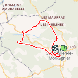
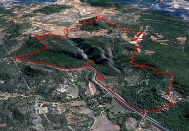
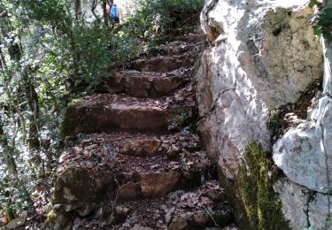
Ruta Senderismo de 13,8 km a descubrir en Provenza-Alpes-Costa Azul, Var, Saint-Julien. Esta ruta ha sido propuesta por Loumo29.
Descripción
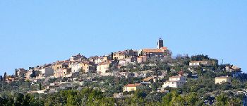
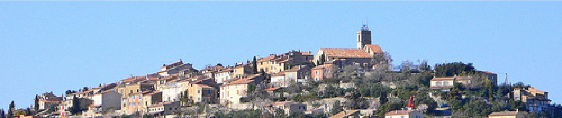
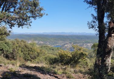
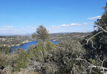
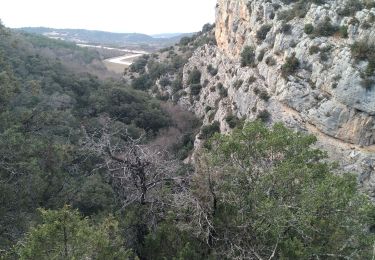
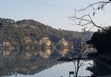
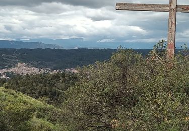
La commune de Saint-Julien est située au nord-ouest du département du Var, sur la rive gauche du Verdon, à la hauteur des basses gorges et du lac d'Esparron. Le village, perché sur une butte isolée, domine les plans de Haute-Provence, succession de plateaux rocheux, couverts d'une maigre végétation arbustive, sur lesquels de place en place une petite agglomération forme le centre d'une surface bien cultivée où dominent quelques céréales, la vigne, la lavande et les oliviers.
La commune de Saint-Julien est incluse dans l'aire du Parc naturel régional du Verdon.
(source Wikipédia).
Localización
Comentarios
Excursiones cerca
![Excursión Senderismo Saint-Julien - Saint Julien le Montagnier par Aqueduc et Grotte de Malaurie - Photo](https://media.geolcdn.com/t/375/260/3ef2484b-75f1-4519-bd6c-2cfbe3cc63d2.jpg&format=jpg&maxdim=2)
![Senderismo Senderismo](https://static1.geolcdn.com/sitytour/trail-icons/101.png)
Senderismo
![](/images/other/stat-length.png)
![](https://static1.geolcdn.com/siteimages/upload/files/16400158638029165_repeat_loop_refresh_sync_direction_icon.png)
![Excursión Senderismo Saint-Julien - 2022-11-11 Balcon de Saint Julien au lac d'Esparon - Photo](https://media.geolcdn.com/t/375/260/62e038c3-e228-4ae0-bf51-fb91477c57ba.jpg&format=jpg&maxdim=2)
![Senderismo Senderismo](https://static1.geolcdn.com/sitytour/trail-icons/101.png)
Senderismo
![](/images/other/stat-length.png)
![](https://static1.geolcdn.com/siteimages/upload/files/16400158638029165_repeat_loop_refresh_sync_direction_icon.png)
![Excursión Senderismo Esparron-de-Verdon - VERDON: SENTIER VERS ESPARRON de Verdon. - Photo](https://media.geolcdn.com/t/375/260/a272c2b1-8b59-4b0a-a41f-cf1731d4a7fb.jpg&format=jpg&maxdim=2)
![Senderismo Senderismo](https://static1.geolcdn.com/sitytour/trail-icons/101.png)
Senderismo
![](/images/other/stat-length.png)
![](https://static1.geolcdn.com/siteimages/upload/files/16400158638029165_repeat_loop_refresh_sync_direction_icon.png)
![Excursión Senderismo Saint-Julien - St Julien - Grotte de Malavasse - Photo](https://media.geolcdn.com/t/375/260/c80d5ad6-4e61-45a1-a28d-af60e80bae63.jpg&format=jpg&maxdim=2)
![Senderismo Senderismo](https://static1.geolcdn.com/sitytour/trail-icons/101.png)
Senderismo
![](/images/other/stat-length.png)
![](https://static1.geolcdn.com/siteimages/upload/files/16400158638029165_repeat_loop_refresh_sync_direction_icon.png)
![Excursión Senderismo Saint-Julien - Le drapeau depuis Les Hugous+ petite incursion dans Malavalas - Photo](https://media.geolcdn.com/t/375/260/160938d6-595e-43a0-98b5-2872a94eaff0.jpg&format=jpg&maxdim=2)
![Senderismo Senderismo](https://static1.geolcdn.com/sitytour/trail-icons/101.png)
Senderismo
![](/images/other/stat-length.png)
![](https://static1.geolcdn.com/siteimages/upload/files/16400158638029165_repeat_loop_refresh_sync_direction_icon.png)
![Excursión Senderismo Saint-Julien - 1Départ le long du lac D'Esparon - Photo](https://media.geolcdn.com/t/375/260/106fec4d-8e51-4d1a-8009-d7ac3698da33.jpg&format=jpg&maxdim=2)
![Senderismo Senderismo](https://static1.geolcdn.com/sitytour/trail-icons/101.png)
Senderismo
![](/images/other/stat-length.png)
![](https://static1.geolcdn.com/siteimages/upload/files/16400158638029165_repeat_loop_refresh_sync_direction_icon.png)
![Excursión Senderismo Saint-Julien - Boucle du lac (grand format) - Photo](https://media.geolcdn.com/t/375/260/5b9184b9-97bd-4481-b73b-e8b04d6c21b1.jpg&format=jpg&maxdim=2)
![Senderismo Senderismo](https://static1.geolcdn.com/sitytour/trail-icons/101.png)
Senderismo
![](/images/other/stat-length.png)
![](https://static1.geolcdn.com/siteimages/upload/files/16400158638029165_repeat_loop_refresh_sync_direction_icon.png)
![Excursión Senderismo Saint-Julien - Les Maurras Les Garduères rduaires - Photo](https://media.geolcdn.com/t/375/260/fa0cec8d-445d-4df0-b0f1-f8a00cb080be.jpg&format=jpg&maxdim=2)
![Senderismo Senderismo](https://static1.geolcdn.com/sitytour/trail-icons/101.png)
Senderismo
![](/images/other/stat-length.png)
![](https://static1.geolcdn.com/siteimages/upload/files/16400158638029165_repeat_loop_refresh_sync_direction_icon.png)
![Excursión Senderismo Saint-Julien - 83 Saint Julien le Montagnier - Photo](https://media.geolcdn.com/t/375/260/0ab7c78e-7671-46a1-a48a-bdbfa9a68e8a.jpg&format=jpg&maxdim=2)
![Senderismo Senderismo](https://static1.geolcdn.com/sitytour/trail-icons/101.png)
Senderismo
![](/images/other/stat-length.png)
![](https://static1.geolcdn.com/siteimages/upload/files/16400158638029165_repeat_loop_refresh_sync_direction_icon.png)