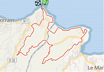
![](/images/other/stat-length.png)
![Excursión Senderismo Le Lorrain - Boucle Seguinrau via Le Marigot - Photo](https://media.geolcdn.com/t/1900/400/5dd48622-738c-4dea-b464-e40ff9640e97.jpg&format=pjpeg&maxdim=2)
Boucle Seguinrau via Le Marigot
Lamartiniere
Usuario GUIDE
![Longitud](/images/other/stat-length.png)
![Altitud máxima](https://static1.geolcdn.com/siteimages/upload/files/1508320355ic_sort_altitude_max_24dp.png)
![Desnivel positivo](https://static1.geolcdn.com/siteimages/upload/files/1508320355ic_sort_den_pos_24dp.png)
![Km-Effort](/images/other/stat-length.png)
![Altitud mínima](https://static1.geolcdn.com/siteimages/upload/files/1508320355ic_sort_altitude_min_24dp.png)
![Desnivel negativo](https://static1.geolcdn.com/siteimages/upload/files/1508320355ic_sort_den_neg_24dp.png)
![Boucle](https://static1.geolcdn.com/siteimages/upload/files/16400158638029165_repeat_loop_refresh_sync_direction_icon.png)
![Senderismo](https://static1.geolcdn.com/sitytour/trail-icons/101.png)
3h30
Dificultad : Difícil
![Escanee este código QR para abrir la excursión en la aplicación SityTrail](https://capi.geolives.com/qq0zvz2zws4bq2lad0pu/sitytour/trails/3006553/qr.png?size=200)
Aplicación GPS de excursión GRATIS
A propósito
Ruta Senderismo de 10,2 km a descubrir en Martinica, Desconocido, Le Lorrain. Esta ruta ha sido propuesta por Lamartiniere.
Descripción
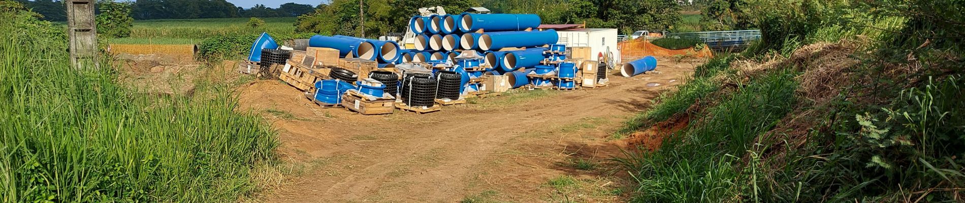
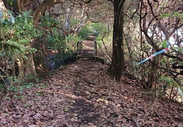
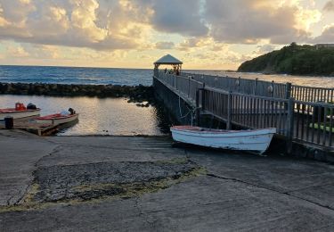
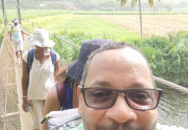
Cette randonnée de 10 kms entre Le Lorrain et Le Marigot, en grande partie sur des terrains agricoles nécessite des autorisations de passages si possible avec assaurance en règle, notamment sur l' habitation Duhaumont au Marigot. Retour par le SLNA.
Localización
Comentarios
Excursiones cerca
![Excursión Senderismo Le Lorrain - Boucle Lorrinoise via Morne Wawa - Photo](https://media.geolcdn.com/t/375/260/2260d5fa-b236-443e-94b6-198d12135800.jpg&format=jpg&maxdim=2)
![Senderismo Senderismo](https://static1.geolcdn.com/sitytour/trail-icons/101.png)
Senderismo
![](/images/other/stat-length.png)
![](https://static1.geolcdn.com/siteimages/upload/files/16400158638029165_repeat_loop_refresh_sync_direction_icon.png)
![Excursión Senderismo Le Marigot - Boucle Le Mariigot - Charpentier - SLNA. - Photo](https://media.geolcdn.com/t/375/260/b4acbe47-87c5-4bec-aa83-83441bd5fc60.jpg&format=jpg&maxdim=2)
![Senderismo Senderismo](https://static1.geolcdn.com/sitytour/trail-icons/101.png)
Senderismo
![](/images/other/stat-length.png)
![](https://static1.geolcdn.com/siteimages/upload/files/16400158638029165_repeat_loop_refresh_sync_direction_icon.png)
![Senderismo Senderismo](https://static1.geolcdn.com/sitytour/trail-icons/101.png)
Senderismo
![](/images/other/stat-length.png)
![](https://static1.geolcdn.com/siteimages/upload/files/16400158638029165_repeat_loop_refresh_sync_direction_icon.png)
![Excursión Senderismo Le Marigot - Marigot vers le Lorrain - Photo](https://media.geolcdn.com/t/375/260/6a93875e-8aed-454e-924f-79cf5824df2f.jpg&format=jpg&maxdim=2)
![Senderismo Senderismo](https://static1.geolcdn.com/sitytour/trail-icons/101.png)
Senderismo
![](/images/other/stat-length.png)
![](https://static1.geolcdn.com/siteimages/upload/files/16400158638029165_repeat_loop_refresh_sync_direction_icon.png)
![Excursión Senderismo Le Lorrain - Boucle Seguineau 22 Mai - Photo](https://media.geolcdn.com/t/375/260/637e5e8f-3e66-4461-a851-15be19fa887e.jpg&format=jpg&maxdim=2)
![Senderismo Senderismo](https://static1.geolcdn.com/sitytour/trail-icons/101.png)
Senderismo
![](/images/other/stat-length.png)
![](https://static1.geolcdn.com/siteimages/upload/files/16400158638029165_repeat_loop_refresh_sync_direction_icon.png)
![Excursión Senderismo Le Lorrain - Morne Jacob au Panneau ONF - Photo](https://media.geolcdn.com/t/375/260/54159292-758e-4621-a73f-109fb913bb31.jpg&format=jpg&maxdim=2)
![Senderismo Senderismo](https://static1.geolcdn.com/sitytour/trail-icons/101.png)
Senderismo
![](/images/other/stat-length.png)
![](https://static1.geolcdn.com/siteimages/upload/files/16400158638029165_repeat_loop_refresh_sync_direction_icon.png)
![Excursión Senderismo Le Lorrain - trace des Amérindiens - Photo](https://media.geolcdn.com/t/375/260/5dbbcceb-f0b2-4ef7-8df6-def9c209f94d.jpg&format=jpg&maxdim=2)
![Senderismo Senderismo](https://static1.geolcdn.com/sitytour/trail-icons/101.png)
Senderismo
![](/images/other/stat-length.png)
![](https://static1.geolcdn.com/siteimages/upload/files/16400158638029165_repeat_loop_refresh_sync_direction_icon.png)
![Excursión Senderismo Le Lorrain - Boucle La Crabiere - Hbt Assier - Photo](https://media.geolcdn.com/t/375/260/411cf4ff-70b2-4b04-9c7e-524092131d90.jpg&format=jpg&maxdim=2)
![Senderismo Senderismo](https://static1.geolcdn.com/sitytour/trail-icons/101.png)
Senderismo
![](/images/other/stat-length.png)
![](https://static1.geolcdn.com/siteimages/upload/files/16400158638029165_repeat_loop_refresh_sync_direction_icon.png)
![Excursión Senderismo Basse-Pointe - Stèle Anse Chalvet - Boulodrome Basse-Pointe - Photo](https://media.geolcdn.com/t/375/260/4492c87a-6138-4e25-8023-ed3682547b8b.jpg&format=jpg&maxdim=2)
![Senderismo Senderismo](https://static1.geolcdn.com/sitytour/trail-icons/101.png)
Senderismo
![](/images/other/stat-length.png)
![](https://static1.geolcdn.com/siteimages/upload/files/16400158638029165_repeat_loop_refresh_sync_direction_icon.png)