


10,3 km | 12,3 km-effort


Usuario


Aplicación GPS de excursión GRATIS
 SityTrail
IGN / Institutos geográficos
SityTrail World
El mundo es suyo
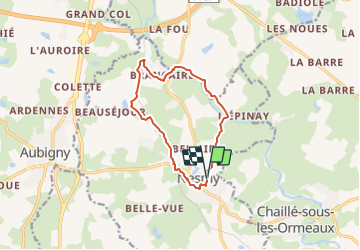
Ruta A pie de 10,5 km a descubrir en Países del Loira, Vandea, Nesmy. Esta ruta ha sido propuesta por cath310.
appelée également Sentier de L'Aulne parcours 9 (PAYS DE YON & VIE)
D/R du parking du jumelage, face au foyer Laborit.
gps N46.59185°/W1.398850°
Balisage JAUNE N°9
durée 3h , facile
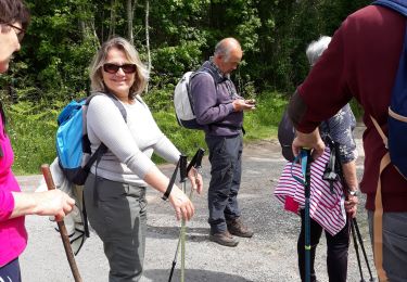
Senderismo

Senderismo
Senderismo
Senderismo
Senderismo

A pie

A pie

Bicicleta